Maps of Canada

A new mapp of America Septentrionale / designed by Mousieur Sanson, geographer to the French King and rendred into English, and illustrated by Richard Blome by His Majesties especiall command; Francis Lamb sculp.
from Charts and maps Mousieur Sanson; Richard Blome,
Amerique septentrionale / par N. Sanson d'Abbeville, geog. du Roy; A. Peyrounin, sculp.
from Whole N. Sanson; A. Peyrounin,
America septentrionalis concinnata juxta observationes Dnñ. Academiae Regalis Scientiarum et nonnullorum aliorum, et juxta annotationes recentissimas
1 : 18000000 per G. de L'Isle geographum G.F. Lotter, sculps. Augustae Vindelicorum : apud Tobiam Conr. Lotter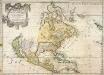
Amerique septentrionale
1 Karte : Kupferdruck ; 39 x 55 cm Sanson; Mariette; Sanson chez Pierre Mariette rue St. Iacques a l'esperance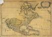
Amerique septentrionale
1 Karte : Kupferdruck ; 38 x 54 cm Sanson; Mariette; Peyrounin chez l'auteur et chez Pierre Mariette rue S. Iacques a l'esperance
L'Amerique septentrionale
1 : 18900000 Severní Amerika Jaillot, Alexis-Hubert H. Iaillot
AMERIQUE SEPTENTRIONALE
1 : 18900000 Severní Amerika Jaillot, Alexis-Hubert H. Iaillot
A new map of North America shewing its principal divisions, chief cities, townes, rivers, mountains &c.
from Whole Printed by T.W. for R. Bonwicke, J. Walthoe, R. Wilkin, and T. Ward?: [London]; Burghers, M.; Wells, Edward,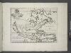
A new map of North America shewing its principal divisions, chief cities, townes, rivers, mountains & c. / delin. M. Burg.; sculpt. Univ. Oxon.; A new sett of maps both of antient and present geography: wherein not only the latitude and longitude of many places are corrected according to the latest observations, but also the most remarkable differences of antient and present geography may be quickly discern'd by a bare inspection or comparing of correspondent maps, which seems to be the most natural and easy method to lead young students (for whose use the work is principally intended) unto a competent knowledge of the geographical science: together with a geographical treatise particularly adapted to the use and design of these maps / by Edward Wells, M.A. and student of Christ-Church, Oxon.
from A new sett of maps both of antient and present geography : wherein not only the latitude and longitude of many places are corrected according to the latest observations, but also the most remarkable differences of antient and present geography may be quickly discern'd by a bare inspection or comparing of correspondent maps, which seems to be the most natural and easy method to lead young students (for whose use the work is principally intended) unto a competent knowledge of the geographical science : together with a geographical treatise particularly adapted to the use and design of these maps / by Edward Wells, M.A. and student of Christ-Church, Oxon. Wells, Edward; Sheldonian Theatre,
Amerique septentrionale divisée en ses principales parties.
from Whole Chés Ian Bt. Elwe: Amsterdam; Elwe, Jan Barend,
Amerique septentrionale divisée en ses principales parties.
from Whole Chés Ian Bt. Elwe: Amsterdam; Elwe, Jan Barend,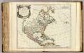
Amerique Septentrionale.
1 : 17400000 Robert de Vaugondy, Gilles, 1688-1766
Amerique septentrionale divisée en ses principale parties.
from Whole Ottens, R. (Reinier); Jaillot, Charles Hubert Alexis,
North America divided into its principall parts where are distinguished the severall states which belong to the English, Spanish, and French / described by Sanson; corrected and amended by William Berry.; [A collection of maps of the world] / [described by Sanson; corrected and amended by William Berry.]
from Collection of maps, 1680-1690 Berry, William; Morden, Robert; Petty, William, Sir; Sanson, Nicolas; Slaney, Edward,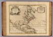
L'Amerique Septentrionale.
1 : 18500000 L'Isle, Guillaume de, 1675-1726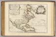
L'Amerique Septentrionale.
1 : 18500000 L'Isle, Guillaume de, 1675-1726
Amerique septentrionale divisée en ses principales parties.
from John H. Levine Collection [s.n.]: A Paris; Jaillot, Charles Hubert Alexis,
Amerique septentrionale divisée en ses principales parties.
from John H. Levine Collection [s.n.]: A Paris; Jaillot, Charles Hubert Alexis,
Carte nouvelle de l'Amerique angloise : contenant la Virginie, Mary-Land, Caroline, Pensylvania, Nouvelle Iorck, N. Iarsey, N. France, et les terres nouvellement decouerte dressé sur les relations les plus nouvelles / par le Sieur S.
from Charts and maps
Amerique septentrionale divisée en ses principales parties: ou sont distingués les vns des autres les estats suivant qu'ils appartiennent presentemet aux François, Castillans, Anglois, Suedois, Danois, Hollandois / tirée des relations de toutes ces nations par le Sr. Sanson, geographe ordinaire du Roy; Cordier, sculps?
from Whole Sanson,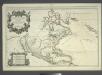
Amerique septentrionale divisée en ses principales parties: ou sont distingués les vns des autres les estats suivant qu'ils appartiennent presenteme[n]t aux François, Castillans, Anglois, Suedois, Danois, Hollandois, tirée des relations de toutes ces nations / par le Sr. Sanson, geographe ordinaire du Roy.
from John H. Levine Collection Sanson,
A map of Rhode Island.
from The American geography; or, A view of the present situation of the United States of America: containing astronomical geography; geographical definitions, discovery, and general description ... By Jedidiah Morse, A.M.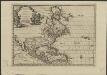
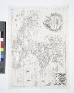
L'Amérique septentrionale, suivant les nouvelles observations de Messr. de l'Académie Royale des Sciences, etc : augmentées de nouveau
1 : 37000000 A Leide : chez Pierre vander Aa
An accurate map of North America from the latest improvements, and regulated by astronomical observations.
from Whole s.n.: [London?]; Rollos, G.,
North America / T. Jefferys, sculp.
from Whole Thomas Jeffreys,
North America / T. Jefferys, sculp.
from Whole Thomas Jeffreys,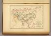
Empire des Mongols.
1 : 35000000 Malte-Brun, Conrad, 1775-1826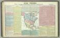
Tableau l'historie de l'Amerique Septenrionales.
1 : 39000000 Duval, Henri