Maps of Coastal Plain

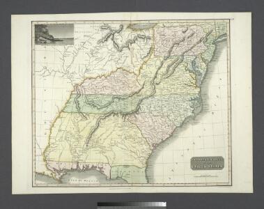
Southern provinces of the United States.
from Charts and maps
Mitchell's Reference & Distance Map Of The United States.
1 : 1584000 Young, James H.
United States.
1 : 6000000 Colton, J. H.
US, Canada.
1 : 11500000 Peterson, Augusts
Mitchell's map of the United States.
1 : 14752000 Mitchell, Samuel Augustus
Mitchell's National Map of the American Republic
1 : 3400000 Mitchell, Samuel Augustus
United States Of North America.
1 : 1550000 Arrowsmith, Aaron
[Kaart], uit: Appleton's spoorwegkaart van de Vereenigde Staten en Canada / door G.F. Thomas ; engraved by Rae Smith
1 : 3550000 titelvariant: Spoorwegkaart van de Vereenigde Staten en Canada; Annotatie: Oorspr. uitg. 1871 uitg. door D. Appleton G.F. Thomas fl. 1872; Smith, Rae Amsterdam : J.H. Laarman
Etats-Unis d'Amerique.
1 : 4200000 Poussin, Guillaume Tell, 1794-1876
Mitchell's Reference & Distance Map Of The United States.
1 : 1584000 Young, James H.
Chapin's Ornamental Map Of The United States.
1 : 2217600 Taylor, J.B.
United States Of North America.
1 : 1350000 Lewis, Samuel
Map of the Atlantic States, Showing Distances From Washington (In BeeLine) By 50 Mile Circles.
1 : 8236800 Prang, L. & Co.
Carte de la Louisiane cours du Mississipi et pais voisins
1 : 6000000
Population - United States census, 1870. Density, Foreign, Colored, British American, Swedish and Norwegian.
1 : 15000000 Baskin, Forster and Company
Population - United States census, 1870. Density, Foreign, Colored, British American, Swedish and Norwegian.
1 : 14000000 Andreas, A. T. (Alfred Theodore), 1839-1900
Population, United States Census, 1870: Density, foreign, colored, British American, Swedish and Norwegian.
Andreas, A. T. (Alfred Theodore), 1839-1900
A map of the United States of North America: drawn from a number of critical researches / By A. Arrowsmith.
from Whole Aaron Arrowsmith,
United States.
1 : 1900800 Varle, Charles P.
United States.
1 : 6200000 Hughes, William
New Map of the United States.
1 : 1584000 Young, James H.
United States.
1 : 1500000 Smith, J. Calvin
Map of the United States Of North America.
1 : 1837440 Burr, David H., 1803-1875
United States.
1 : 8050000 Tanner, Henry S.
Mitchell's Reference & Distance Map Of The United States.
1 : 1584000 Young, James H.
Mitchell's Reference & Distance Map Of The United States.
1 : 1584000 Young, James H.
Verein-Staaten von Nord-America mit Ausnahme Florida's und der westlichen Territoirien
Hand-Atlas über alle Theile der Erde nach dem neuesten Zustande und über das Weltgebäude Stieler, Adolf bei Justus Perthes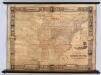
United States.
1 : 2471040 Munson, S. Bishop
Map of the Atlantic States, showing distances from Washington (in bee line) by 50 mile circles