Cataloged map
Partie orientale du Canada ou de la Nouvelle France : ou sont les provinces, ou pays de Sagvenay, Canada, Acadie etc., les peuples, ou nations des Etechemins, Iroquois, Attiquameches etc., auec la Nouvelle Angleterre, la Nouvelle Ecosse, la Nouvelle Yorc


Full title:Partie orientale du Canada ou de la Nouvelle France : ou sont les provinces, ou pays de Sagvenay, Canada, Acadie etc., les peuples, ou nations des Etechemins, Iroquois, Attiquameches etc., auec la Nouvelle Angleterre, la Nouvelle Ecosse, la Nouvelle Yorc
Physical Size:20 x 30 cm
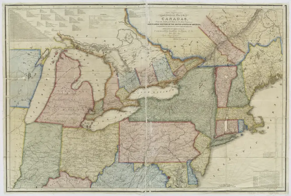
New travelling and commercial map of the Canadas: from the Sault of St. Marie to the river Saguenay, and a large section of the United States of America / compiled from the latest surveys and most approved authorities ... by his obliged obedient humble servant David Taylor, R.N., March 1834; engraved by S. Stiles & Co.
1834
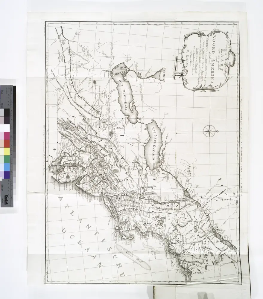
Nieuwe en nauwkeurige kaart van een gedeelte van Noord Amerika : behelzende Nieuw Engeland, New York, Pennsylvania, New Jersey, Connecticut, Rhode Island, een stuk van Virginia, Kanada en Halifax, ter opheldering der reizen van den Heer P. Kalm / C.J. de
1772
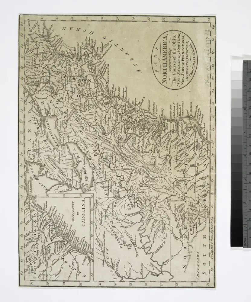
Part of North America: comprehending the course of Ohio, New England, New York, New Jersey, Pennsylvania, Maryland, Virginia, Carolina & Georgia.
1775
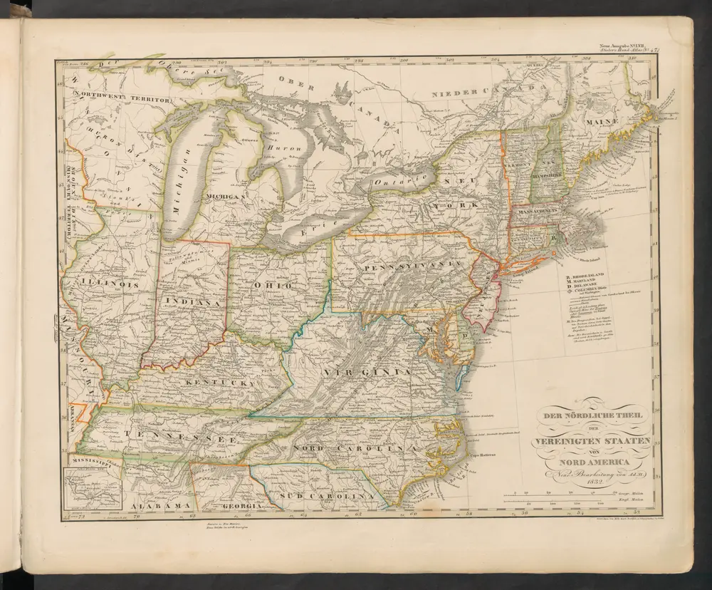
Der Nördliche Theil der Vereinigten Staaten von Nord America
1845
Stieler, Adolf
Vereinigte Staaten von Nord-Amerika in 6 blattern, bl. 3
1876
Novi Belgii, quod nunc Novi Jorck vocatur, Novae q[ue] Angliae & partis Virginiae : accuratissima et novissima delineatio
1671
Montanus, Arnoldus, 1625?-1683
1:4m
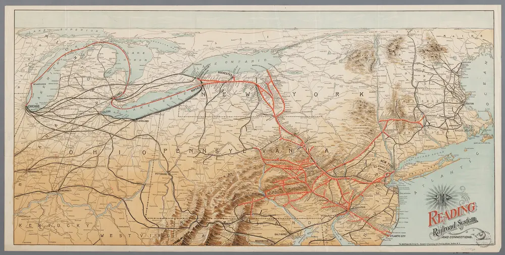
[Recto], uit: Reading railroad system and connections
1893
Buffalo, N.Y. : The Matthews-Northrup Co.
n/a
1858
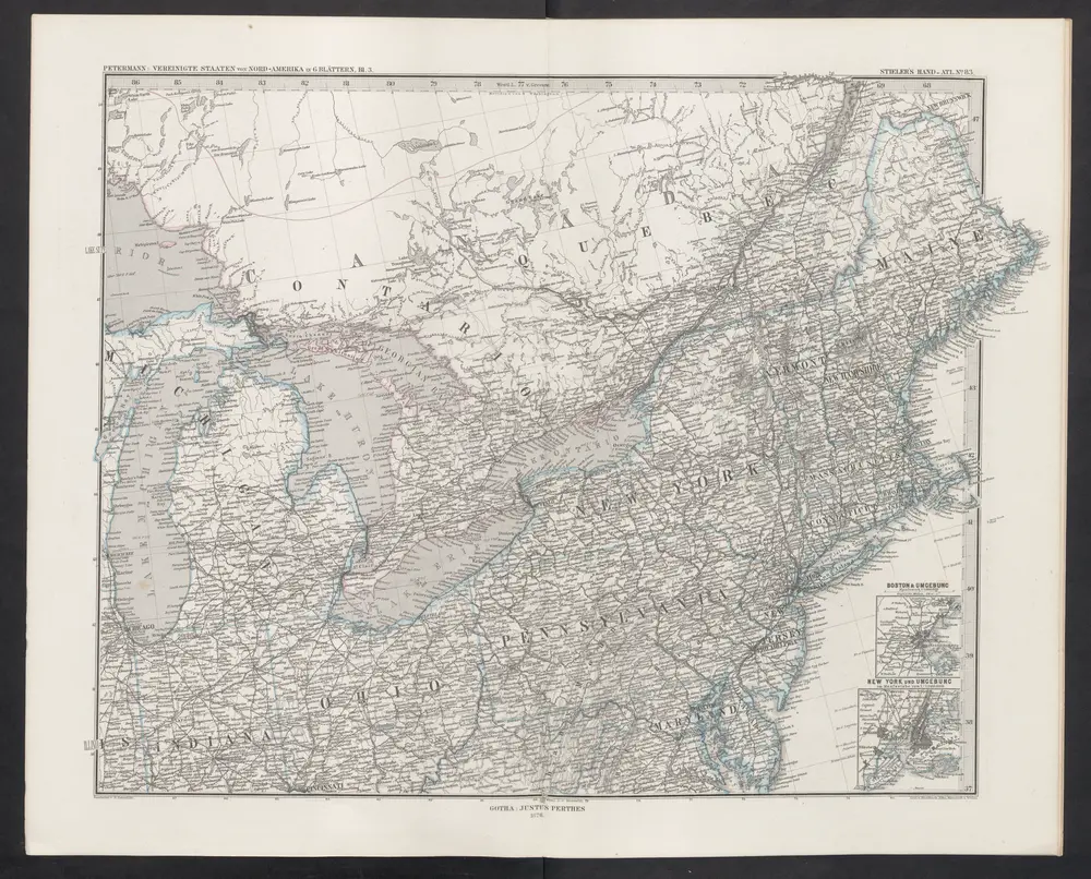
[Die Vereinigten Staaten von Nord-Amerika, Blatt 3]
1876
Stieler, Adolf
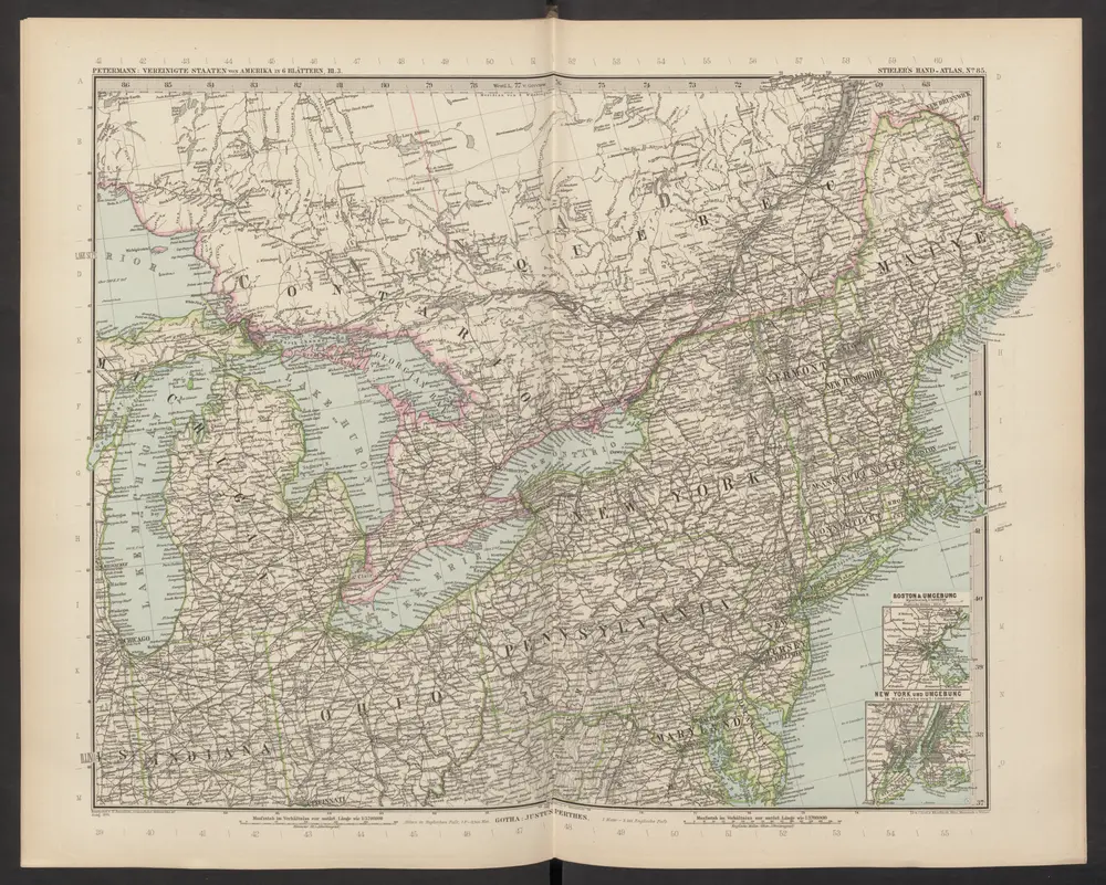
[Die Vereinigten Staaten von Amerika in 6 Blättern, Blatt 3]
1892
Stieler, Adolf