Cataloged map
A plan of New York Island, with part of Long Island, Staten Island & east New Jersey : with a particular description of the engagement on the woody heights of Long Island, between Flatbush and Brooklyn, on the 27th of August 1776 between His Majesty'


Full title:A plan of New York Island, with part of Long Island, Staten Island & east New Jersey : with a particular description of the engagement on the woody heights of Long Island, between Flatbush and Brooklyn, on the 27th of August 1776 between His Majesty'
Physical Size:20 x 30 cm
Map of the Hudson ... from New York Harbor the Fort Washington.
1820
Map showing routes & stations on the dual system October, 1918
1918
New York (State). Public Service Commission
1:46k
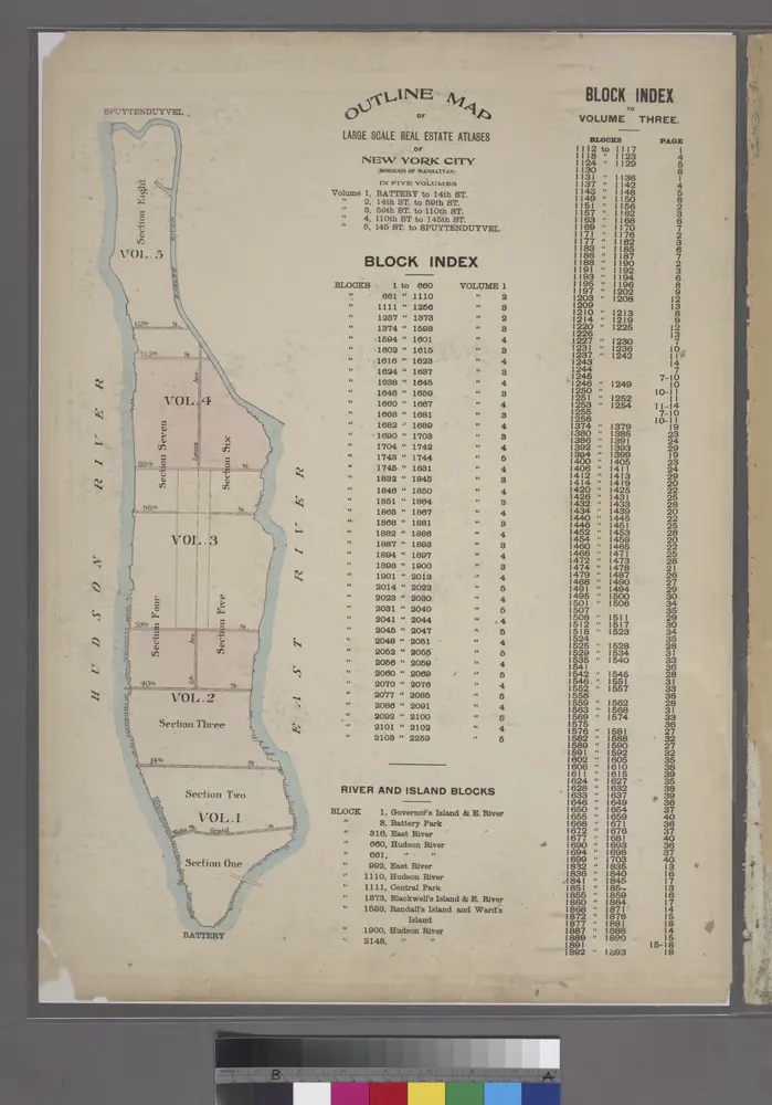
Outline Map of Large Scale Real Estate Atlases of New York City, Borough of Manhattan.
1920
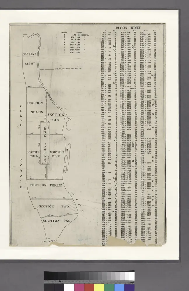
BLOCK INDEX. Includes the map of Manhattan, Sections 1-8.
1897
New York City and vicinity
1899
Geological Survey (U.S.)
1:63k
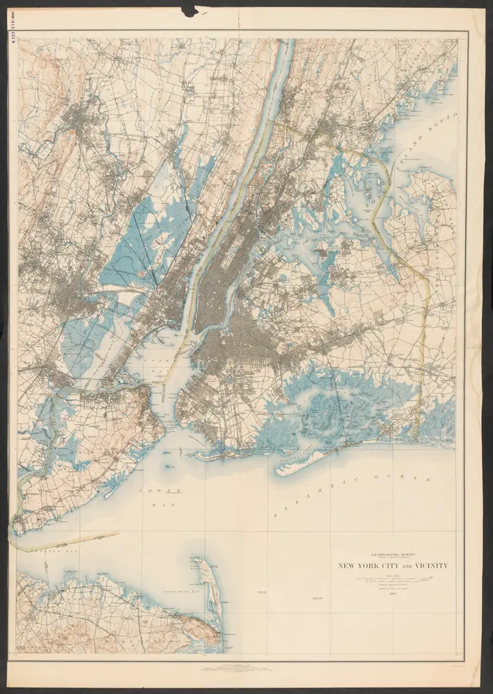
New York City and vicinity
1899
United States Geological Survey
1:63k
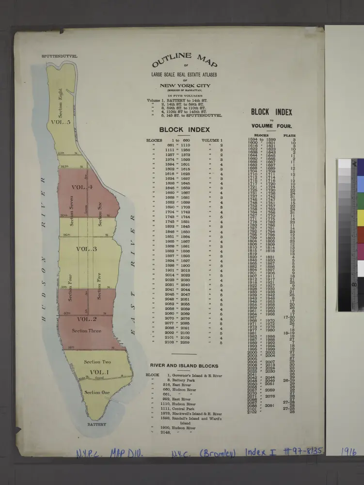
Outline map of large scale real estate atlases of New York City, Borough of Manhattan.
1916
Map of the five cities of New York, Brooklyn, Jersey City, Hoboken & Hudson City : Southern sheet
1860
Dripps, M. (Matthew)
Map of the five cities of New York, Brooklyn, Jersey City, Hoboken & Hudson City : Northern sheet
1860
Dripps, M. (Matthew)
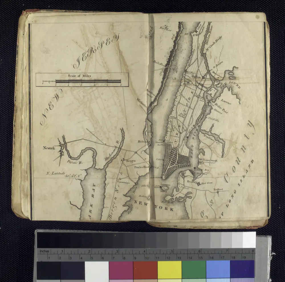
Map of the city and county of New York : with the adjacent country
1829
Burr, David H., 1803-1875
1:20k