Mapa catalogado
Map of the counties of Albany and Schenectady / by David H. Burr ; engd. by Rawdon, Clark & Co., Albany, & Rawdon, Wright & Co., N.Y.
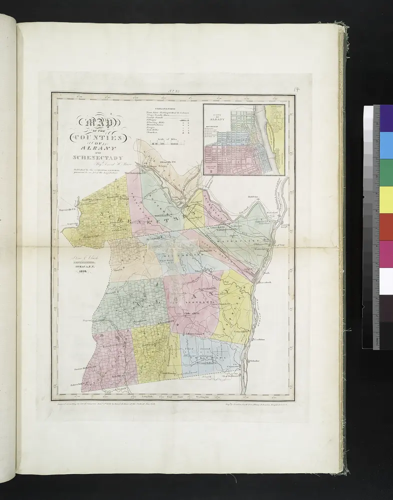

Título completo:Map of the counties of Albany and Schenectady / by David H. Burr ; engd. by Rawdon, Clark & Co., Albany, & Rawdon, Wright & Co., N.Y.
Año de ilustración:1829
Tamaño físico:20 x 30 cm
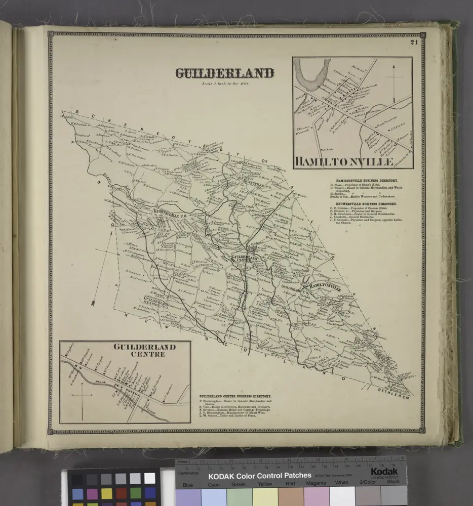
Guilderland [Township]; Hamiltonville [Village]; Hamiltonville Business Directory.; Knowersville Business Directory.; Guilderland Centre [Village]; Guilderland Centre Business Directory.
1866
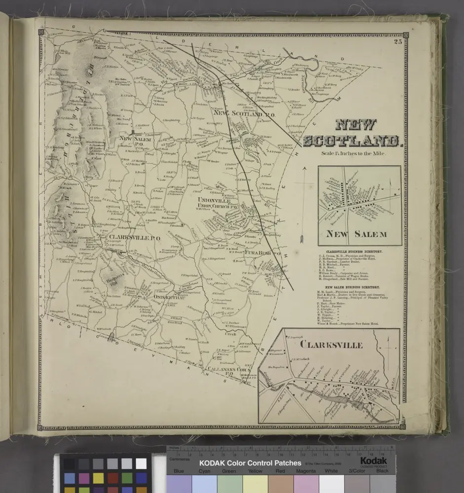
New Scotland. [Township]; New Salem [Village]; Clarksville Business Directory.; New Salem Business Directory.; Clarksville [Village]
1866
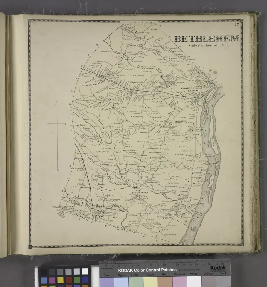
Bethlehem [Township]
1866
Albany
1950
1:63k
Albany
1947
1:63k
Albany
1927
1:63k
Albany
1927
1:63k
Albany
1927
1:63k
Albany
1927
1:63k
Albany
1927
1:63k
Berne
1903
1:63k
Berne
1903
1:63k
Berne
1903
1:63k
Berne
1903
1:63k
Berne
1903
1:63k
Berne
1903
1:63k
Berne
1903
1:63k
Berne
1903
1:63k
Berne
1900
1:63k
Berne
1900
1:63k
Albany
1898
1:63k
Albany
1898
1:63k
Albany
1898
1:63k
Albany
1898
1:63k
Albany
1898
1:63k
Albany
1898
1:63k
Albany
1898
1:63k
Albany
1898
1:63k
Albany
1895
1:63k
Albany
1893
1:63k