Maps of Berkshire County

[Columbia County].
from New York Atlas.
Map of the county of Columbia / by David H. Burr ; engd. by Rawdon, Clark & Co., Albany, & Rawdon, Wright & Co., New York.
from An atlas of the state of New York, designed for the use of engineers, containing a map of the state and of the several counties. / Projected and drawn ... under the superintendence and direction of Simeon de Witt.
Map of the county of Columbia / by David H. Burr ; engd. by Rawdon, Clark & Co., Albany, & Rawdon, Wright & Co., New York.
from An atlas of the state of New York : containing a map of the state and of the several counties. / Projected and drawn under the superintendence and direction of Simeon de Witt ... And also the physical geography of the State ...
Railway and highway map of the famous Berkshire Hills region, showing also villages and points of interest : from official records and other information
1 : 134376 Watson, Walter, civil engineer Struthers, Servoss & Co.
Railway and highway map of the famous Berkshire Hills region : showing also villages and points of interest : from official records and other information
1 : 134376 Watson, Walter, civil engineer Sun Printing Company
Columbia Co.
from Atlas of Columbia County, New York. From actual surveys and official records. Compiled & published by D. G. Beers & Co.
Map of the county of Berkshire, Massachusetts : based upon the trigonometrical survey of the state
1 : 50688 Walling, Henry Francis, 1825-1888 Smith, Gallup & Co.
Map of Livingston Manor, 1714
from Cities and towns, A-Z
Map of the county of Columbia / by David H. Burr; engd. by Rawdon, Clark & Co., Albany, & Rawdon, Wright & Co., New York.; An atlas of the state of New York: containing a map of the state and of the several counties / by David H. Burr.
from An atlas of the state of New York : containing a map of the state and of the several counties / by David H. Burr. Burr, David H.; Rawdon, Clark & Co.; Rawdon, Wright & Co.; Stone & Clark Republishers,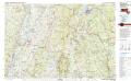
Pittsfield
1 : 100000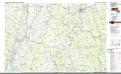
Pittsfield
1 : 100000
Albany, Rensselaer, Columbia counties.
1 : 158400 Bien, Joseph Rudolf
Berkshire County.
1 : 158400 Gray, Ormando Willis; Walling, H. F.
[Dutchess County].
from New York Atlas.
Plan of the encampment and position of the army under His Excelly. Lt. General Burgoyne at Swords House on Hudson's River near Stillwater on Septr. 17th : with the positions of that part of the army engaged on the 19th Septr. 1777 / drawn by W. C. Wilkin
from Revolutionary War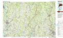
Waterbury
1 : 100000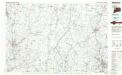
Waterbury
1 : 100000
Hudson River & vicinity / drawn by David H. Burr ; S. Stiles & Co., N.Y.
from Hudson River
New York
1 : 2000000 Breese, S.
Map of Dutchess County New York
from New illustrated atlas of Dutchess County, New York. / Compiled & drawn from personal examinations, surveys etc. under the personal supervision of O.W. Gray & Son and F.A. Davis, and published under the superintendence of H. L. Kochersperger.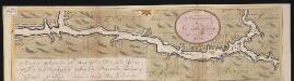
Nieuwe afteekeningh van de Noord Rivier met alle desselfs ancker plaetsen dieptens banken en klippen, geleegen in Nieuw Nederlandt [south part]
United States Gerard van Keulen
Housatonic
1 : 125000
Housatonic
1 : 125000
Housatonic
1 : 125000
Housatonic
1 : 125000
Housatonic
1 : 125000
Housatonic
1 : 125000
The Hudson by daylight map, from New York Bay to the head of tide water : containing names of streams, islands, and heights of mountains according to the latest coast survey : also the names of prominent residences, historic land marks, the old reaches o
from Hudson River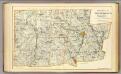
Litchfield Co. N.
1 : 72000 D.H. Hurd & Co.
![[Columbia County].](https://images-2.georeferencer.com/images/iiif/545348373658/full/,300/0/native.jpg)

