Maps of Jersey City

Jersey City, V. 1, Double Page Plate No. 29 [Map bounded by Dungan Ave., Olean Ave., West Side Ave., Boyed Ave., Hacken Sack River] / compiled under the direction of and published by G.M. Hopkins Co.
From V. 1
Jersey City, V. 1, Double Page Plate No. 30 [Map bounded by Newark Ave., West Side Ave., Duncan Ave., Hackensack River] / compiled under the direction of and published by G.M. Hopkins Co.
From V. 1
Jersey City, V. 1, Double Page Plate No. 28 [Map bounded by Hackensack River, Boyd Ave., West Side Ave., Newark Bay] / compiled under the direction of and published by G.M. Hopkins Co.
From V. 1
Jersey City, V. 1, Double Page Plate No. 16 [Map bounded by Montgomery St., Summit Ave., Crescent Ave., Communipaw Ave., Olean Ave.] / compiled under the direction of and published by G.M. Hopkins Co.
From V. 1
Jersey City, V. 1, Double Page Plate No. 20 [Map bounded by Communipaw Ave., Madison Ave., Clerk St., Orient Ave., West Side Ave.] / compiled under the direction of and published by G.M. Hopkins Co.
From V. 1
Topographical atlas of the City of New York / by Egbert L. Viele.
from Topographical atlas of the city of New York, / including the annexed territory showing original water courses and made land / prepared under the direction of Egbert L. Viele.
Jersey City, V. 1, Double Page Plate No. 40 [Map bounded by E. 40th St., New York Bay, E. 21st St.] / compiled under the direction of and published by G.M. Hopkins Co.
From V. 1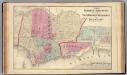
Hoboken, Jersey City.
1 : 19200 Beers, F. W. (Frederick W.)
Road from Philadelphia to New York. (Maps) 14 and 15.
1 : 63360 Moore, S.S.
Jersey City, V. 1, Double Page Plate No. 21 [Map bounded by Orient Ave., Ocean Ave., Woodlawn Ave., West Side Ave.] / compiled under the direction of and published by G.M. Hopkins Co.
From V. 1
Jersey City, V. 1, Double Page Plate No. 15 [Map bounded by West Side Ave., Newark Ave., Summit Ave., Montgomery St.] / compiled under the direction of and published by G.M. Hopkins Co.
From V. 1
Jersey City, V. 1, Double Page Plate No. 17 [Map bounded by Madison Ave., Summit Ave., Balowin Ave., Montgomery St., Bright St., Van Horne St., Bramhall Ave.] / compiled under the direction of and published by G.M. Hopkins Co.
From V. 1
Jersey City, V. 1, Double Page Plate No. 19 [Map bounded by Ocean Ave., Bramhall Ave., Bay View Ave.] / compiled under the direction of and published by G.M. Hopkins Co.
From V. 1
Jersey City
1 : 24000
Jersey City
1 : 24000
Jersey City
1 : 24000
Jersey City
1 : 24000
Jersey City
1 : 24000
Facsimile of the unpublished British head quarters coloured manuscript map of New York & environs / reproduced from the original drawing in the War Office, London.
from Whole
King's bird's-eye view of Brooklyn
From Brooklyn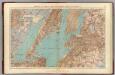
Brooklyn, N.Y. Bay, Jersey City, Hoboken, Bayonne, Newark Bay.
1 : 31680 Vermeule, C. C. (Cornelius Clarkson), 1858-1950
Watson's New Map Of New-York And Adjacent Cities.
1 : 18600 Watson, Gaylord
Map of property situated in the 12th ward of the city of New York belonging to the estate of John Taylor : to be sold at auction by Jas. Bleecker & Sons at the Merchts. Exchange at 12 o'clock on Tuesday the 1st April 1834.
from Manhattan
Goulding's Directory Map of New York City, including the two recently annexed wards, engraved from the latest and most accurate surveys.
From Manhattan
Handy map of Brooklyn.
From Brooklyn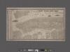
New York City map. Including an index to the streets of New York and Brooklyn.
From Manhattan
City & county map of New York, Brooklyn, Williamsburgh, Jersey City & the adjacent waters.
From Manhattan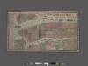
New York City Map. Extracted from Phelps' strangers and citizens' guide to New York City, with maps and engravings.
From Manhattan
Map of New-York Bay and Harbor and the environs / founded upon a trigonometrical survey under the direction of F. R. Hassler, superintendent of the Survey of the Coast of the United States ; triangulation by James Ferguson and Edmund Blunt, assistants ;
from New York harbor
![Jersey City, V. 1, Double Page Plate No. 29 [Map bounded by Dungan Ave., Olean Ave., West Side Ave., Boyed Ave., Hacken Sack River] / compiled under the direction of and published by G.M. Hopkins Co.](https://images-2.georeferencer.com/images/iiif/039825028639/full/,300/0/native.jpg)

