Maps of Jersey City

Jersey City, V. 1, Double Page Plate No. 10 [Map bounded by Central Ave., Franklin St., Jersey Ave., 12th St., Washborn St., Oakland Ave.] / compiled under the direction of and published by G.M. Hopkins Co.
From V. 1
Hoboken - Plate A.
Hopkins, G.M.
Jersey City, V. 1, Double Page Plate No. 13 [Map bounded by Liberty Ave., Manhattan Ave., Oakland Ave., Newark Ave.] / compiled under the direction of and published by G.M. Hopkins Co.
From V. 1
Jersey City, V. 1, Double Page Plate No. 11 [Map bounded by South St., Marshall St., Franklin St., Manhattan Ave., Hudson Blvd.] / compiled under the direction of and published by G.M. Hopkins Co.
From V. 1
Jersey City, V. 1, Double Page Plate No. 7 [Map bounded by Jersey Ave., Hoboken Ave., Provost St., 11th St.] / compiled under the direction of and published by G.M. Hopkins Co.
From V. 1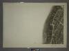
8C - N.Y. City (Aerial Set).
from Sectional aerial maps of the City of New York / [photographed and assembled under the direction of the chief engineer, July 1st, 1924].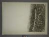
12A - N.Y. City (Aerial Set).
from Sectional aerial maps of the City of New York / [photographed and assembled under the direction of the chief engineer, July 1st, 1924].
Jersey City, V. 1, Double Page Plate No. 9 [Map bounded by Summit Ave., Washburn St., Division St., Bright St.] / compiled under the direction of and published by G.M. Hopkins Co.
From V. 1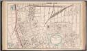
Jersey City - Plate I.
Hopkins, G.M.
Jersey City, V. 1, Double Page Plate No. 4 [Map bounded by Division St., 12th St., Jersey Ave., 2nd St.] / compiled under the direction of and published by G.M. Hopkins Co.
From V. 1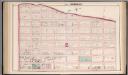
Hoboken - Plate C.
Hopkins, G.M.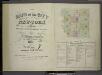
[Volume 7 Index Map.]
from Maps of the city of New York / surveyed under directions of insurance companies of said city.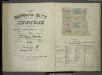
[Volume 6 Index Map.]
from Maps of the city of New York / surveyed under directions of insurance companies of said city.
New map of that part of the city of New York south from 20th Street on the Hudson & 35th Street on the East River : showing the position of Greenwich, Washington and West Streets on the Hudson River, and Pearl, Water, Front, Cherry & Tompkins Sts. on the
from Manhattan
Use District Map Section No. 12
from Use district map / City of New York, Board of Estimate and Apportionment.
Area District Map Section No. 8
from Area district map / City of New York, Board of Estimate and Apportionment.
Height District Map Section No. 8
from Height district map / City of New York, Board of Estimate and Apportionment.
Use District Map Section No. 8
from Use district map / City of New York, Board of Estimate and Apportionment.
Height District Map Section No. 12
from Height district map / City of New York, Board of Estimate and Apportionment.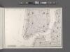
Area District Map Section No. 12
From Area district map.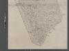
Map of New York City from Battery to 60th Street.
From Manhattan
New-York.
from The American traveller ; or, Guide through the United States, containing brief notices of the several states, cities, principal towns, canals and rail roads, etc. ; with tables of distances by stage, canal and steam boat routes ... by H.S. Tanner.
New York (City).
1 : 24000 Goodrich, S.G.
New York.
1 : 24000 Bradford, Thomas G.
Plan of New York
1 : 2000
Map of the city of New York : with the adjacent cities of Brooklyn & Jersey City, & the village of Williamsburg / drawn & engraved by Story & Atwood, 151 Fulton St., N.Y.
from Manhattan
1 New York, Brooklyn, Jersey City.
1 : 18300 Watson, Gaylord
Map of the city of New York, 1850 / drawn for D.T. Valentine's Manual 1850, by G. Hayward.
from Manhattan
Map of the local boundaries of the Protestant Episcopal Churches of the city of New York.
from Manhattan
![Jersey City, V. 1, Double Page Plate No. 10 [Map bounded by Central Ave., Franklin St., Jersey Ave., 12th St., Washborn St., Oakland Ave.] / compiled under the direction of and published by G.M. Hopkins Co.](https://images-2.georeferencer.com/images/iiif/651390715876/full/,300/0/native.jpg)

