Maps of River Vale

Maps of River Vale

$title$

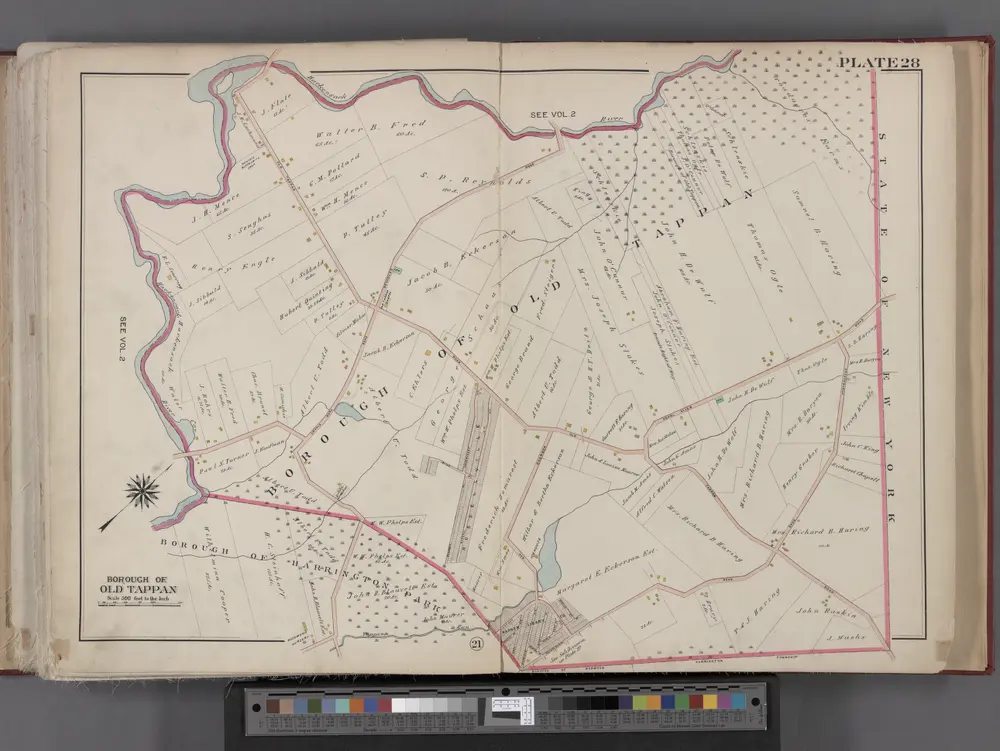
Bergen County, V. 1, Double Page Plate No. 28 [Map of borough of Old Tappan] / by George W. and Walter S. Bromley.

From V. 1, 1912.
$title$

Bergen County, V. 1, Double Page Plate No. 27 [Parts of the boroughs of Harrington Park, Norwood TWP. of Harrington] / by George W. and Walter S. Bromley.

From V. 1, 1912.
$title$

Lower East Side, East Village, Chinatown, Two Bridges. (cont.)

From District 3
$title$

6 Rockland, Westchester counties.

1 : 14400 Watson & Co. (New York, N.Y.)
$title$

4. Yonkers-Tarrytown-Hartsdale.

1 : 80000 Servoss, R. D.
$title$

Nyack

1 : 24000
$title$

Nyack

1 : 24000
$title$

Nyack

1 : 24000
$title$

Nyack

1 : 24000
$title$

Nyack

1 : 24000
$title$

Nyack

1 : 31680
$title$

Nyack

1 : 31680
$title$

Nyack

1 : 31680
$title$

Nyack

1 : 24000
$title$

Nyack

1 : 24000
$title$

4. Yonkers-Tarrytown-Hartsdale.

1 : 80000 Servoss, R. D.
$title$

New York and Brooklyn.

From Manhattan
$title$

Plans of Parts of Piermont, Sparkill, and Palisades, N.Y. and Harrington, N.J.

from Atlas of the Hudson River Valley from New York city to Troy, including a section of about 8 miles in width. Published by Watson & co. Compiled from official records and careful surveys, under the supervision of F. W. Beers.
$title$

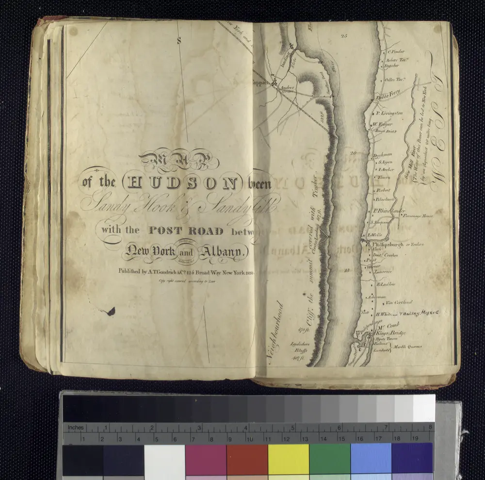
Map of the Hudson ... from Spuyten Duyvil to P. Livingston's.

from Map of the Hudson between Sandy Hook & Sandy Hill : with the post road between New York and Albany / Bridges delt. ; Rollinson sct.
$title$

Paterson, N.J. - N.Y., ed. of Feb. 1903, repr. 1924

from New Jersey, 15 minute series (topographic) / mapped, edited, and published by the Geological Survey.
$title$

(Metropolitan New York and Long Island) Northern Section. To and Through Manhattan.

Shell Oil Company
$title$

The Hudson by daylight map : showing the prominent residences, historic landmarks, old reaches of the Hudson, Indian names, &c.

from Hudson River
$title$

Country from Frog's Point to Croton River shewing the American and British Armies 1776.

1 : 120000 Marshall, John
$title$

7 NE red sandstone.

1 : 63360 Vermeule, C. C. (Cornelius Clarkson), 1858-1950
$title$

N.Y.-Norwalk Is.

1 : 80000 United States Coast Survey
$title$

New York City and Vicinity.

1 : 30000 Walling, H. F.
$title$

New York Island, Part of Long Island .

1 : 100000 Marshall, John
$title$

Bergen, Passaic Cos., N.J.

1 : 126720 Beers, F. W. (Frederick W.)
$title$

Birds Eye View Map Of New York And Vicinity.

1 : 80033 Hammond, C.S.
$title$

New Jersey, Double Page Sheet No. 7 [Map of Northeastern Red Sandstone]

From Atlas of New Jersey.
© MapTiler © OpenStreetMap contributors
How does it work?
These instructions will show you how to find historical maps online.
Getting started
Type the place name in the search box to find the exact location. You can further adjust the search by zooming in and out.
Zoom
Zoom in and out with the buttons or use your mouse or touchpad natively.
Exact Area tool
Click here and draw a rectangle over the map to precisely define the search area.
Set filters
Narrow your search with advanced settings, such as Years (from/to), Fulltext, Publisher, etc.
Results
See the results of your search on the right side. You can scroll down to find more maps of this location.
?

Download OldMapsOnline Mobile