Mapa catalogado
Key


Título completo:Key
Año de ilustración:1900
Tamaño físico:20 x 30 cm
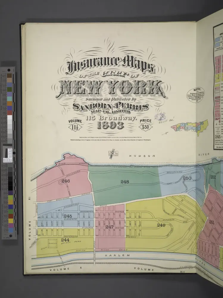
Insurance maps of the City of New York. Surveyed and published by Sanborn-Perris Map Co., Limited, 115 Broadway, 1893. Volume 11 1/2.
1893
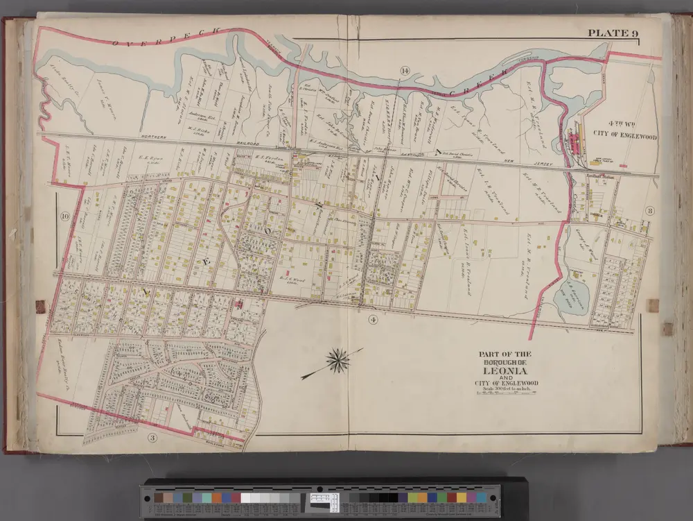
Bergen County, V. 1, Double Page Plate No. 9 [Map bounded by Overpeck Creek, Cedar Lane, Phelps Ave., Broad Ave., Borough Blvd., Oakdene Ave.] / by George W. and Walter S. Bromley.
1912
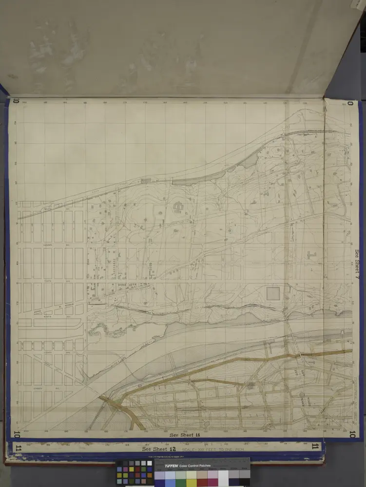
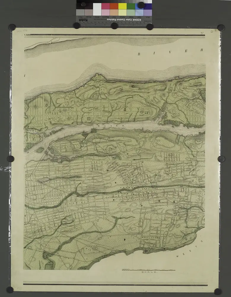
Bronx, Topographical Map Sheet 10; [Map bounded by Anderson Ave., Jerome Ave.; Including 7th Ave., 149th St., River St.]
1871
A sketch of part of the Island of New York shewing the operations of His Majesty's troops in the 16 Novr. 1776 which terminated in the immediate surrender of Fort Washington
1776
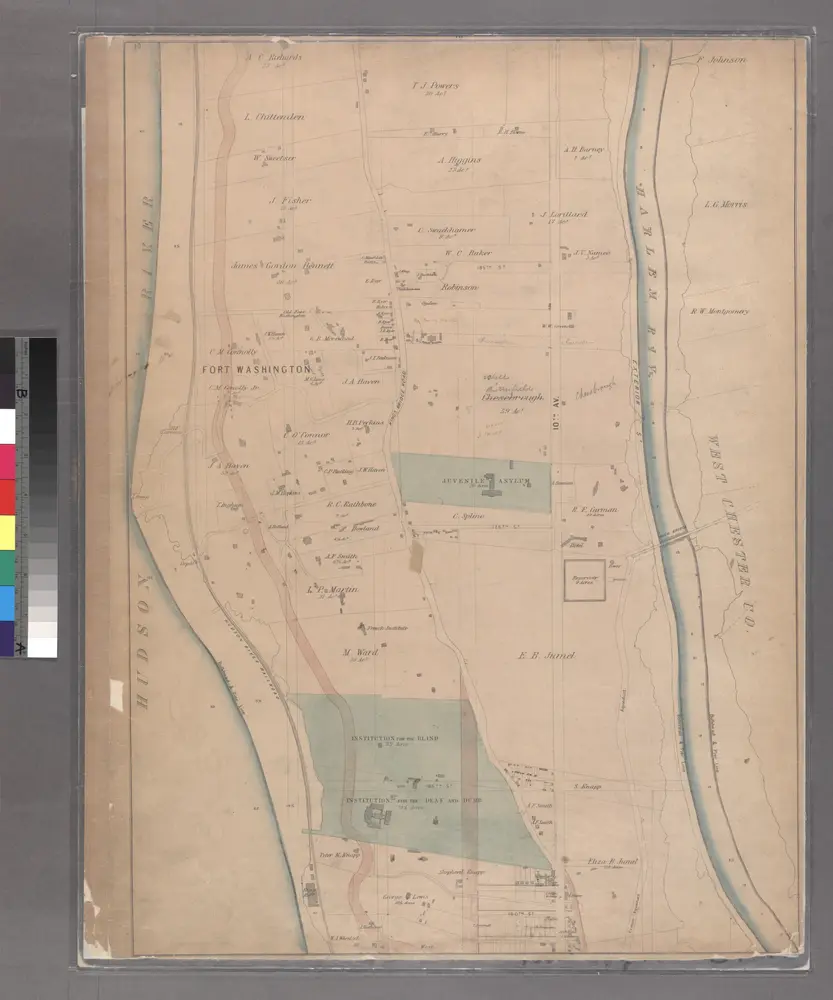
Sheet 19: [Bounded by Hudson River Bulk Head Pier Line, Fort Washington, 10th Avenue (Harlem River Bulk Head Pier Line) and 160th Street.]
1867
Topographical atlas of the city of New York, including the annexed territory showing original water courses and made land. / prepared under the direction of Egbert L. Viele.
1874
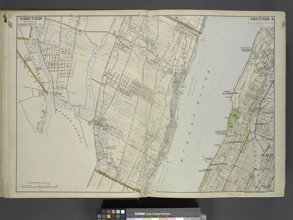
Portion of Bergen County, N.J.
1891
Central Park
1995
1:24k
Central Park
1966
1:24k
Central Park
1966
1:24k
Central Park
1966
1:24k
Central Park
1966
1:24k
Central Park
1956
1:24k
Central Park
1956
1:24k
Central Park
1947
1:24k