Maps of Bronx County

Bronx, V. B, Plate Letter. D [Map bounded by Duryea Pl., Long Island Sound, Eastchester Bay]
From Atlas 44. Vol. B, 1897.
Sheet 43: Grid #32000E - 39000E, #4000N - 11000N. [Includes City Island, South of Ditmars Street to the South of Schofield Avenue.]
from Topographical survey sheets of the borough of the Bronx easterly of the Bronx River.
Sheet 42: Grid #34000E - 35000E, #6000N - 9000N. [Includes City Island between Schofield Avenue and Ditmars Street.]
from Topographical survey and new street system of the borough of the Bronx, easterly of the Bronx River
Town of Pelham, Westchester Co. N.Y. - City Island, Pelham Township, Westchester Co. N.Y.
from County atlas of Westchester, New York. Published by J.B. Beers & Co., assisted by S.W. Wilson and others.
Small folder - S1
from Atlas of New York and vicinity : from actual surveys / by and under the direction of F. W. Beers, assisted by A. B. Prindle & others
4D - N.Y. City (Aerial Set).
from Sectional aerial maps of the City of New York / [photographed and assembled under the direction of the chief engineer, July 1st, 1924].
Hart & City Island, Sachem's Head Harbor.
1 : 20000 Hassler, F. R.
Sheet 29: Map of Pelham Bay Park, City of New York, forming sheet 29 of the Topographical Atlas of the Territory East of the Bronx River.
from Topographical survey and new street system of the borough of the Bronx, easterly of the Bronx River
Area District Map Section No. 4
from Area district map / City of New York, Board of Estimate and Apportionment.
Hammods Atlas of New York City and the metropolitan district

Flushing
1 : 24000
Flushing
1 : 24000
Flushing
1 : 24000
Flushing
1 : 24000
Flushing
1 : 24000
Flushing
1 : 24000
Flushing
1 : 24000
Flushing
1 : 24000
Flushing
1 : 24000
Plate 50: Town of Westchester, Westchester Co. N.Y.
from County atlas of Westchester, New York. Published by J.B. Beers & Co., assisted by S.W. Wilson and others.
From New York to Stratford. (2)
1 : 35000 Colles, Christopher
Map or plan showing the system of streets, avenues, public squares and places, parks, bridges, etc. in that part of the borough of the Bronx, City of New York lying easterly of the Bronx River.
From Bronx
Petersen's New Map of the Bronx showing all present and proposed Trolley and rapid transit lines. [Also showing Congressional Districts]
From Bronx
3. Ft. Schuyler-Orienta-Glen Cove.
1 : 80000 Servoss, R. D.
1 Bronx.
1 : 18000 Hyde & Company
2. Harlem-Yonkers-Pelham Manor.
1 : 80000 Servoss, R. D.
Plan of East Chester, Pelham and New Rochelle, Westchester County, New York.
1 : 42240 Beers, Frederick W.
Map of the Borough of the Bronx, City of New York, showing street pavements on January 1st, 1913.
From Bronx
New Standard map of the Borough of Bronx.
From Bronx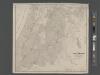
![Bronx, V. B, Plate Letter. D [Map bounded by Duryea Pl., Long Island Sound, Eastchester Bay]](https://images-2.georeferencer.com/images/iiif/182729095959/full/,300/0/native.jpg)

