Mapa catalogado
Manhattan, V. 5, Double Page Plate No. 99 [Map bounded by W. 47th St., 10th Ave., W. 42nd St., Hudson River]
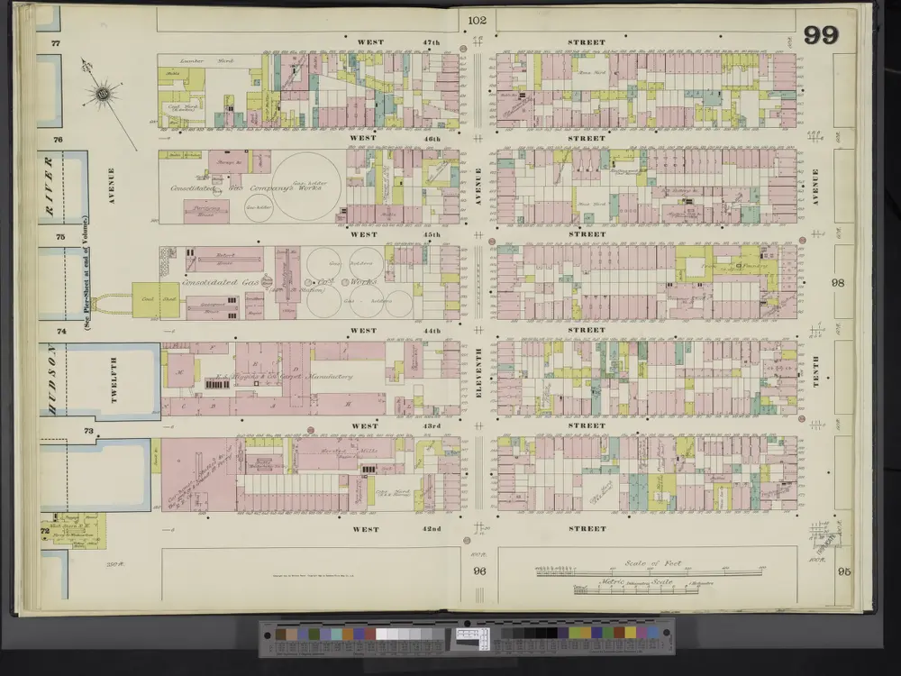

Título completo:Manhattan, V. 5, Double Page Plate No. 99 [Map bounded by W. 47th St., 10th Ave., W. 42nd St., Hudson River]
Año de ilustración:1890
Tamaño físico:20 x 30 cm
8A - N.Y. City (Aerial Set).
1924
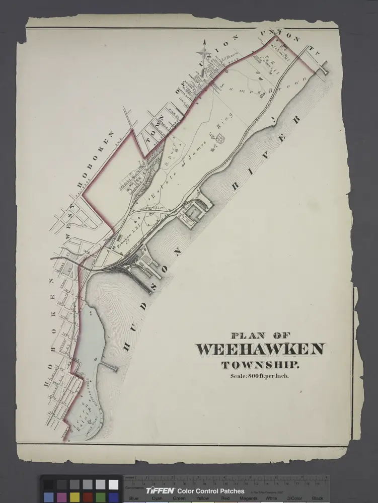
Plan of Weehawken township.
1873
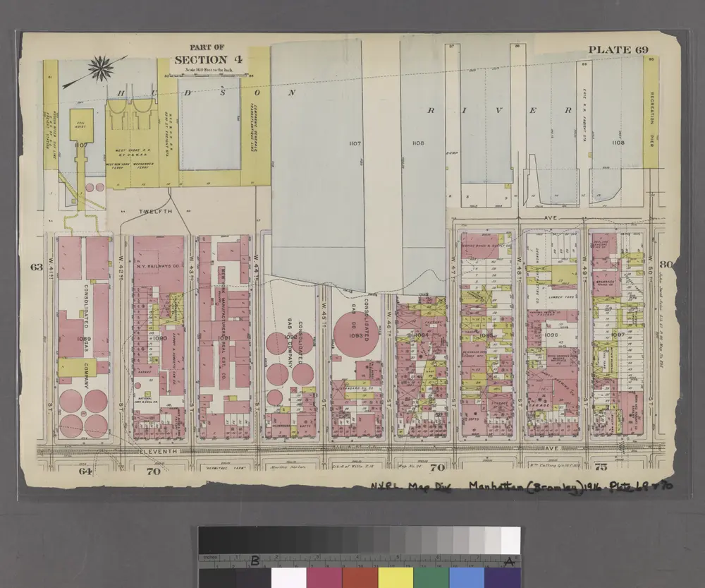
Part of Sections 3 , & 5 : Plate 69
1916
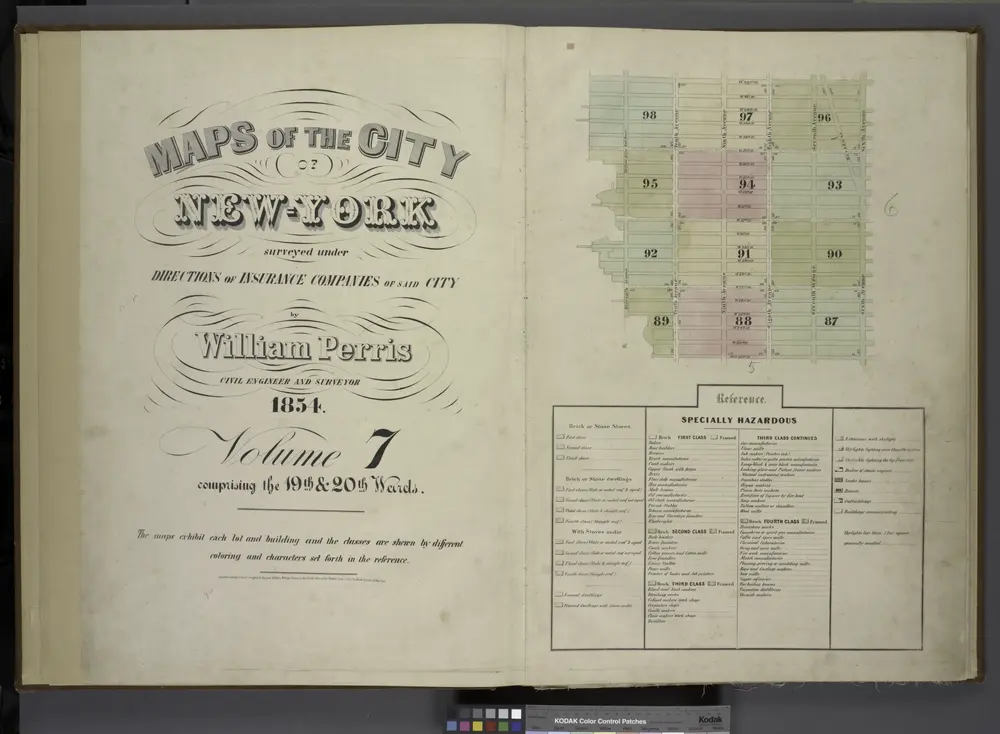
[Volume 7 Index Map.]
1854
Key
1890

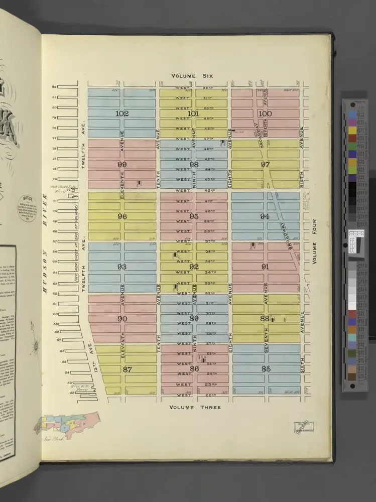
[Map bounded by Pier - Line, W. 44th St, Eleventh Avenue, W. 36th St; Including Twelfth Avenue, W. 37th St, W. 38th St, W. 39th St, W. 40th St, W. 41st St, W. 42nd St, W. 43th St]
1860
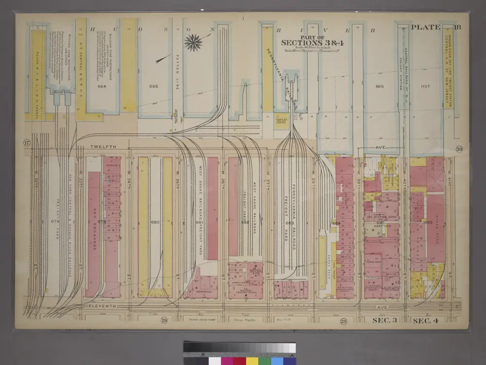
Plate 18, Part of Sections 3&4: [Bounded by (Hudson River Piers)Twelfth Avenue, W. 41st Street, Eleventh Avenue and W. 34th Street.
1905
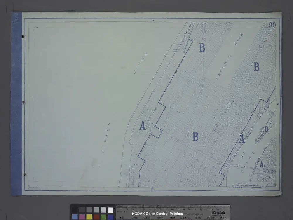
Area District Map Section No. 8
1916
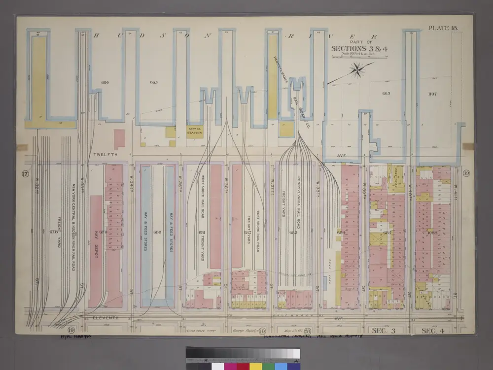
Plate 18, Part of Sections 3&4: [Bounded by (Hudson River Piers)Twelfth Avenue, W. 41st Street, Eleventh Avenue and W. 34th Street.]
1899
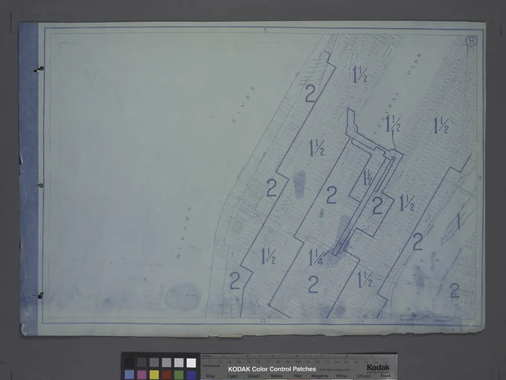
Height District Map Section No. 8
1916