Maps of Bronx County

Manhattan, V. 12, Plate No. 50 [Map bounded by 10th Ave., Dyckman St., Nagle Ave.]
From Atlas 129. Vol. 12, 1913.
Manhattan, V. 12, Plate No. 52 [Map bounded by 10th Ave., W. 204th St., Harlem River, W. 201st St.]
From Atlas 129. Vol. 12, 1913.
Manhattan, V. 12, Plate No. 51 [Map bounded by Dyckman St., W. 201st St., Harlem River]
From Atlas 129. Vol. 12, 1913.
Manhattan, V. 12, Plate No. 48 [Map bounded by Dyckman St., Fort George Ave.]
From Atlas 129. Vol. 12, 1913.
Manhattan, V. 12, Plate No. 59 [Map bounded by W. 207th St., Nagle Ave., Academy St., Sherman Ave.]
From Atlas 129. Vol. 12, 1913.
Manhattan, V. 12, Plate No. 49 [Map bounded by Vermilyea Ave., Academy St., Nagle Ave., Dyckman St.]
From Atlas 129. Vol. 12, 1913.
Manhattan, V. 12, Plate No. 47 [Map bounded by Dyckman St., St. Nicholas Ave., Ellwood St., Nagle Ave.]
From Atlas 129. Vol. 12, 1913.
Manhattan, V. 12, Plate No. 23 [Map bounded by W. 208th St., Harlem River, Academy St., Nagle Ave.]
From Atlas 128. Vol. 12, 1900.
Part of Section 8: Plate 180
from Atlas of the borough of Manhattan, city of New York.
Plate 185: Bounded by Nagle Avenue, Amsterdam Avenue, W. 208th Street, Harlem River and (Sherman's Creek) Academy Street.
from Atlas of the borough of Manhattan, city of New York.
Manhattan, V. 12, Plate No. 14 [Map bounded by Academy St., Nagle Ave.]
From Atlas 128. Vol. 12, 1900.
Manhattan, V. 11 1/2, Double Page Plate No. 251 [Map bounded by W. 211st St., Harlem River, Dyckman St., Prescott Ave.]
From Atlas 42.61. Vol. 11-11 1/2, 1893.
Manhattan, V. 11 1/2, Double Page Plate No. 249 [Map bounded by Broadway, Harlem River, W. 187th St.]
From Atlas 42.61. Vol. 11-11 1/2, 1893.
Part of Section 8 : New York City.
from Atlas of the city of New York, borough of Manhattan. From actual surveys and official plans / by George W. and Walter S. Bromley.
Part of Section 8 : New York City.
from Atlas of the city of New York, borough of Manhattan. From actual surveys and official plans / by George W. and Walter S. Bromley.
Part of Section 8: Plate 184
from Atlas of the borough of Manhattan, city of New York.
Manhattan, V. 12, Plate No. 13 [Map bounded by Academy St., Nagle Ave., Broadway]
From Atlas 128. Vol. 12, 1900.
Plate 179: Bounded by Broadway, Sherman Avenue, Dyckman Street, St Nicholas Avenue and Fairview Avenue.
from Atlas of the borough of Manhattan, city of New York.
Manhattan, V. 12, Plate No. 22 [Map bounded by Isham St., Nagle Ave., Academy St., Vermilyea Ave.]
From Atlas 128. Vol. 12, 1900.
Manhattan, V. 12, Plate No. 60 [Map bounded by 10th Ave., W. 207th St., Harlem River, W. 204th St.]
From Atlas 129. Vol. 12, 1913.
Manhattan, V. 12, Plate No. 46 [Map bounded by Dyckman St., Nagle Ave., Ellwood St., Sherman Ave.]
From Atlas 129. Vol. 12, 1913.
Page 25: [Bounded by W. 211th Street, Harlem Creek, W. 197th Street and Hudson River.]
from Sackersdorf Farm Set.
Page 24: [Bounded by 199th Street, Harlem River, 177th Street and Hudson River.]
from Sackersdorf Farm Set.
Fort Washington section.
From Manhattan
32. Ward 12.
1 : 3600 G.W. Bromley & Co.; Geo. W. Bromley & E. Robinson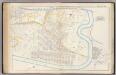
Pl. 45: ward 12.
1 : 3600 Bromley, George Washington; Bromley, Walter Scott
Sheet 20: [Bounded by 225th Street, (Spuyten Duyvel Creek Bulk Head Pier Line), 10th Avenue and 195th Street.]
from Plan of New York City, from the Battery to Spuyten Duyvil Creek. Showing every lot and building thereon; old farm lines, strreet numbers at the corners of blocks, railroads, steamboat landings, bulkhead and pier lines, etc. Based on the surveys made by Messrs. Randall & Blackwell, and on the special survey by J. F. Harrison.
[Plate 31: Bounded by Harlem River, W. 166th Street, Hudson River...]
from Atlas of the city of New York : embracing all territory within its corporate limits from official records, private plans & actual surveys / by and under the supervision of E. Robinson & R.H. Pidgeon, civil engineers.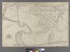
Part of Ward 12, New York City.
from Atlas of the city of New York : embracing all territory within its corporate limits from official records, private plans & actual surveys / by and under the supervision of E. Robinson & R.H. Pidgeon, civil engineers.
![Manhattan, V. 12, Plate No. 50 [Map bounded by 10th Ave., Dyckman St., Nagle Ave.]](https://images-2.georeferencer.com/images/iiif/877938254445/full/,300/0/native.jpg)

