Maps of Kings County

Queens V. 4, Plate No. 29 [Map bounded by Atlantic Ave., Ferry St., Broadway, 1st St.]
From Atlas 139. Vol. 4, 1901.
Queens V. 4, Plate No. 30 [Map bounded by Atlantic Ave., Morris Ave., Broadway, Ferry]
From Atlas 139. Vol. 4, 1901.
Queens V. 4, Plate No. 20 [Map bounded by Ferry, Atlantic Ave., Shaw Ave., 7th St.]
From Atlas 139. Vol. 4, 1901.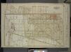
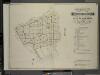
Queens, Vol. 1, Double Page Plate No. 2; Part of Ward Four, Jamaica; [Map bounded by Borough of Brooklyn, Elderst Lane, Drew Ave., Center Ave., Snedeker Ave., Rockaway Plank Road, Dakota Ave., Shaw Ave., Nevada Ave., Montana Ave., Fulton Ave., Be
from Fourth and fifth wards: Jamaica and Rockaway.
Queens V. 4, Plate No. 6 [Map bounded by Jamaica Ave., Thrall Pl., Atlantic Ave., 3rd St.]
From Atlas 139. Vol. 4, 1901.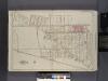
Queens, V. 1, Double Page Plate No. 2; Part of Jamaica, Ward 4; [Map bounded by Pitkin Pl., Hopkinton Ave., Liberty Ave., Elderts Ln.]
From Fourth and fifth wards: Jamaica and Rockaway.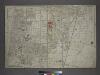
[Plate 31: Bounded by New York and Rockaway Beach, Ocean Avenue, Freeland Avenue, Flushing (Woodhaven) Avenue, Sutter Avenue, Cedar Lane, Conduit, Ruby Street, Atlantic Avenue, Drew Avenue, and (Crest Park) Brooklyn and Jamaica Plank Avenue.]
from Atlas of the city of New York, borough of Queens, Long Island City, Newtown, Flushing, Jamaica, Far Rockaway, from actual surveys and official plans / by George W. and Walter S. Bromley.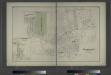
Woodhaven, Town of Jamaica, Queens Co. - South Woodhaven, Town of Jamaica, Queens Co.
from Atlas of Long Island, New York. From recent and actual surveys and records.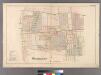
Woodhaven, Town of Jamaica.
from Atlas of Queens Co., Long Island, New York / compiled from official records, private plans & actual surveys by and under the direction of Chester Wolverton.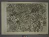
18A - N.Y. City (Aerial Set).
from Sectional aerial maps of the City of New York / [photographed and assembled under the direction of the chief engineer, July 1st, 1924].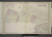
Brooklyn, Double Page Section 9; East New York; [Map bounded by Eldert Lane, Liberty Ave., Bennett Ave., New Lots Road, Duryea Ave., Centre Ave., Stmarks Ave., Saratoga Ave., Cooper PL., Mc. Dougal St.; Including Hopkinson Ave., Rockaway Ave., Gran
from Farm line map of the city of Brooklyn, from official records and surveys; comp. and drawn by Henry Fulton.
Height District Map Section No. 18; Height district map / City of New York, Board of Estimate and Apportionment.
from Height district map / City of New York, Board of Estimate and Apportionment. New York (N.Y.). Board of Estimate and Apportionment,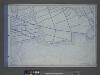
Use District Map Section No. 18; Use district map / City of New York, Board of Estimate and Apportionment.
from Use district map / City of New York, Board of Estimate and Apportionment. New York (N.Y.). Board of Estimate and Apportionment,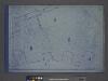
Area District Map Section No. 18; Area district map / City of New York, Board of Estimate and Apportionment.
from Area district map / City of New York, Board of Estimate and Apportionment. New York (N.Y.). Board of Estimate and Apportionment,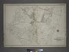
[Plate 40: Bounded by Old South Road, Centerville Avenue, Rockway Plank Road, Road to Bergens Landing, Old South Road, (Jamaica Bay, Vanderveers Island, Hortsmans Island &c.) Conduit Road and Cedar Lane.]
from Atlas of the city of New York, borough of Queens, Long Island City, Newtown, Flushing, Jamaica, Far Rockaway, from actual surveys and official plans / by George W. and Walter S. Bromley.
Key Continued
From Atlas 137a. Vol. 3, 1914.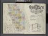
Insurance Maps of the Brooklyn city of New York Volume Eight. Published by the Sanborn map co. 117, Broadway, New York. 1887.
From Atlas 86. Vol. 8, 1887.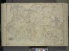
Queens, Vol. 1, Double Page Plate No. 17; Part of Ward 4; Jamaica; [Map bounded by Liberty Ave., Rockaway Turnpike, Mile Hill Road; Including Corn Fill Creek, Spring Creek]
from Fourth and fifth wards: Jamaica and Rockaway.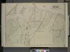
Queens, Vol.2, Double Page Plate No. 29; Part of Ward Two Newtown (East Williamsburgh, Melina and Nassau Heights); [Map bounded by Rotting Course Lane, Dry Harbor Road, Boundary between the Boroughs of Queens and Brooklyn, Newtown Creek, Bradle
from First and second wards: Long Island City and Newtown.
Community resources
From District 5
Key
From Atlas 142a, Vol. 6, 1911.
Spring Creek -- Linear City. (cont.)
From Spring Creek -- Linear City
Jamaica
1 : 24000
Jamaica
1 : 24000
Jamaica
1 : 24000
Jamaica
1 : 24000
Jamaica
1 : 24000
Jamaica
1 : 24000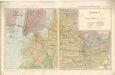
Hammods Atlas of New York City and the metropolitan district
![Queens V. 4, Plate No. 29 [Map bounded by Atlantic Ave., Ferry St., Broadway, 1st St.]](https://images-2.georeferencer.com/images/iiif/362964614894/full/,300/0/native.jpg)

