Maps of Queens County

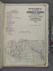
Index Map to Volume Two / by and under the supervision of Hugo Ullitz.
From v. 2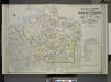
Index Map to Vol. 2, Atlas of the Borough of Queens, 1st and 2nd Wards City of New York Published by E. Belgher Hyde. 5 Beekman St. Temple Court Manhattan, 97 Liberty St. Brooklyn Borough. 1908
from Long Island City.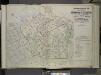
Index map to Volume Two Atlas of the Borough of Queens 1st and 2nd Wards City of New York, Published by E. Belcher Hyde, 5 Beekman St. (Temple Court) Manhattan. 97 Liberty St., Brooklyn Borough. 1908.
from First and second wards: Long Island City and Newtown.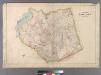
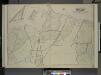
Plate 30: Town of Newtown.
from Atlas of Queens Co., Long Island, New York / compiled from official records, private plans & actual surveys by and under the direction of Chester Wolverton.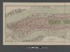
Boroughs of Manhattan and Bronx, showing the electric service of the New York Edison Co.
From Manhattan
Key
From Atlas 137. Vol. 3, 1902.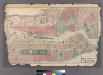
Plates 11 & 12: Map of New York City and central portion of Brooklyn.
from County atlas of Westchester, New York. Published by J.B. Beers & Co., assisted by S.W. Wilson and others.
New York (City) and Brooklyn.
1 : 32000 Johnson, A.J.
New York (City) and Brooklyn.
1 : 32000 Johnson, A.J.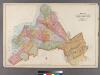
Plate 32: Map of the City of Brooklyn, Kings Co., N.Y.
from Robinson's atlas of Kings County, New York : compiled from official records ... / under the direction of E. Robinson.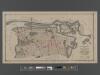
[Long Island City, Queens] Record of searches in relation to the legal status of avenues and streets in the 1st Ward of the Borough of Queens.
From Queens
Map of Newtown Creek and vicinity / prepared by the Department of Health of Brooklyn, N.Y., January 1896 ; W.W. Locke, sanitary engineer.
from Brooklyn
Map of Long Island City, Queens County, N. Y., showing farmlines, reduced from Commissioners new city map.
From Queens
Map of Newtown Creek and vicinity [and factories nearby.]
From Brooklyn
Fire department of the city of Brooklyn.
From Brooklyn
Map of the City of Williamsburg with part of Greenpoint.
From Brooklyn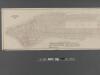
Fire Chart of the Borough of Manhattan, N.Y.
From Manhattan
New York (City) and Brooklyn.
1 : 32000 Johnson, A.J.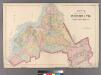
Plate 2: Map of the City of Brooklyn, Long Island, N.Y.
from Atlas of Queens Co., Long Island, New York / compiled from official records, private plans & actual surveys by and under the direction of Chester Wolverton.
New York City, Brooklyn, Jersey City, Hoboken.
1 : 749000 Colton, G. Woolworth
Manhattan, 1910 census tabulation tracts.
From Manhattan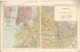
Hammods Atlas of New York City and the metropolitan district
Queens, Vol.2, Double Page Plate No. 29; Part of Ward Two Newtown (East Williamsburgh, Melina and Nassau Heights); [Map bounded by Rotting Course Lane, Dry Harbor Road, Boundary between the Boroughs of Queens and Brooklyn, Newtown Creek, Bradle
from First and second wards: Long Island City and Newtown.
Brooklyn
1 : 24000
Brooklyn
1 : 24000
Brooklyn
1 : 24000
Brooklyn
1 : 24000
Brooklyn
1 : 24000
Brooklyn
1 : 24000
Brooklyn
1 : 24000