Maps of Centre County

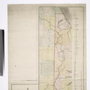
Map of the route of the proposed New York & Erie Railroad, as surveyed in 1834 / reduced from the plans as returned by Benjn. Wright, Civil Engineer ; D. R. Harrison, sc.
From Whole
Pennsylvania.
1 : 530000 Rand McNally and Company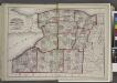
"Niagara, Erie, Chautauqua, Cattaraugus, Orleans, Genesee, Wyoming, Allegany, Monroe, and Livingston Counties"
from New topographical atlas and gazetteer of New York, comprising a topographical view of the several counties of the state, ... including ... map of the United States and territories ... Compiled from the latest astronomical observations, official surveys and records of the United States and territories ...
Map of Pennsylvania / constructed from the county surveys authorized by the state, and other original documents ; revised and improved under the supervision of Wm. E. Morris, civil engineer, upon data procured in each county ; engraved by Edwd. Yeager.
From Whole
Pennsylvania, Western Section.
1 : 539000 Rand McNally and Company
Map of Morris's Purchase or West Geneseo in the state of New York : exhibiting part of the Lakes Erie and Ontario, the Straights of Niagara ...
1 : 336000 Ellicott, Joseph Holland Land Co.
Pennsylvania (western part).
1 : 585000 Hammond, C.S.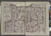
"Monroe, Livingston, Allegany, Wayne, Ontario, Steuben, Yates, Schuyler, Chemung, Seneca, Cayuga, Tompkins, Tioga, Onondaga, and Cortland Counties "
from New topographical atlas and gazetteer of New York, comprising a topographical view of the several counties of the state, ... including ... map of the United States and territories ... Compiled from the latest astronomical observations, official surveys and records of the United States and territories ...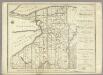
Map of Morris's Purchase or West Geneseo In the State of New York.
1 : 336000 Ellicott, Joseph & B.
Warren
1 : 250000
Warren
1 : 250000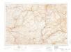
Warren
1 : 250000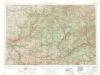
Warren
1 : 250000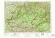
Warren
1 : 250000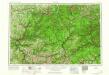
Warren
1 : 250000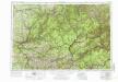
Warren
1 : 250000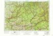
Warren
1 : 250000
Buffalo
1 : 250000
Buffalo
1 : 250000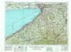
Buffalo
1 : 250000
Buffalo
1 : 250000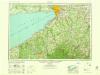
Buffalo
1 : 250000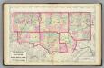
Warren, McKean, Potter, Forest, Elk, Cameron counties.
1 : 300000 Gray, Ormando Willis; Walling, H. F.
Map of the county of Erie / by David H. Burr ; engd. by Rawdon, Clark & Co., Albany, & Rawdon, Wright & Co., New York.
from An atlas of the state of New York : containing a map of the state and of the several counties. / Projected and drawn under the superintendence and direction of Simeon de Witt ... And also the physical geography of the State ...
Erie, Crawford, Venango counties.
1 : 300000 Gray, Ormando Willis; Walling, H. F.
Map of the Oil Region of Pennsylvania.
1 : 158400 Townsend & Dale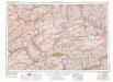
Williamsport
1 : 250000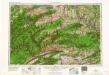
Williamsport
1 : 250000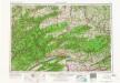
Williamsport
1 : 250000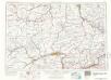
Williamsport
1 : 250000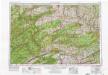
Williamsport
1 : 250000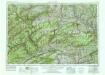
Williamsport
1 : 250000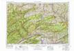
Williamsport
1 : 250000
Williamsport
1 : 250000