Cataloged map
A new map of the British colonies in North America : shewing the seat of the present war, taken from the best surveys, compared with and improved from manuscripts of several noblemen and gentlemen / by John Andrews.


Full title:A new map of the British colonies in North America : shewing the seat of the present war, taken from the best surveys, compared with and improved from manuscripts of several noblemen and gentlemen / by John Andrews.
Physical Size:20 x 30 cm
A new map of the province of Quebec in North America, drawn from the best authorities
1764
1:7m

Atlas Ameriquain Septentrional Contenant, mapa ze strany: [12]
1778
Chez le Rouge, Ingenieur Géographe du Roi, Rue des grands Augustins
Carte de la Province de Québec, Canada ; pour accompagner la brochure intitulée "La Province de Québec et l'Émigration européenne" = Map of the province of Quebec, Canada ; to accompany the pamphlet entitled "the province of Quebec and european emigration"
1870
Québec (province). Département des terres de la Couronne
1:2m
Paskaert van de Noordelijckste kuste van America van Groenland door de Straet Davis en de Straet Hudson tot Terra Neuf
1668
Colom, Jacob Aertsz
1:8m
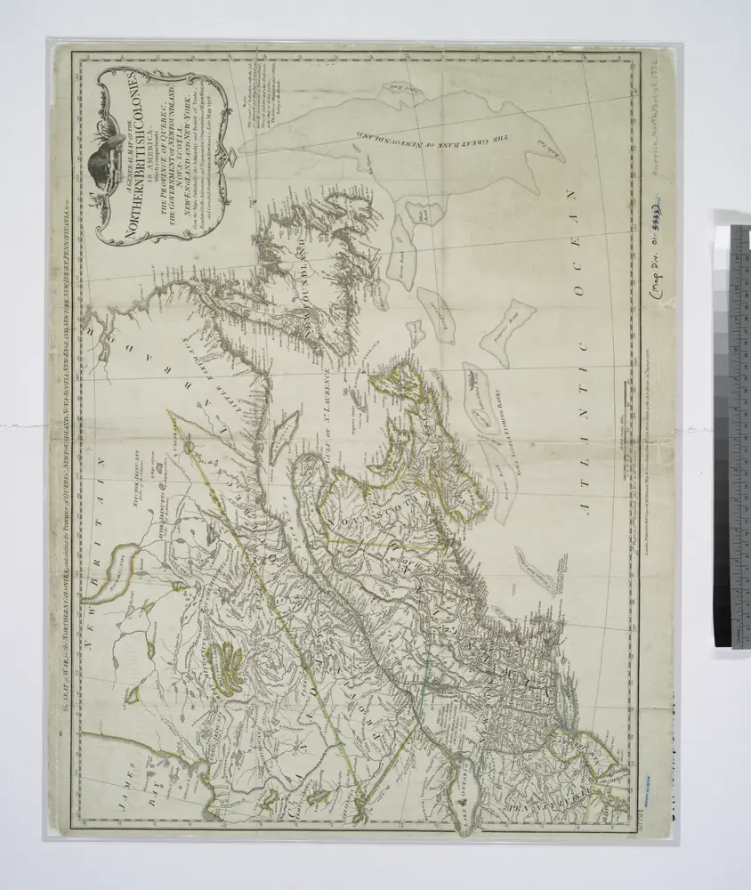
A general map of the northern British colonies in America: which comprehends the province of Quebec, the government of Newfoundland, Nova-Scotia, New-England and New-York / from the maps published by the Admiralty and Board of Trade, regulated by the astronomic and trigonometric observations of Major Holland, and corrected from Governor Pownall's late map 1776.
1776
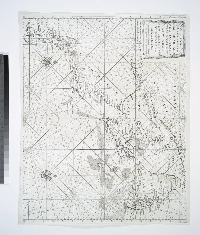
A chart of the sea coast of New Foundland, New Scotland, New England, New York, New Jersey, with Virginia and Maryland.
1770
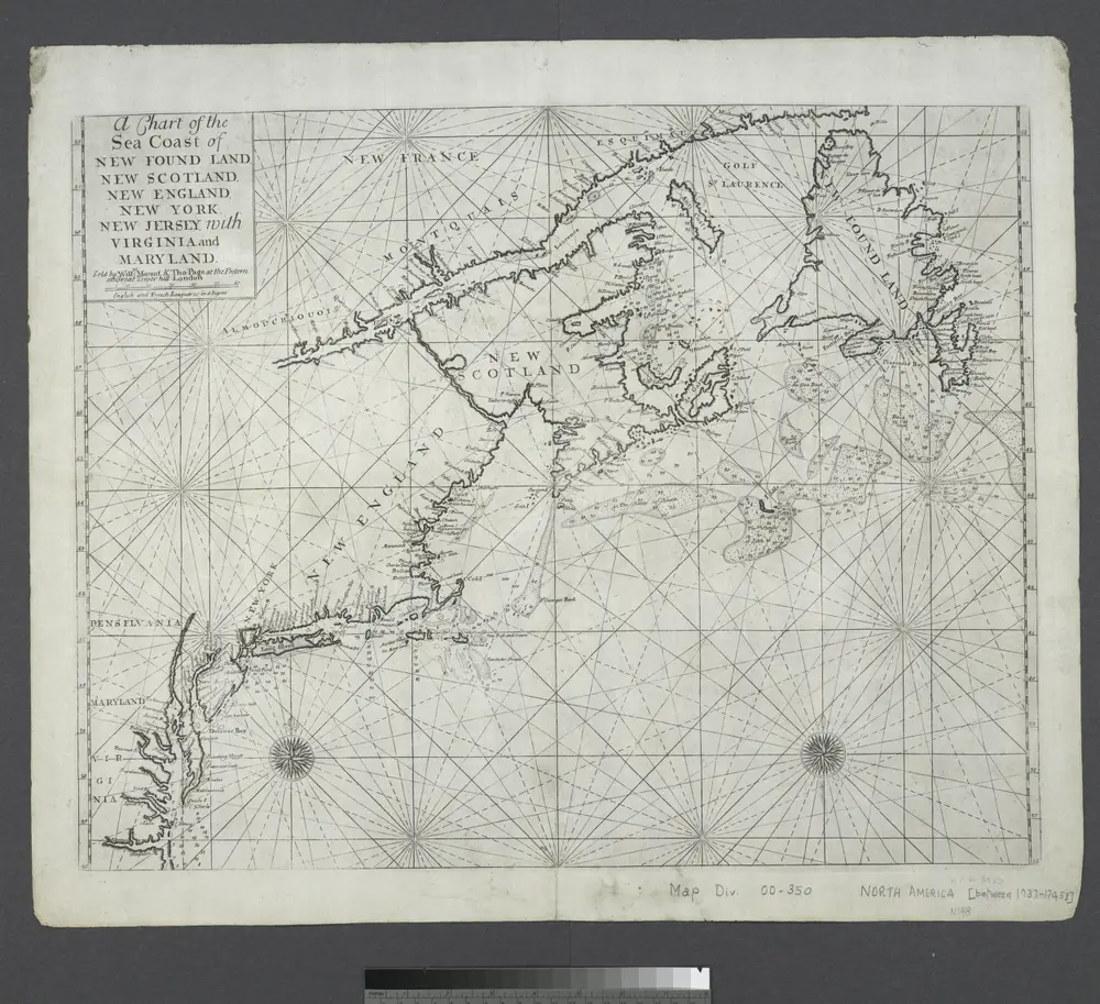
A chart of the sea coast of New Foundland, New Scotland, New England, New York, New Jersey, with Virginia and Maryland.
1745

Atlas Ameriquain Septentrional Contenant, mapa ze strany: [13]
1778
Chez le Rouge, Ingenieur Géographe du Roi, Rue des grands Augustins
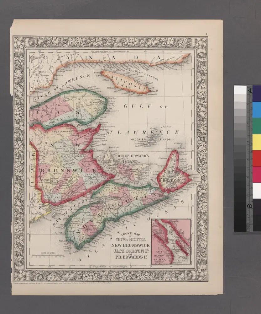
County map of Nova Scotia, New Brunswick, Cape Breton, and Prince Edward's Islands; City and harbor of Halifax [inset].
1860
Map of the European and North American Railway : showing its connection with the railways of the United States & Canada
1850
Morton, A. C., engineer
1:2m