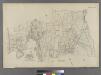
Maps of Manhattan Community Board 9

[Map of the city of New York and island of Manhattan as laid out by the commissioners appointed by the Legislature, April 3, 1807]
From Manhattan
Topographical atlas of the city of New York, including the annexed territory showing original water courses and made land. / prepared under the direction of Egbert L. Viele.
From Topographical atlas of the city of New York, including the annexed territory showing original water courses and made land
Outline and Index Map, Sections 9 and 10, Borough of the Bronx.
from Atlas and owners names, borough of the Bronx, sections 9 & 10 : from actual surveys and official plans / by George W. and Walter S. Bromley.
Hammods Atlas of New York City and the metropolitan district

W. Farms, Morrisania.
1 : 15840 Beers, F. W. (Frederick W.)
Key
From Atlas 128. Vol. 12, 1900.
Proposed Harlem River Drive from 155th Street to Dyckman River.
From Manhattan
Map of that part of the city of New York north of 155 street
1 : 6375 Major & Knapp Eng. Mfg. & Lith. Co.
Outline and Index Map of the 23rd Ward, City of New York.
from Atlas of the city of New York : from official records, private plans & actual surveys / compiled under the supervision of E. Robinson & R. H. Pidgeon.
Use District Map Section No. 3; Use district map / City of New York, Board of Estimate and Apportionment.
from Use district map / City of New York, Board of Estimate and Apportionment. New York (N.Y.). Board of Estimate and Apportionment,
Height District Map Section No. 3; Height district map / City of New York, Board of Estimate and Apportionment.
from Height district map / City of New York, Board of Estimate and Apportionment. New York (N.Y.). Board of Estimate and Apportionment,
Area District Map Section No. 3; Area district map / City of New York, Board of Estimate and Apportionment.
from Area district map / City of New York, Board of Estimate and Apportionment. New York (N.Y.). Board of Estimate and Apportionment,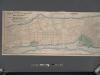
Map of the City of New York north of 155th street, showing the progress made in laying out streets, roads, public squares and places by the Commissioners of Central Park.
From Manhattan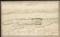
A sketch of part of the Island of New York shewing the operations of His Majesty's troops in the 16 Novr. 1776 which terminated in the immediate surrender of Fort Washington
Part of Ward 24, New York City.
from Atlas of the city of New York : embracing all territory within its corporate limits from official records, private plans & actual surveys / by and under the supervision of E. Robinson & R.H. Pidgeon, civil engineers.
Riderdale, Fieldston, Kingsbridge, North Riverdale, Spuyten Duyvil
From District 14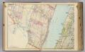
3 Bergen Co., N.J.
1 : 14400 Watson & Co. (New York, N.Y.)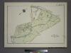
Plate 83, Part of Section 13, Borough of the Bronx. [Bounded by Webster Avenue, Bronx Boulevard, White Plains Road, E. 180th Street, Boston Road, E. 188th Street, Southern Boulevard and E. Fordham Road.]
from Atlas of borough of the Bronx, Sections 9 10 11 12 & 13 : from actual surveys and official plans / G.W. Bromley and Co.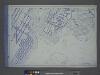
Use District Map Section No. 6
from Use district map / City of New York, Board of Estimate and Apportionment.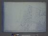
Height District Map Section No. 1
from Height district map / City of New York, Board of Estimate and Apportionment.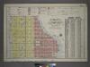
Outline and Index Map of Volume Four.
from Atlas of the city of New York, borough of Manhattan / from actual surveys and official plans by George W. and Walter S. Bromley.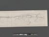
Plan for the Riverside Drive Extension from 155th Street to the Harlem River (exhibit A.)
From Manhattan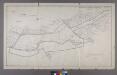
Map or Plan of Section 28. [Bounded by Southern Boulevard, E. 200th Street, Jerome Avenue, Gun Hill Road and Webster Avenue.]
from Maps or plans and profiles, with field notes and explanatory remarks, showing the location, width, grades, and class of streets, roads, avenues, public squares and places, located and laid out by the Commissioner of Street Improvements of the 23rd and 24th wards of the city of New York : under authority of Chapter 545 of the laws of 1890.
Bronx, Topographical Map Sheet 10; [Map bounded by Anderson Ave., Jerome Ave.; Including 7th Ave., 149th St., River St.]
From Topographical map made from surveys by the commissioners of the Department of Public Parks of the City of New York of that part of Westchester County adjacent to the City and County of New York embraced by chapter 534 of laws of 1871 as amended b...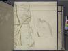
Bronx, Topographical Map Sheet 9; [Map bounded by Southern Blvd., Kingsbridge Road, Bronx River, Home St.; Including Westchester Ave., Intervale Ave., Stebbins Ave., Marion Ave.]
From Topographical map made from surveys by the commissioners of the Department of Public Parks of the City of New York of that part of Westchester County adjacent to the City and County of New York embraced by chapter 534 of laws of 1871 as amended b...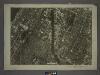
6A - N.Y. City (Aerial Set).
from Sectional aerial maps of the City of New York / [photographed and assembled under the direction of the chief engineer, July 1st, 1924].
Plates 23 & 24: Southern Part of Yonkers and portion of West Farms.
from County atlas of Westchester, New York. Published by J.B. Beers & Co., assisted by S.W. Wilson and others.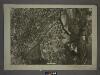
6B - N.Y. City (Aerial Set).
from Sectional aerial maps of the City of New York / [photographed and assembled under the direction of the chief engineer, July 1st, 1924].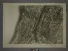
3C - N.Y. City (Aerial Set).
from Sectional aerial maps of the City of New York / [photographed and assembled under the direction of the chief engineer, July 1st, 1924].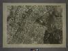
![[Map of the city of New York and island of Manhattan as laid out by the commissioners appointed by the Legislature, April 3, 1807]](https://images-2.georeferencer.com/images/iiif/201793920643/full/,300/0/native.jpg)

