Mapa catalogado
Lay's map of the United States / compiled from the latest and best authorities and actual surveys by Amos Lay, geographer and map publisher ; engraved by O.H. & D.S. Throop & Wm. Chapin.

Título completo:Lay's map of the United States / compiled from the latest and best authorities and actual surveys by Amos Lay, geographer and map publisher ; engraved by O.H. & D.S. Throop & Wm. Chapin.
Tamaño físico:20 x 30 cm
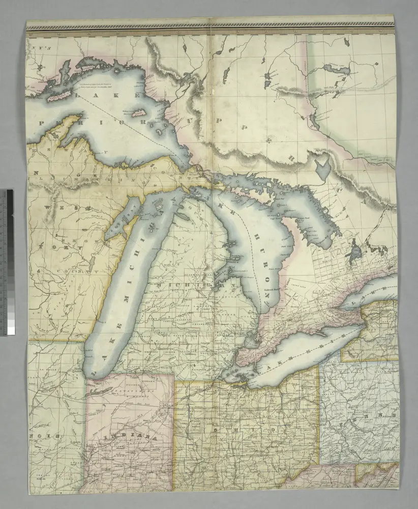
General Chart of the Northern and Northwestern Lakes
1911
War Department, Corps of Engineers
1:1m
Map of the state of Michigan and the surrounding country : exhibiting the sections and the latest surveys
1851
Farmer, John
1:780k
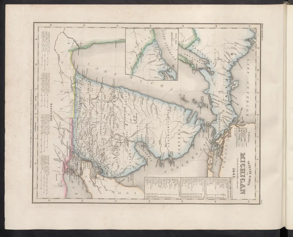
Neueste Karte von Michigan
1860
Meyer, J.
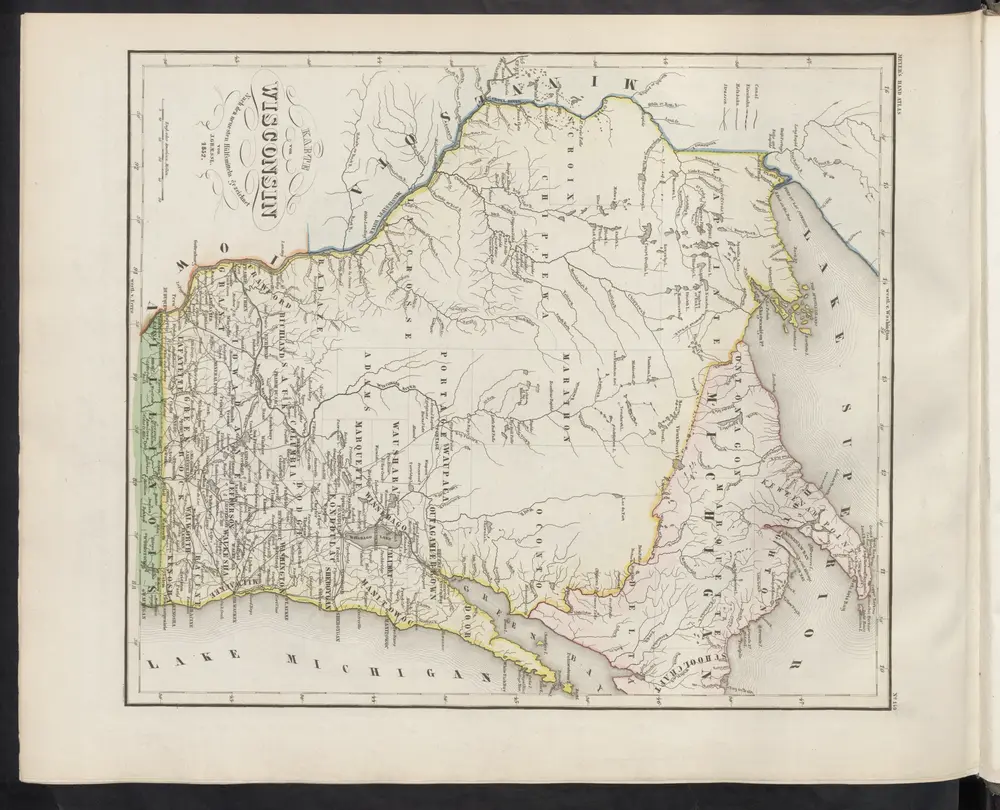
Karte von Wisconsin
1860
Meyer, J.
Wisconsin
1974
Kishner, Mel
Preliminary traffic map, showing annual 24 hour average traffic, state of Wisconsin
1948
Wisconsin. State Highway Commission
1:1m
Historical map of Wisconsin
1938
Bohlman, Nina S.
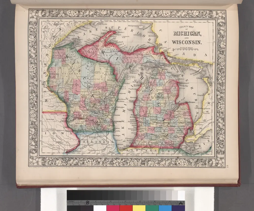
County map of Michigan, and Wisconsin.
1860
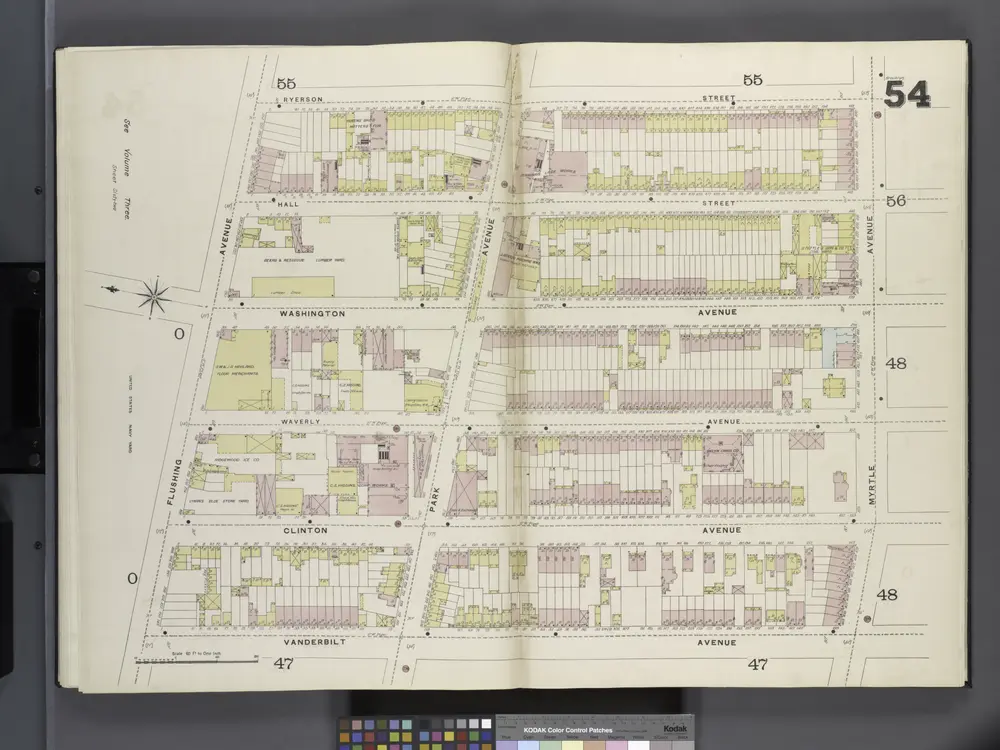
Brooklyn V. 2, Double Page Plate No. 54 [Map bounded by Ryerson St., Myrtle Ave., Vanderbilt Ave., Flushing Ave.]
1887
Educational map of the state of Wisconsin
1875
Searing, Edward
1:380k
A Geological Map of Wisconsin
1855
Lapham, Increase Allen
1:2m