Maps of Peekskill
Brooklyn, V. 9, Double Page Plate No. 267 [Map bounded by Covert Ave., Bleecker St., Irving Ave., Flushing Ave.]
From Atlas 89. Vol. 9, 1888.
Map of Newtown Creek and vicinity / prepared by the Department of Health of Brooklyn, N.Y., January 1896 ; W.W. Locke, sanitary engineer.
from Brooklyn
Bushwick, Ridgewood. (cont.)
From District 4
Maspeth, Sunnyside, Woodside. (cont.)
From District 2
Height District Map Section No. 1
from Height district map / City of New York, Board of Estimate and Apportionment.
Area Zoning Map Section No. 13
From Area zoning map of the city of New York, compiled in the Dept. of City Planning, Division of Mapping and Zoning, May 27, 1953. Irving F. Ashworth, senior civil engineer.
Area Zoning Map Section No. 17
From Area zoning map of the city of New York, compiled in the Dept. of City Planning, Division of Mapping and Zoning, May 27, 1953. Irving F. Ashworth, senior civil engineer.
Area District Map Section No. 13
from Area district map / City of New York, Board of Estimate and Apportionment.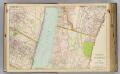
4 Yonkers, Bergen Co.
1 : 14400 Watson & Co. (New York, N.Y.)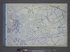
Use District Map Section No. 13
from Use district map / City of New York, Board of Estimate and Apportionment.
W. Farms, Morrisania.
1 : 15840 Beers, F. W. (Frederick W.)
Key
From Atlas 134. Vol. 2, 1915.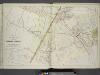
Plans of Parts of Piermont, Sparkill, and Palisades, N.Y. and Harrington, N.J.
from Atlas of the Hudson River Valley from New York city to Troy, including a section of about 8 miles in width. Published by Watson & co. Compiled from official records and careful surveys, under the supervision of F. W. Beers.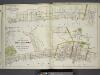
Plan of Grand View, Rockland County, N.Y. ; Plans of Nyack, South Nyack and part of Piermont, Rockland County, N.Y.
from Atlas of the Hudson River Valley from New York city to Troy, including a section of about 8 miles in width. Published by Watson & co. Compiled from official records and careful surveys, under the supervision of F. W. Beers.
Height District Map Section No. 29
from Height district map / City of New York, Board of Estimate and Apportionment.
Key
From Atlas 128. Vol. 12, 1900.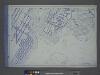
Use District Map Section No. 6
from Use district map / City of New York, Board of Estimate and Apportionment.
Key
From Atlas 137a. Vol. 3, 1914.
Key continued
From Atlas 128. Vol. 12, 1900.
Proposed Harlem River Drive from 155th Street to Dyckman River.
From Manhattan
Plan of the city of Brooklyn, L.I. / by William Perris.
from Brooklyn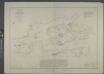
Hell Gate and its approaches / from a trigonometrical survey under the direction of F.R. Hassler and A.D. Bache, superintendents of the Survey of the Coast of the United States.
from New York harbor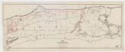
Map of that part of the city of New York north of 155 street
1 : 6375 Major & Knapp Eng. Mfg. & Lith. Co.
Plan of the city of Brooklyn, L.I. / by William Perris.
from Brooklyn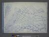
Use District Map Section No. 9
from Use district map / City of New York, Board of Estimate and Apportionment.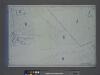
Area District Map Section No. 29; Area district map / City of New York, Board of Estimate and Apportionment.
from Area district map / City of New York, Board of Estimate and Apportionment. New York (N.Y.). Board of Estimate and Apportionment,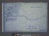
Use District Map Section No. 29; Use district map / City of New York, Board of Estimate and Apportionment.
from Use district map / City of New York, Board of Estimate and Apportionment. New York (N.Y.). Board of Estimate and Apportionment,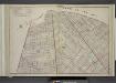
Brooklyn, Double Page Section 7; [Including Wards 18, 24, 25]
from Farm line map of the city of Brooklyn, from official records and surveys; comp. and drawn by Henry Fulton.
Area District Map Section No. 23; Area district map / City of New York, Board of Estimate and Apportionment.
from Area district map / City of New York, Board of Estimate and Apportionment. New York (N.Y.). Board of Estimate and Apportionment,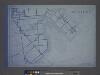
Use District Map Section No. 23; Use district map / City of New York, Board of Estimate and Apportionment.
from Use district map / City of New York, Board of Estimate and Apportionment. New York (N.Y.). Board of Estimate and Apportionment,
![Brooklyn, V. 9, Double Page Plate No. 267 [Map bounded by Covert Ave., Bleecker St., Irving Ave., Flushing Ave.]](https://images-2.georeferencer.com/images/iiif/954197553181/full/,300/0/native.jpg)

