Maps of Wyoming
Brooklyn V. 2, Double Page Plate No. 56 [Map bounded by De Kalb Ave., Washington Ave., Myrtle Ave., Classon Ave.]
From Atlas 66. Vol. 2, 1887.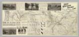
Great No. RR line.
1 : 2730000 Great Northern Railway Company (U.S.)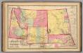
Nebraska, and the territories of Dakota, Idaho, Montana and Wyoming.
1 : 3000000 Lloyd, H.H.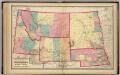
Nebraska, and the territories of Dakota, Idaho, Montana and Wyoming.
1 : 3000000 Walling, H. F.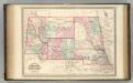
Nebraska, Dakota, Idaho, Montana, and Wyoming.
1 : 3400000 Johnson, A.J.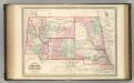
Nebraska, Dakota, Idaho, Montana, and Wyoming.
1 : 3400000 Johnson, A.J.
Ontario.
Rand McNally and Company
Map Of Chicago & North-Western Railway Lines (To) Dakota.
1 : 2611000 Chicago and North Western Railway Company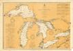
General Chart of the Northern and Northwestern Lakes
1 : 1200000 Chart showing all of the Great Lakes: Lake Superior, Lake Michigan, Lake Huron, Lake Erie, and Lake Ontario and canals, rivers and cities that border the lakes. The map also includes tables of United States and Canadian canals, annual water levels, dry docks, and marine railways. War Department, Corps of Engineers U.S. Lake Survey Office
Brooklyn V. 2, Double Page Plate No. 54 [Map bounded by Ryerson St., Myrtle Ave., Vanderbilt Ave., Flushing Ave.]
From Atlas 66. Vol. 2, 1887.
[Horní tok Mississippi]
Mississippi, řeka-oblast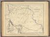
Territory of Nebraska.
1 : 3453120 Rogers, Henry Darwin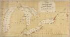
A Chart exhibiting the Light Houses, on the Lake Coasts of the United States of America
A Chart exhibiting the Light Houses, on the Lake Coasts of the United States of America.
Canada West (Upper).
1 : 2000000 Tanner, Henry S.
North Western and MichiganTerritories.
1 : 4400000 Lucas, Fielding Jr.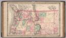
Oregon, and Washington Territory.
1 : 3000000 Colton, G.W.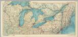
United States of America - Great Lakes. Pergamon World Atlas.
1 : 2500000 Polish Army Topography Service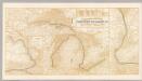
Northern Steamship Co. (map)
1 : 4752000 Northern Steamship Company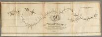
Map of the Mississippi River from its Source to the Mouth of the Missouri.
1 : 1584000 Pike, Zebulon Montgomery
Plan of Captain Carvers Travels in the interior Parts of North America.
1 : 2851200 Carver, Jonathan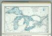
Great Lakes including Canals and Tributary Navigable Streams.
1 : 3353000 Hammond, C.S.
Iowa, Wisconsin.
1 : 3380000 Nicollet, J. N. (Joseph Nicolas), 1786-1843
Michigan, Wisconsin, Iowa, & Minnesota.
1 : 3200000 Black, Adam & Charles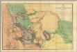
Map Of The Yellowstone And Missouri Rivers.
1 : 1200000 Raynolds, William F.
Michigan Ter.
1 : 4435200 Lucas, Fielding Jr.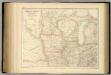
United States ... North Central Section.
1 : 2851200 Fullarton, A. & Co.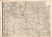
A Map of the British Empire in America. (Sheet 5).
1 : 2000000 Popple, Henry
Climatology of Michigan ... isothermals January, July, summer, winter.
1 : 5000000 Winchell, Alexander, 1824-1891
Climatology of Michigan ... isothermals spring, autumn, year average.
1 : 5000000 Winchell, Alexander, 1824-1891
![Brooklyn V. 2, Double Page Plate No. 56 [Map bounded by De Kalb Ave., Washington Ave., Myrtle Ave., Classon Ave.]](https://images-2.georeferencer.com/images/iiif/307284418538/full/,300/0/native.jpg)

