Carte cataloguée
Plan of Tarrytown, North Tarrytown, and Surroundings.


Titre complet:Plan of Tarrytown, North Tarrytown, and Surroundings.
Année de l'image:1891
Taille physique:20 x 30 cm
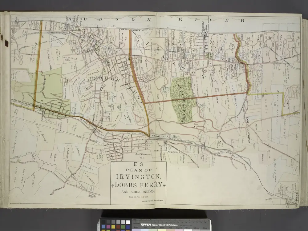
Plan of Irvington, Dobbs Ferry and Surroundings.
1891
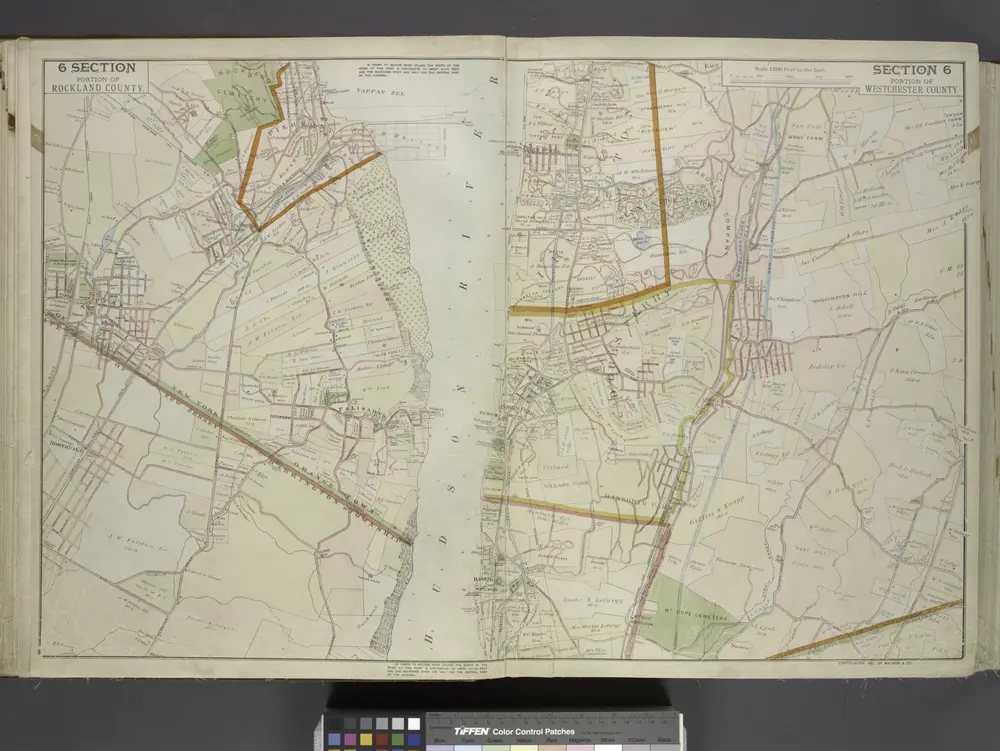
Portion of Rockland County. ; Portion of Westchester County.
1891
White Plains
1967
1:24k
White Plains
1967
1:24k
White Plains
1967
1:24k
White Plains
1957
1:24k
White Plains
1957
1:24k
White Plains
1947
1:24k
White Plains
1938
1:32k
White Plains
1938
1:32k
White Plains
1932
1:24k