Maps of Yonkers

Maps of Yonkers

$title$

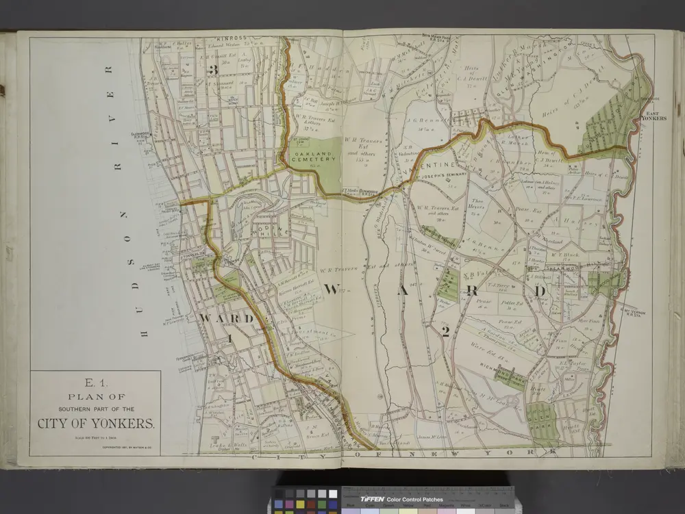
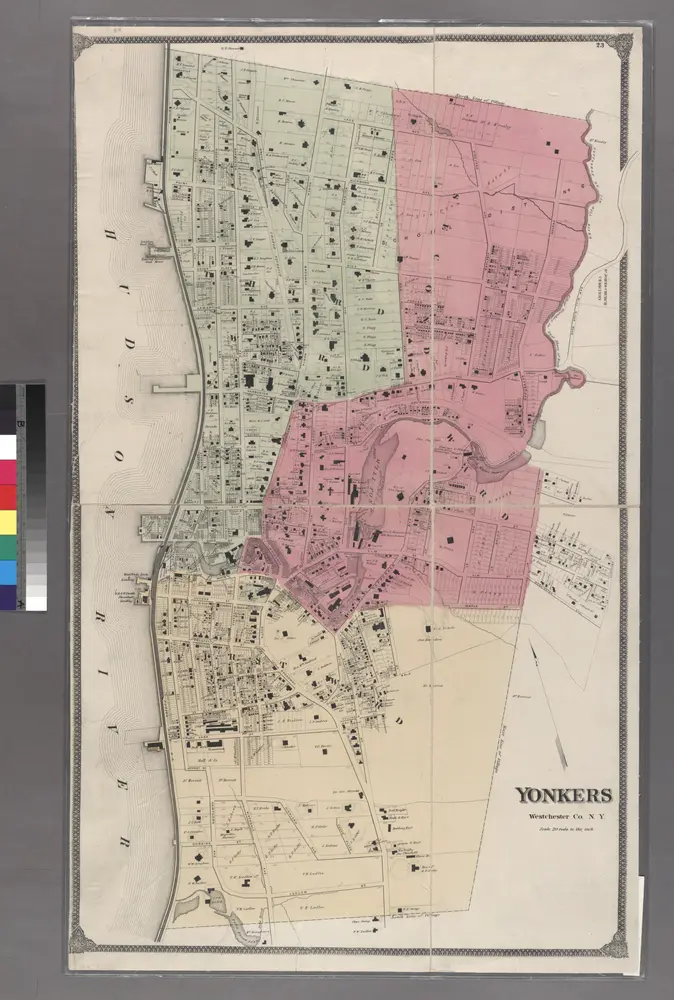
Plan of Southern part of the City of Yonkers.

from Atlas of the Hudson River Valley from New York city to Troy, including a section of about 8 miles in width. Published by Watson & co. Compiled from official records and careful surveys, under the supervision of F. W. Beers.
$title$

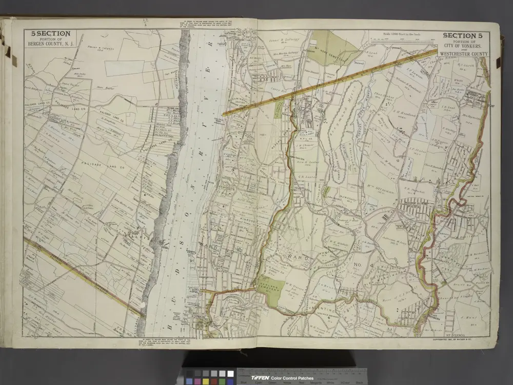
2 Yonkers.

1 : 18000 Hyde & Company
$title$

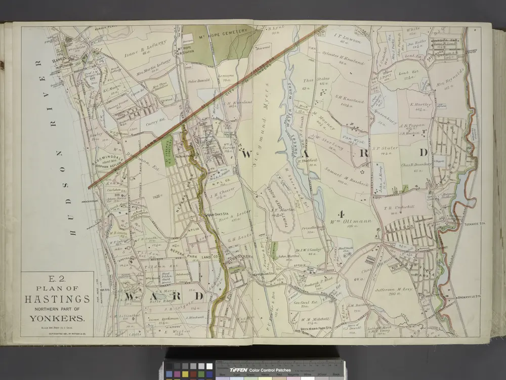
E1 Yonkers S.

1 : 9600 Watson & Co. (New York, N.Y.)
$title$

East Chester.

1 : 14400 Bromley, George Washington; Bromley, Walter Scott; G.W. Bromley & Co.
$title$

Yonkers wards 3-4.

1 : 9600 Bromley, George Washington; Bromley, Walter Scott; G.W. Bromley & Co.
$title$

Bronx, Topographical Map Sheet 1; [Map bounded by Morris St., Livingstone Ave., Hamilton Ave., Broadway, Highland Ave., Park Hill Ave., Tibbet's Brook; Including Lawrence St., New York Boston Railroad, Mosholu Ave., Old Post Road, Riverdale, Bettners ...

From Topographical map made from surveys by the commissioners of the Department of Public Parks of the City of New York of that part of Westchester County adjacent to the City and County of New York embraced by chapter 534 of laws of 1871 as amended b...
$title$

Plate 25: Parts of 1st Ward of the City of Yonkers, Mt. St. Vincent and Riverdale.

from County atlas of Westchester, New York. Published by J.B. Beers & Co., assisted by S.W. Wilson and others.
$title$

Plate 21: Town of Yonkers, Westchester County. (River Dale.)

from Atlas of New York and vicinity : from actual surveys / by and under the direction of F. W. Beers, assisted by A. B. Prindle & others
$title$

Large folder - L1

from Atlas of New York and vicinity : from actual surveys / by and under the direction of F. W. Beers, assisted by A. B. Prindle & others
$title$

1B - N.Y. City (Aerial Set).

from Sectional aerial maps of the City of New York / [photographed and assembled under the direction of the chief engineer, July 1st, 1924].
$title$

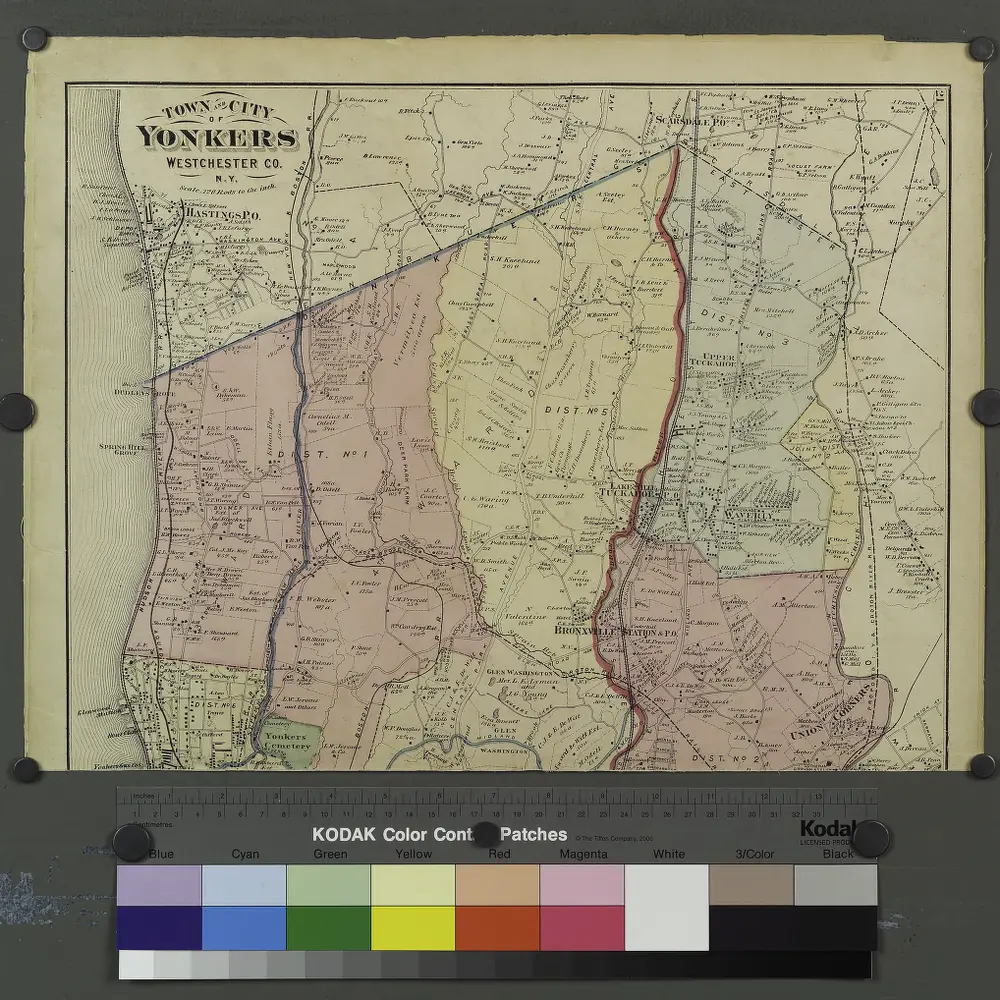
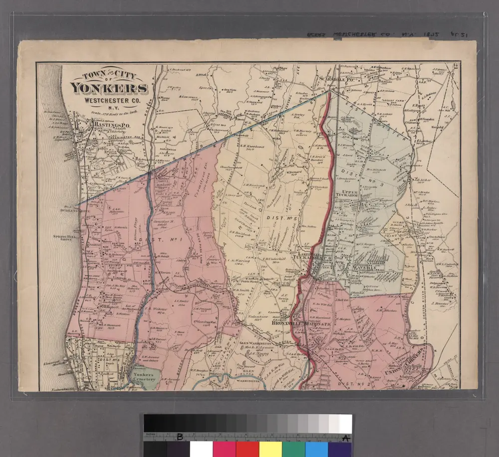
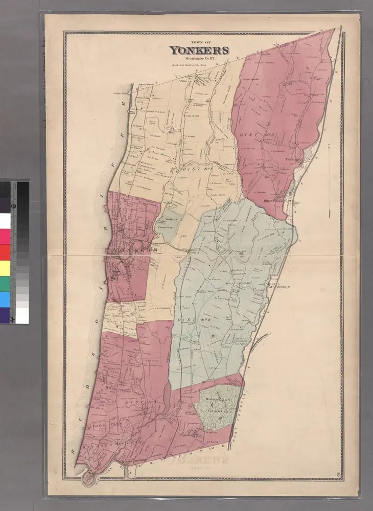
Plan of Yonkers, Town of Yonkers, Westchester County, New York.

1 : 42240 Beers, Frederick W.
$title$

Section 26 of Final Maps and Profiles, of the 23rd & 24th Wards.

from Maps or plans and profiles, with field notes and explanatory remarks, showing the location, width, grades, and class of streets, roads, avenues, public squares and places, located and laid out by the Commissioner of Street Improvements of the 23rd and 24th wards of the city of New York : under authority of Chapter 545 of the laws of 1890.
$title$

Map or Plan of Section 25. [Bounded by Riverdale Avenue, W. 262nd Street, Broadway and W. 253rd Street.]

from Maps or plans and profiles, with field notes and explanatory remarks, showing the location, width, grades, and class of streets, roads, avenues, public squares and places, located and laid out by the Commissioner of Street Improvements of the 23rd and 24th wards of the city of New York : under authority of Chapter 545 of the laws of 1890.
$title$

21. Yonkers.

1 : 3600 Kiser, Ellis; Mueller, A. H.
$title$

Westchester, Double Page Plate No. 11 [Map bounded by East Chester, E. 2nd St., Mount Vernon Ave., City of Yonkers] / prepared under the direction of Joseph R. Bien, from general surveys and official records.

From Atlas of Westchester County, New York
$title$

24-25 Yonkers.

1 : 7200 G.W. Bromley & Co.
$title$

22. Yonkers.

1 : 3600 Kiser, Ellis; Mueller, A. H.
$title$

17. Yonkers.

1 : 3600 Kiser, Ellis; Mueller, A. H.
$title$

18. Yonkers.

1 : 3600 Kiser, Ellis; Mueller, A. H.
$title$

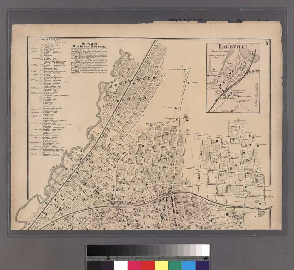
Mount Vernon, Town of East Chester, Westchester Co., N.Y. (insets) Washingtonville. East Chester. Lakeville.

1 : 5940 Beers, J.B.
$title$

Lakeville - Washingtonville - East Chester.

from County atlas of Westchester, New York. Published by J.B. Beers & Co., assisted by S.W. Wilson and others.
$title$

Bronx, Topographical Map Sheet 2; [Map bounded by Midland Ave., Mc. Lean Ave., New York and Harlem Railroad, Mosholu Ave.; Including Croton Aqueduct, New York and Boston Railroad, Tibbet's Brook]

From Topographical map made from surveys by the commissioners of the Department of Public Parks of the City of New York of that part of Westchester County adjacent to the City and County of New York embraced by chapter 534 of laws of 1871 as amended b...
$title$

Plate 34: Mount Vernon, Westchester Co. N.Y.

from Atlas of New York and vicinity : from actual surveys / by and under the direction of F. W. Beers, assisted by A. B. Prindle & others
$title$

2A - N.Y. City (Aerial Set).

from Sectional aerial maps of the City of New York / [photographed and assembled under the direction of the chief engineer, July 1st, 1924].
$title$

Westchester, Double Page Plate No. 10 [Map bounded by 15th Ave., City of Yonkers, Mount Vernon Ave.] / prepared under the direction of Joseph R. Bien, from general surveys and official records.

From Atlas of Westchester County, New York
$title$

40. Ward 24.

1 : 7200 G.W. Bromley & Co.; Geo. W. Bromley & E. Robinson
$title$

Section 27 of Final Maps and Profiles, of the 23rd & 24th Wards.

from Maps or plans and profiles, with field notes and explanatory remarks, showing the location, width, grades, and class of streets, roads, avenues, public squares and places, located and laid out by the Commissioner of Street Improvements of the 23rd and 24th wards of the city of New York : under authority of Chapter 545 of the laws of 1890.
$title$

Lakeville - Washingtonville - East Chester.

from County atlas of Westchester, New York. Published by J.B. Beers & Co., assisted by S.W. Wilson and others.
$title$

Map or Plan of Section 19. [Bounded by Jerome Avenue, E. 233rd Street, Mount Vernon Avenue, E. 239th Street, Vireo Avenue and Webster Avenue.]

from Maps or plans and profiles, with field notes and explanatory remarks, showing the location, width, grades, and class of streets, roads, avenues, public squares and places, located and laid out by the Commissioner of Street Improvements of the 23rd and 24th wards of the city of New York : under authority of Chapter 545 of the laws of 1890.
$title$

Map or Plan of Section 24. [Bounded by Riverdale Avenue, 253rd Street, Broadway, W. 238th Street and Spuyten Duvil Parkway.]

from Maps or plans and profiles, with field notes and explanatory remarks, showing the location, width, grades, and class of streets, roads, avenues, public squares and places, located and laid out by the Commissioner of Street Improvements of the 23rd and 24th wards of the city of New York : under authority of Chapter 545 of the laws of 1890.
© MapTiler © OpenStreetMap contributors
How does it work?
These instructions will show you how to find historical maps online.
Getting started
Type the place name in the search box to find the exact location. You can further adjust the search by zooming in and out.
Zoom
Zoom in and out with the buttons or use your mouse or touchpad natively.
Exact Area tool
Click here and draw a rectangle over the map to precisely define the search area.
Set filters
Narrow your search with advanced settings, such as Years (from/to), Fulltext, Publisher, etc.
Results
See the results of your search on the right side. You can scroll down to find more maps of this location.
?

Download OldMapsOnline Mobile