Mapa catalogado
Part of Ward 3. [Map bound by Johnson Ave, Innis St, Grant St, Sherman Ave, Prospect St, Richmond Ave, Washington Ave, Van Pelt Ave, Pier & Bulkhead Line 1881]


Título completo:Part of Ward 3. [Map bound by Johnson Ave, Innis St, Grant St, Sherman Ave, Prospect St, Richmond Ave, Washington Ave, Van Pelt Ave, Pier & Bulkhead Line 1881]
Año de ilustración:1907
Tamaño físico:20 x 30 cm
Elizabeth
1995
1:24k
Elizabeth
1967
1:24k
Elizabeth
1967
1:24k
Elizabeth
1967
1:24k
Elizabeth
1955
1:24k
Elizabeth
1955
1:24k
Elizabeth
1947
1:24k
Elizabeth
1947
1:24k
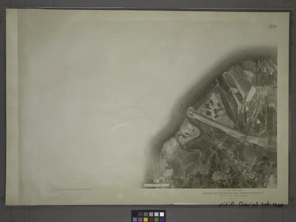
20A - N.Y. City (Aerial Set).
1924
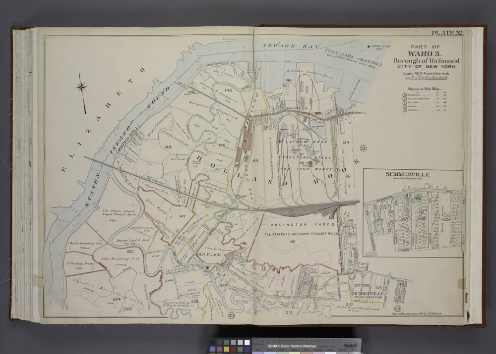
Part of Ward 3. [Map bound by State Line, Richmond (Shore Road) Terrace, Holland Ave, John St, Washington Ave, Irving PL, South Ave, Old Place Creek; Summerville - Washington Ave, South Ave, Irving PL, Garfield Ave, Dechen Ave]
1907