Cataloged map
Part of Wards 1 & 3. [Map bound by Palmer's Run, Jewett Ave, Cherry Lane, Barrett Ave, Decker Ave, Richmond Ave, Prospect St, Grant St, Johnson Ave, Kill Van Kull]


Full title:Part of Wards 1 & 3. [Map bound by Palmer's Run, Jewett Ave, Cherry Lane, Barrett Ave, Decker Ave, Richmond Ave, Prospect St, Grant St, Johnson Ave, Kill Van Kull]
Depicted:1907
Physical Size:20 x 30 cm
Arthur Kill
1966
1:24k
Arthur Kill
1966
1:24k
Arthur Kill
1966
1:24k
Arthur Kill
1966
1:24k
Arthur Kill
1955
1:24k
Arthur Kill
1955
1:24k
Arthur Kill
1947
1:24k
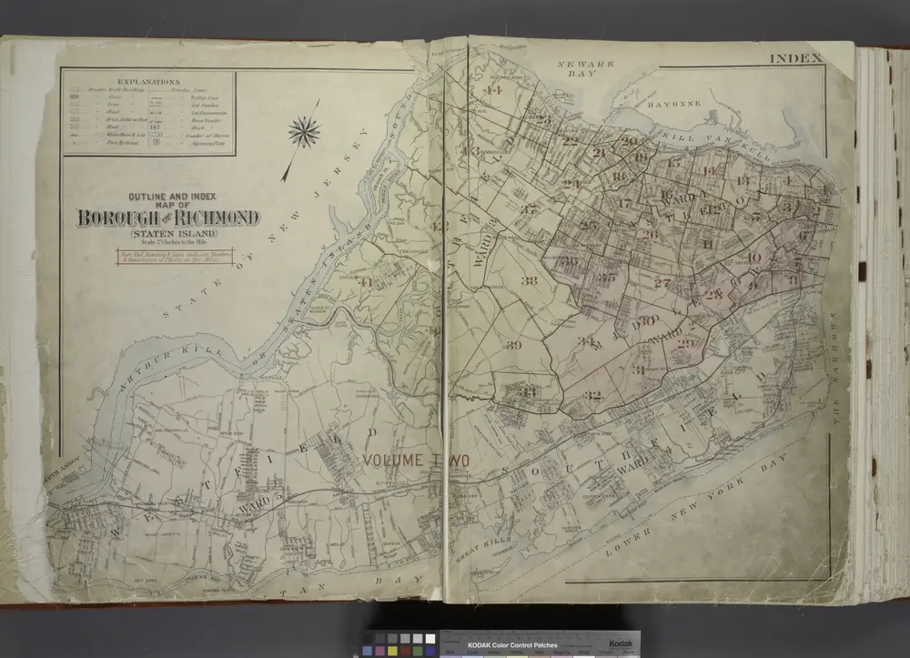
Outline & Index Map of The Borough of Richmond (Staten Island); Explanation; Note.
1917
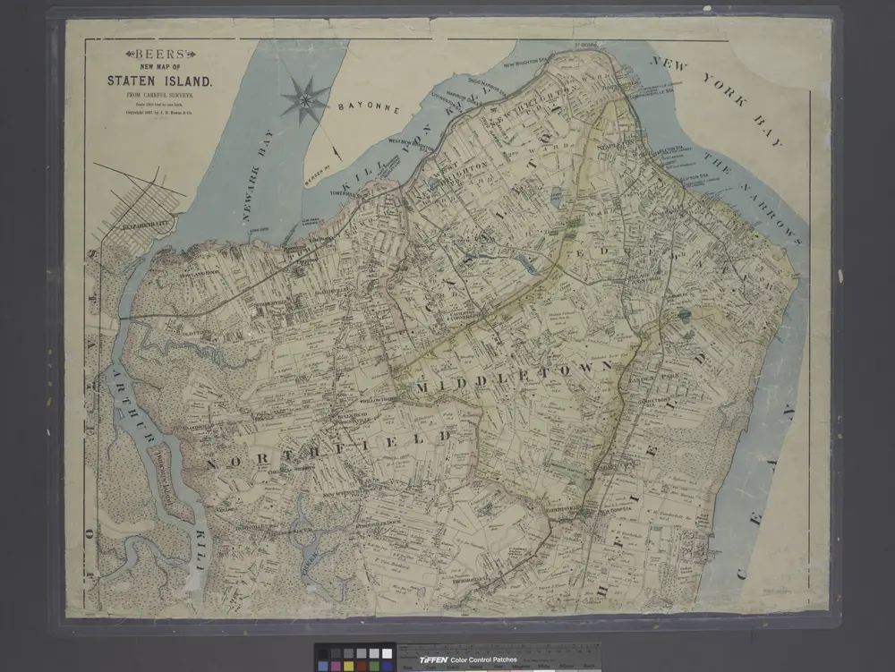
New map of Staten Island
1887
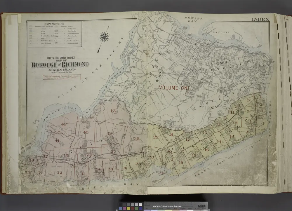
Outline & Index Map of The Borough of Richmond (Staten Island); Explanation; Note.
1917