Maps of Northern European Plain
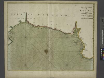
The sea-coast of FRANCE from Havre de Grace to Cape de Barfleur
from The sea-atlas : containing an hydrographical description of most of the sea-coasts of the known parts of the world.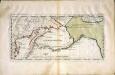
Carte der Entdekvngen zwischen Sibirien und America bis auf das Jahr 1780
1 Karte : Kupferdruck ; 18 x 40 cm Pallas s.n.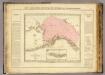
Possessions russes.
1 : 7600000 Pierron, Jean Antoine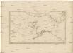
Karte von den n.w. amerikanischen und n.oe. asiatischen Küsten
Severní Amerika-oblast severozápadní Roberts, Heinrich Lackner, I. C. von F.A. Schraembl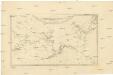
Karte von den N.W. Amerikanischen und N.Oe. Asiatischen Küsten
1 : 8800000 Severní Amerika-oblast severozápadní Roberts, Heinrich Lackner, I. C. von F. A. Schraembl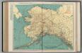
Alaska.
1 : 4055000 Rand McNally and Company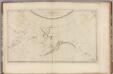
N.W. coast America, N.E. coast Asia.
1 : 8700000 Cook, James, 1728-1779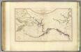
NW America, NE Asia.
1 : 8800000 Roberts, Henry, Lieut.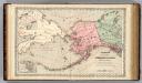
Territory of Alaska (Russian America).
1 : 7000000 Colton, G.W.
North America...N.W. Sheet.
1 : 7500000 Tanner, Henry S.
North America...N.W. Sheet.
1 : 7500000 Tanner, Henry S.
Alaska.
1 : 7315000 Colton, G. Woolworth
Alaska.
1 : 3817000 U.S. General Land Office
Map Of Alaska.
1 : 3484800 Punnett Brothers
Alaska.
1 : 8400000 Rand McNally and Company
Alaska.
1 : 8200000 Rand McNally and Company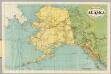
Rand-McNally Official 24x36 Map Of Alaska.
1 : 3611520 Rand McNally and Company
Territory of Alaska.
1 : 7500000 Colton, G.W.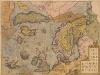
Septentrionalium Regionum Descrip. [Karte], in: Theatrum orbis terrarum, S. 105.
1 Karte aus Atlas Ortelius, Abraham
Carte réduite des mers du Nord
1 Karte : Kupferdruck ; 31 x 42 cm Bellin Didot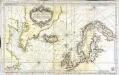
Carte réduite des mers du Nord
1 Karte : Kupferdruck ; 51 x 84 cm s.n.
Cambrai
1 : 40000 First World War map: Shows front lines at 20th November and 6th December 1917. War Office
Orientační plán hlavního města Prahy s okolím
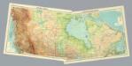
Composite: Canada.
1 : 5000000 John Bartholomew and Son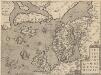
Septentrionallium Regionum Descrip. [Karte], in: Theatrum orbis terrarum, S. 381.
1 Karte aus Atlas Ortelius, Abraham Vrients, Jan Baptista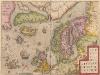
Septentrionalium Regionum Descrip. [Karte], in: Theatrum orbis terrarum, S. 286.
1 Karte aus Atlas Ortelius, Abraham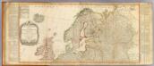
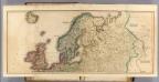
Europe (north)
1 : 4800000 Robert Laurie & James Whittle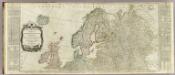
Europe divided into its empires, kingdoms, states, republics, &c. (Northern States)
1 : 4800000 Kitchin, Thomas
Septentrionalium regionum descriptio
1 : 28000000 1 Karte : Kupferdruck ; 8 x 11 cm Galle, Philippe [Christophe Plantin]