Cataloged map
Area District Map Section No. 10
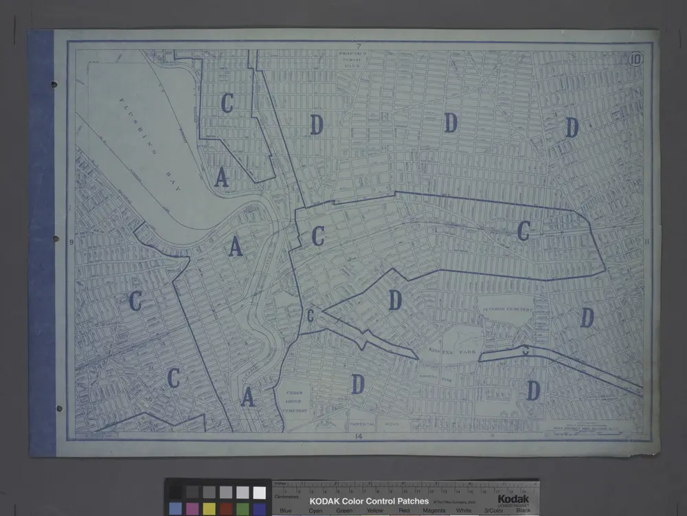

Full title:Area District Map Section No. 10
Depicted:1916
Physical Size:20 x 30 cm
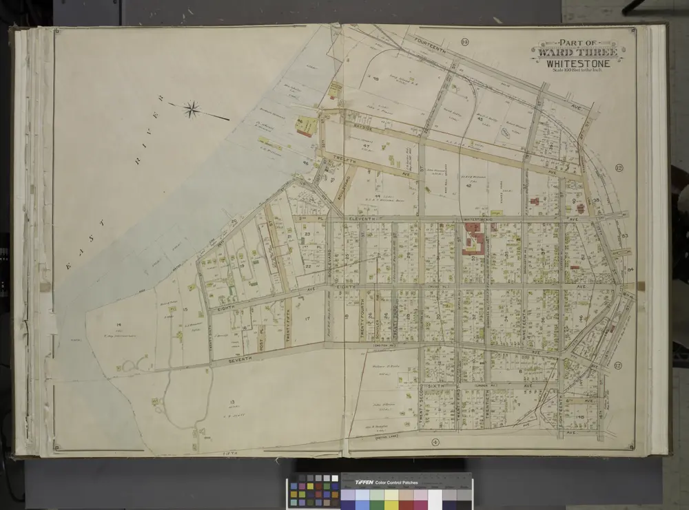
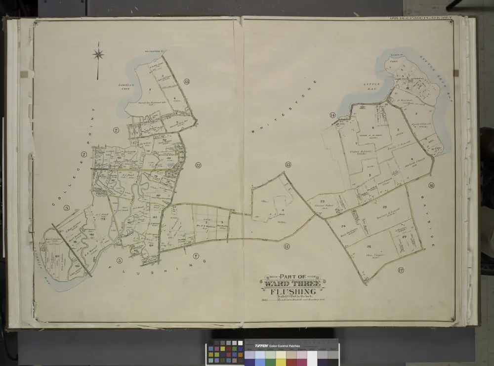
Queens, Vol. 3, Double Page Plate No. 12; Part of Ward Three Whitestone; [Map bounded by 14th Ave., Haggertys Lane, 11th Ave., Clinton Pl., Cryders Lane, 10th Ave., 9th Ave., 8th Ave., 7th Ave., 5th Ave., 4th Ave., Tatham Pl., Private, Howl
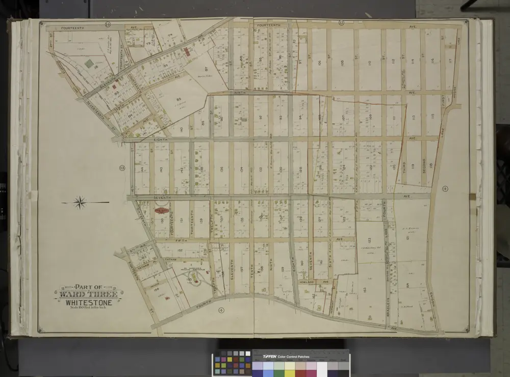
1913
Queens, Vol. 3, Double Page Plate No. 13; Part of Ward Three Whitestone; [Map bounded by 14th Ave., Bayside Ave., 12th Ave., 8th Ave., Irving PL., 11th Ave., Whitestone Ave., 2nd PL., Boulevard, Post PL., Schuyler Ave., 7th Ave., Croton Ave
1913
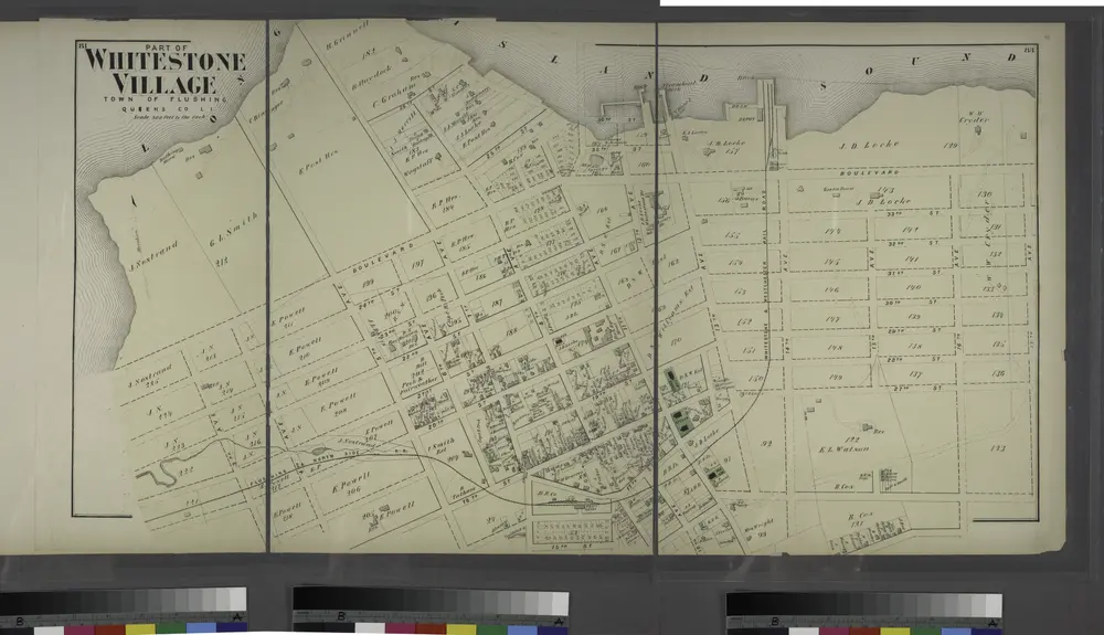
Part of Whitestone Village. Town of Flushing, Queens Co. L.I. [Covers from 3rd Avenue to 17th Avenue, and Boulevard to 17th Street.]
1873
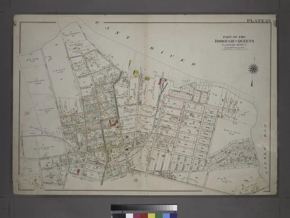
Part of the Borough of Queens, Flushing, Ward 3.
1909
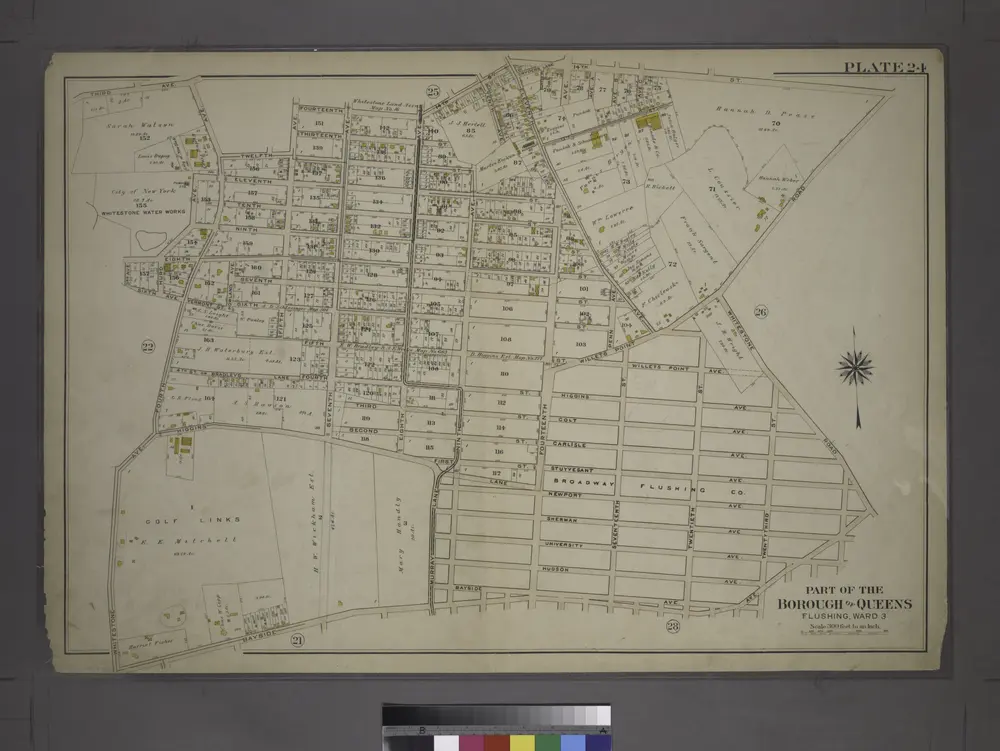
Part of the Borough of Queens, Flushing, Ward 3.
1909
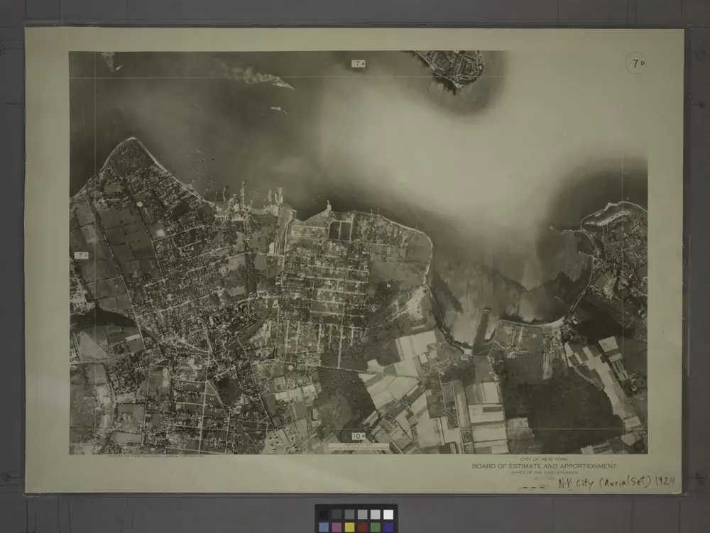
7D - N.Y. City (Aerial Set).
1924
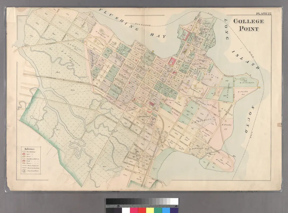
College Point.
1891
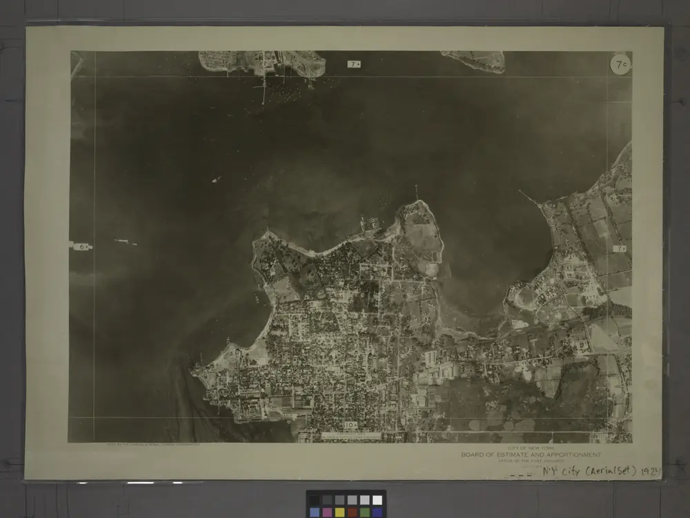
7C - N.Y. City (Aerial Set).
1924
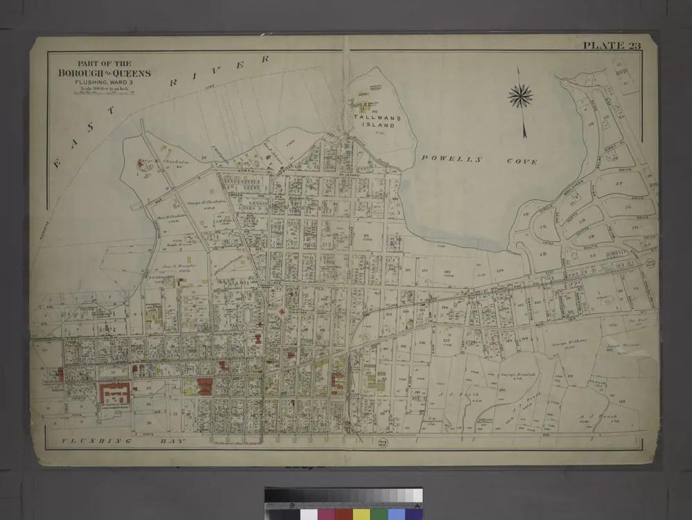
[Plate 23: Bounded by (East River) Avenue G, North Boulevard, N. 20th Street, Avenue C, Boulevard Drive, South Point, Circle Boulevard Drive, Malba Drive, 18th Street, Third Avenue, N. 22nd Street, Fourth Avenue, 5th Street, Third Avenue, First Street, F
1909
Queens, Vol. 3, Double Page Plate No. 4; Part of ward Three College Point. [Map bounded by 11th Ave., 10th Ave., 7th Ave., 6th Ave., Linden Ave., 5th Ave., Simths Lane, 4th Ave., Lawrence Ave., 3rd Ave., Nostrand Lane, Old Flushing Rd., Whitestone
1913