Mapa catalogado
Massapequa

Título completo:Massapequa
Año de ilustración:1914
Tamaño físico:20 x 30 cm
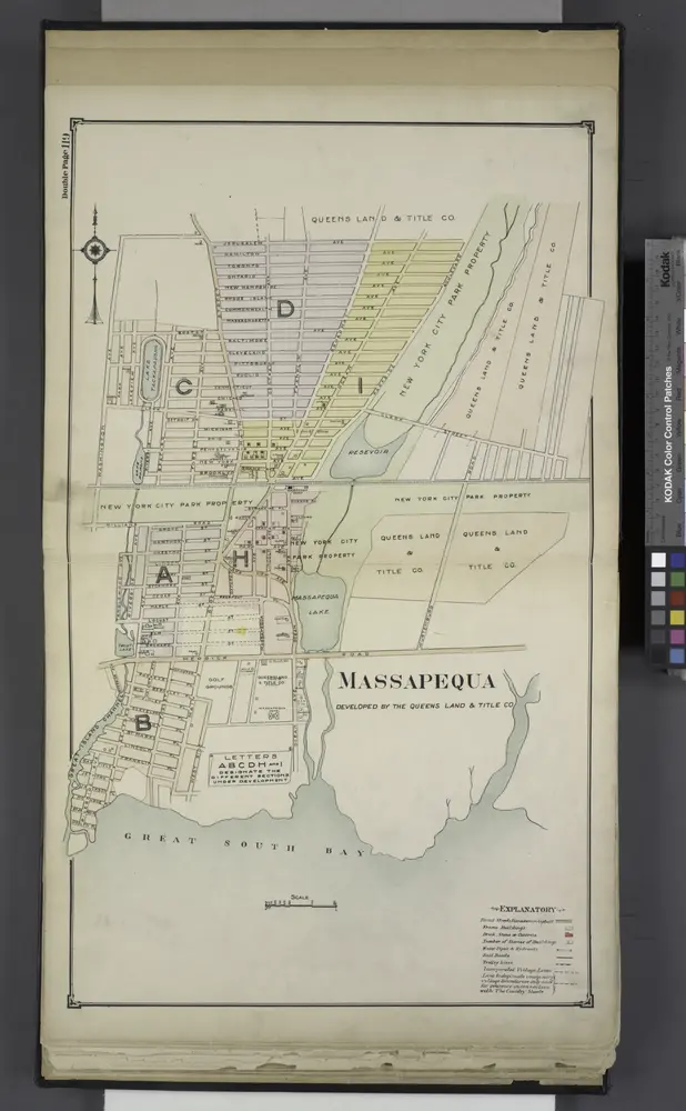
Massapequa
1914
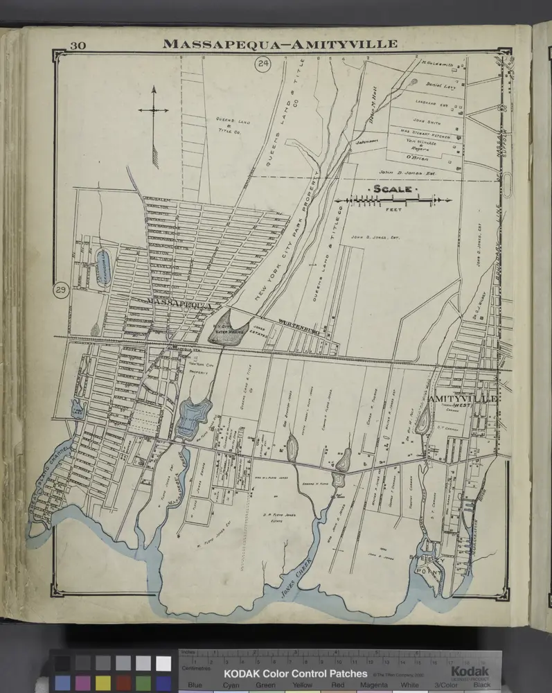
Massapequa - Amityville
1914
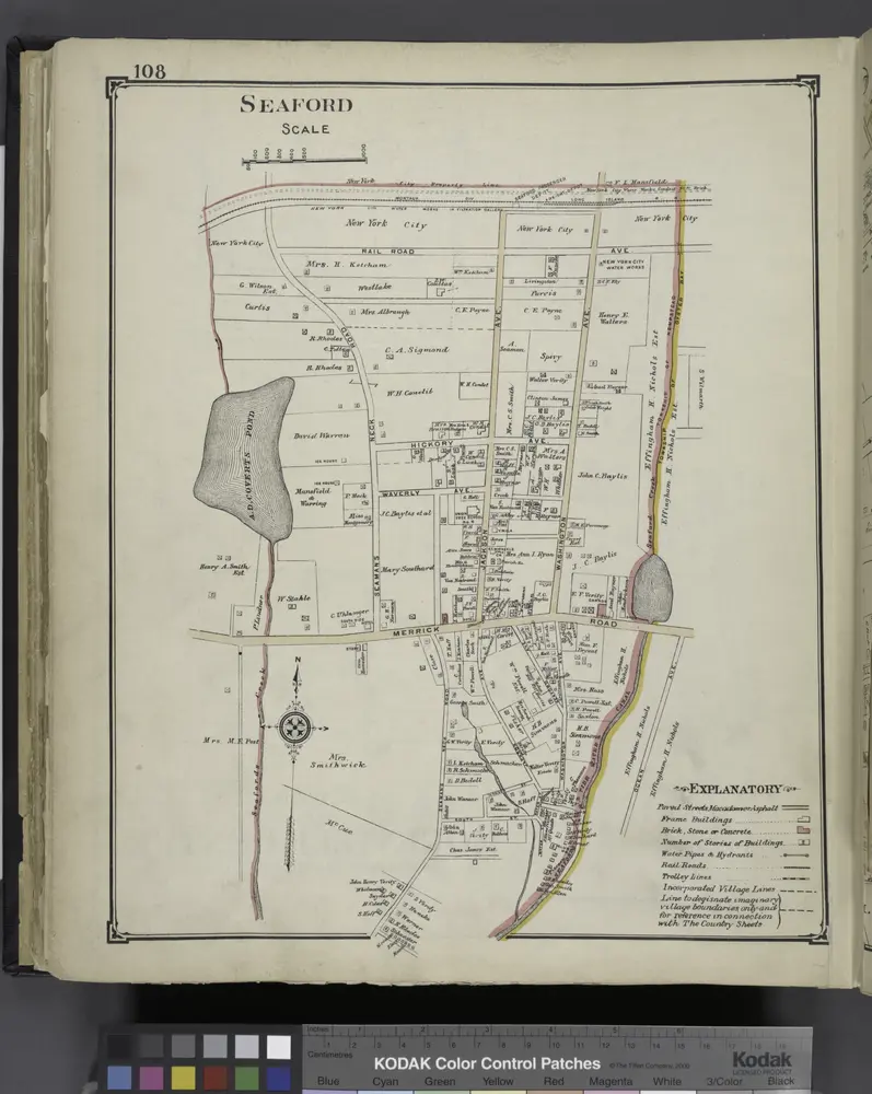
Seaford
1914
Amityville
1994
1:24k
Amityville
1969
1:24k
Amityville
1969
1:24k
Amityville
1954
1:24k
Amityville
1947
1:24k
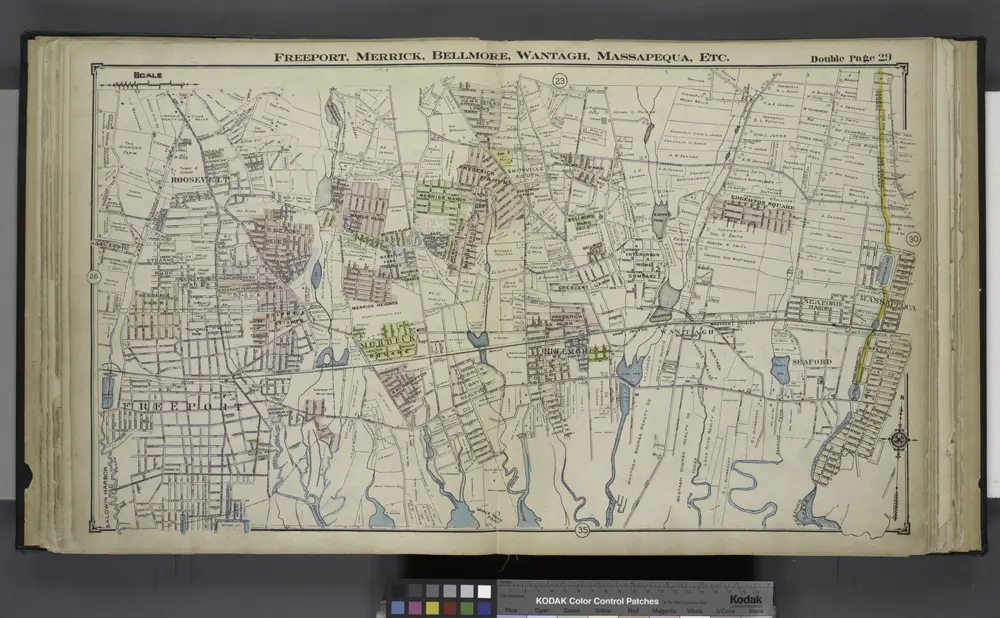
Freeport, Merrick, Belimore, Wantagh, Massapequa, Etc.
1914
Babylon
1919
1:63k
Babylon
1903
1:63k
Babylon
1903
1:63k
Babylon
1903
1:63k
Babylon
1903
1:63k
Babylon
1903
1:63k
Babylon
1903
1:63k
Babylon
1903
1:63k
Babylon
1903
1:63k
Babylon
1901
1:63k