Maps of Saddle Rock Estates

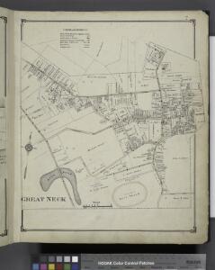
Great Neck
from Atlas of Nassau County, Long Island, N.Y. Complete in one volume. Historical, statistical. Based upon maps on file at the county seat in Mineola and upon private plans and surveys furnished by surveyors and individual owners. Supplemented by careful measurements & field observations by our own corps of engineers.
Part of Great Neck Estate; Glen Head
from Atlas of Nassau County, Long Island, N.Y. Complete in one volume. Historical, statistical. Based upon maps on file at the county seat in Mineola and upon private plans and surveys furnished by surveyors and individual owners. Supplemented by careful measurements & field observations by our own corps of engineers.
Great Neck - Pt. Washington - Kesington - Sea Cliff - Plandome, Etc.
from Atlas of Nassau County, Long Island, N.Y. Complete in one volume. Historical, statistical. Based upon maps on file at the county seat in Mineola and upon private plans and surveys furnished by surveyors and individual owners. Supplemented by careful measurements & field observations by our own corps of engineers.
Petersen's New Map of the Bronx showing all present and proposed Trolley and rapid transit lines. [Also showing Congressional Districts]
From Bronx
Map of the Borough of the Bronx, City of New York, showing street pavements on January 1st, 1913.
From Bronx
Map of the Bronx showing present and proposed transit system.
From Bronx
Westchester, Double Page Plate No. 3 [Map of Towns of Westchester and Pelham] / prepared under the direction of Joseph R. Bien, from general surveys and official records.
From Atlas of Westchester County, New York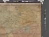
Map of Kings and part of Queens Counties, Long Island, N.Y. / [cartographic material]
From Counties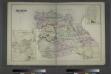
Flushing, Queens Co. L.I. - Douglaston, Town of Flushing, Queens Co. - Hinsdale, Town of Flushing, Kings Co.
from Atlas of Long Island, New York. From recent and actual surveys and records.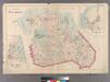
Plate 29: Town of Flushing. - Douglaston. - Bay Side.
from Atlas of Queens Co., Long Island, New York / compiled from official records, private plans & actual surveys by and under the direction of Chester Wolverton.
Index to the Topographical survey sheets of the borough of the Bronx easterly of the Bronx River.
from Topographical survey and new street system of the borough of the Bronx, easterly of the Bronx River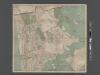
New Map of the Borough of the Bronx, City of New York . . . Circular stickers mark Carnegie Library sites.
From Bronx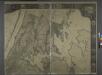
General map of the city of New York, consisting of boroughs of Manhattan, Brooklyn, Bronx, Queens and Richmond : consolidated into one municipality by act of the legislature of the state of New York (Chapter 378 of the laws of 1897) : showing in addition
from Whole
Newtown, Queens Co. L.I.
from Atlas of Long Island, New York. From recent and actual surveys and records.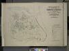
Index map to Vol. 3; Atlas of the Borough of Queens Third Ward city of New York. Published by E. Belcher Hyde; 97 Liberty St., Brooklyn Borough. 1904.
from Third ward: Flushing.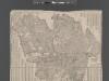
Street Indexed map of the Borough of Queens, also showing the Congressional Districts.
From Queens
Map of Queens Borough, City of New York.
From Queens
Index: Borough of Manhattan. Scale 1800 feet to the Inch. LEGEND, [Battery Park - 158th Street].
from Atlas of the city of New York, borough of Manhattan. From actual surveys and official plans / by George W. and Walter S. Bromley.
Hagstrom's Map of Queens, city of New York. House number and subway guide.
From Queens
3 Mt. Vernon, E. Chester, Pelham, New Rochelle, Scarsdale, Mamaroneck.
1 : 18000 Hyde & Company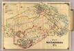
4 White Plains, Harrison, Rye.
1 : 18000 Hyde & Company
TheRand McNally map of the Borough of Manhattan.
From Manhattan
Borough of Manhattan [and] the principal portions of the Boroughs of Bronx, Brooklyn, and Queens and the Business District of Jersey City.
From Manhattan
Street Indexed map of the Borough of Queens, also showing the Congressional Districts.
From Queens
Plaines Blanches et Armees Americaine et Britannique, 12 Octobre1776.
1 : 130000 Marshall, John
Outline and Index Map of the Borough of Queens, City of New York.
from Atlas of the city of New York, borough of Queens, Long Island City, Newtown, Flushing, Jamaica, Far Rockaway, from actual surveys and official plans / by George W. and Walter S. Bromley.
Manhattan Borough and part of Bronx Borough of the City of New York.
From Manhattan
Map of New York City showing portions of Brooklyn, Jersey City, and Westchester Co. on enlarged scale.
From Manhattan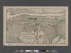
TheHeart of Greater New York, showing commercial facilities and tentative plans of development and recent additions.
From Manhattan