Maps of Mediterranean Sea
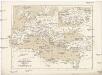
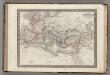
A new map of Turky in Europe and parts adjoyning shewing their principal divisions and chief cities, towns, rivers, mountains &c.
from A new sett of maps both of antient and present geography : wherein not only the latitude and longitude of many places are corrected according to the latest observations, but also the most remarkable differences of antient and present geography may be quickly discern'd by a bare inspection or comparing of correspondent maps, which seems to be the most natural and easy method to lead young students (for whose use the work is principally intended) unto a competent knowledge of the geographical science : together with a geographical treatise particularly adapted to the use and design of these maps / by Edward Wells, M.A. and student of Christ-Church, Oxon.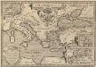
Argonautica. [Karte] [Europa.], [Thessalia und Umgebung], [Hellespontus, Phryxeum aequor, et Athamantidis fluenta.] [3 Nebenkarten], in: Theatrum orbis terrarum, S. 538.
1 Karte aus Atlas Ortelius, Abraham Vrients, Jan Baptista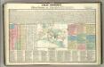
Tableau historique de Rome ancienne.
1 : 23700000 Duval, Henri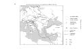
Geschäftsverbindungen und Kupferhandel der Medici 1393-1395
Europa Medici, Bankiers, Fuersten, Italien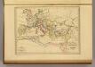
Empire Romain sous Constantin et sous Trajan.
1 : 17200000 Malte-Brun, Conrad, 1775-1826
Gemaelde des Roemischen Reichs in seiner grösten Ausdehnung
Historisch-genealogisch-geographischer Atlas von Le Sage Las Cases, Emmanuel Auguste Dieudonné Marius Joseph de Johann Velten, Kunsthändler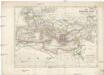
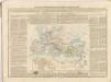
Das Römische Reich unter Traianus
starověký Řím
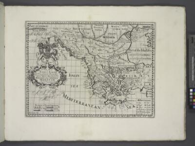
Turkey, in Europe and Hungary, from the best authorities.
from Carey's general atlas, improved and enlarged : being a collection of maps of the world and quarters, their principal empires, kingdoms, &c.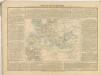

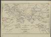
Romanum Imperium.
1 : 13000000 Darton, William
Empire Romain.
1 : 14400000 Monin, C.V.
Die nach der Völkerwanderung entstandenen neuen Reiche. Anfang des 6ten Jahrh
Europa Völkerwanderung
Orbis Homeri. 900? Ante Chr.
Mittelmeerraum Homerus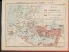
L'Empire Grec au temps de Justinien (VI.e siècle)
Byzantinisches Reich Justinian I.
Imperium Romanum Antiquum
Römisches Reich
Střední Evropa a Přední Asie za časů III. války křížové
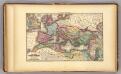
Roman Empire.
1 : 9000000 Young, James H.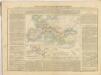
[Hierographie, oder topographisch-synchronistische Darstellung der Geschichte der christlichen Kirche] : VII. Von Gregor d. Gr. bis auf Carl d. G. J. 604-800
1 : 8400000 W.A. Möller Lith. bey Arnz & Co. in Düsseldorf Elberfeld : Büschler
Das Römische Reich in der Kaiserzeit
starověký Řím Gindely, Antonín F. Tempsky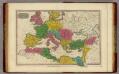
Romanum Imperium.
1 : 13000000 Finley, Anthony
L'Europe au Temps des Croisades.
Andriveau-Goujon, J.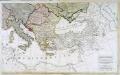
Carte generale de toute l'Europe, 3
2 Blätter : 56 x 90 cm J.M. Will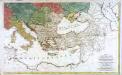
Carte générale de toute l'Europe, 2
2 Blätter : 57 x 93 cm T.C. Lotter
Europa Aetate Napoleontis I
Europa Napoleon I., Frankreich, Kaiser
Europa zur Zeit der Kreuzzüge
Europa, Byzantinisches Reich, Kreuzzüge
Europa zu Anfang des 6ten Jahrhunderts
Europa Völkerwanderung