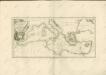
Maps of Mediterranean Sea
Italy, Sicily, &c.
from A new sett of maps both of antient and present geography : wherein not only the latitude and longitude of many places are corrected according to the latest observations, but also the most remarkable differences of antient and present geography may be quickly discern'd by a bare inspection or comparing of correspondent maps, which seems to be the most natural and easy method to lead young students (for whose use the work is principally intended) unto a competent knowledge of the geographical science : together with a geographical treatise particularly adapted to the use and design of these maps / by Edward Wells, M.A. and student of Christ-Church, Oxon.
Mer Mediterranee.
1 : 10000000 Garnier, F. A., 1803-1863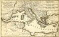
Mare Mediterranevm
1 : 5600000 Mollova mapová sbírka Homann, Johann Baptist Hauer, Daniel Adam Homann, Johann Baptista - dědici
[Historisch-geographischer Atlas zu den allgemeinen Geschichtswerken von C. v. Rotteck, Pölitz u. Becker] : Italien eine Uebersicht seiner Völker und Staaten in der ältesten Zeit
von Julius Loewenberg Lithographie von B. Herder in Freiburg im Breisgau [Freiburg im Breisgau] : [Herder]
M. Herberers ongelukkige voyagie gedaan in verscheyde gedeeltens van Asia en Africa
1 : 24000000 1 Karte : Kupferdruck ; 22 x 29 cm Aa, Pieter van der [Michel Herberer]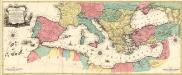
Carte Geographique representant la Mer Mediterranée ou la seconde Partie du Theatre de la Guerre entre les Russes et les Turcs
1 : 4400000 Mollova mapová sbírka Lotter, Tobias Conrad Lotter, Johann Jakob II.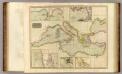
Mediterranean Sea.
1 : 6300000 Thomson, John
Itinera expeditionum sacrarum
Europa, Mittelmeerraum, Reiseweg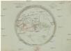
Aelteste Geographie der Griechen, nach dem Homer und Hesiodus
Afrika severní
Karte des Mittelländischen Meeres
Středozemní moře-oblast Handtke, Friedrich C. Flemming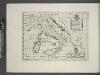
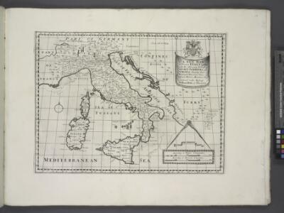
A new map of ancient Italy, together with the adjoyning islands of Sicily, Sardinia, and Corsica, shewing their principal divisions, cities, towns, rivers, mountains &c.
from A new sett of maps both of antient and present geography : wherein not only the latitude and longitude of many places are corrected according to the latest observations, but also the most remarkable differences of antient and present geography may be quickly discern'd by a bare inspection or comparing of correspondent maps, which seems to be the most natural and easy method to lead young students (for whose use the work is principally intended) unto a competent knowledge of the geographical science : together with a geographical treatise particularly adapted to the use and design of these maps / by Edward Wells, M.A. and student of Christ-Church, Oxon.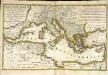
Mare Mediterranevm
1 Karte : Kupferdruck ; 37 x 59 cm Hauer Homännische Erben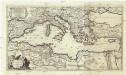
La mer Mediterranée divisée en ses principales parties ou mers
1 : 6200000 Středozemní moře-oblast Valk, Gerhard G. Valk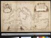
Nieuwe paskaart van de Middelanse Zee
Mediterranean Christoffel Middaghten Gerard van Keulen
Totius Danubii nova & accuratiss. tabula, universam simul Turciam Europaeam, Hungariam magnam Germaniae partem, totam pene Italiam, atque una Moream cum Sicilia et Candia complectens
1 : 3000000 auctore Jacobo de la Feuille [Amsterdam], Jacobo de la Feuille
[LL.03949gk: 100/od/1943], uit: Kompas van Italië en Zuid-Oost Europa
1 : 3500000 Annotatie: Ook op de kaart: Tom Tas van Kompas; Vrijgegeven door W.B.N. [Wehrmachts Bereich in den Niederlanden] 30.10.'43; Grenzen van 1 sept. 1939; Op verso: incompleet gedeelte van wat waarschijnlijk poster is geweest, met tekst: Oranje Boot, half om half Den Haag : Kompas
Italien und Balkanhalbinsel
1 : 9000000 Balkanhalbinsel, Italien
Turquie in Europe.
from A new systeme of the mathematicks: containing I. Arithmetick, as well natural and decimal, as in species, or the principles of algebra. II. Practical geometry, together with the first six books of Euclid's Elements, as also the eleventh and twelfth, symbo
Generalkarte der Mittelmeerländer
Charte vom mittellændischen Meer
1 Karte : Kupferdruck ; 23 x 49 cm Abel; Cotta im Verlag der J. G. Cotta'schen Buchhandlung
Mediterranean Basin.
1 : 6400000 Johnston, Alexander Keith, 1804-1871
Mare Mediterraneum
1 Karte : Kupferdruck ; 48 x 56 cm Seutter Matthäus Seutter
Geographie des Grecs Primitive.
Malte-Brun, Conrad, 1775-1826
Mittelländisches und Schwarzes Meer
Atlas der Hydrographie Berghaus, Hermann Justus Perthes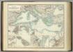
Mediterranean Basin.
1 : 6800000 Johnston, Alexander Keith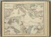
Mediterranean Basin.
1 : 6800000 Johnston, Alexander Keith
Völkerkarte von Mittel-und Südosteuropa
1 : 15000000 Mitteleuropa, Südosteuropa, ethnische Gruppe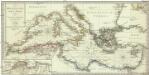
Karte des Mittellaendischen Meers enthaltend die europaische, afrikanische u. asiatische Küste
1 : 7000000 Středozemní moře-oblast Walch, Johann Joh. Walch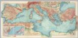
Mediterranean Sea. Pergamon World Atlas.
1 : 5000000 Polish Army Topography Service