Mapa catalogado
A map of the East-Indies and the adjacent countries ; with the settlements, factories and territories explaning what belongs to England, Spain, France, Holland, Denmark, Portugal &c. ...


Título completo:A map of the East-Indies and the adjacent countries ; with the settlements, factories and territories explaning what belongs to England, Spain, France, Holland, Denmark, Portugal &c. ...
Año de ilustración:1736
Tamaño físico:20 x 30 cm
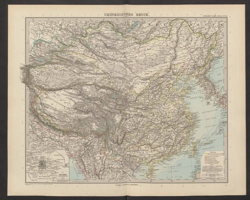
Chinesisches Reich
1892
Stieler, Adolf
Čínská říše
1909
J. Otto
1:19m
China
1860
1:10m
中華民國現勢圖
1937
鐵道省運輸局
1:10m
韓國輿地圖:中國
1893
金鴻圭
天下輿地圖:中國圖
1712
The National Geographic Magazine map of China and its territories
1913
Bartholomew, J. G. (John George), 1860-1920
1:10m
Karte von China mit dessen Eintheilung in 18 Provinzen
1841
Roost, J. B
1:7m
Carte industrielle de la Chine, contenant les lignes ferrées & lignes télégraphiques construites, concédées & probables, les mines & usines connues ...
1885
1:5m
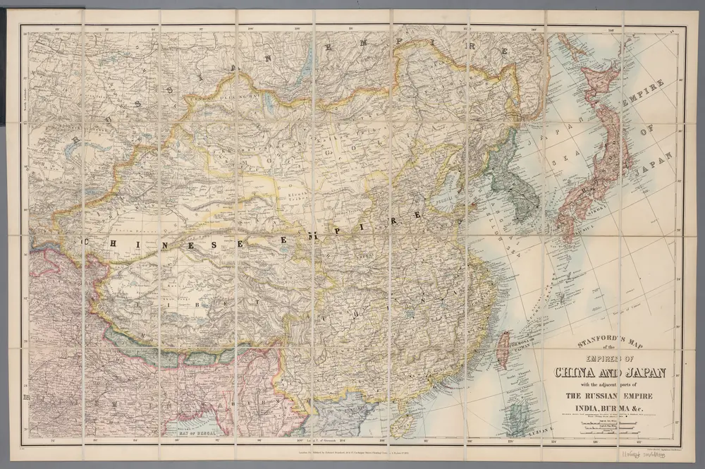
[Kaart], uit: Stanford's map of the empires of China and Japan : with the adjacent parts of the Russian Empire, India, Burma &c
1899
London : Stanford
1:6m