Maps of Piedmont
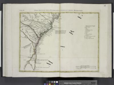
Parte Orientale della Florida, della Georgia, e Carolina Meridionale.
from Le colonie unite dell' America settentrle : di nuova projezione a s.s.e.e. li Signori Riformatori dello Studio di Padova.
A Map of the British Empire in America. (Sheet 10).
1 : 2000000 Popple, Henry
[Die Vereinigten Staaten von Amerika in 6 Blättern, Blatt 6]
Adolf Stieler's Handatlas über alle Theile der Erde und über das Weltgebäude Stieler, Adolf Justus Perthes
[Die Vereinigten Staaten von Nord-Amerika, Blatt 6]
Handatlas über alle Theile der Erde und über das Weltgebäude Stieler, Adolf Justus Perthes
Carolina.
1 : 5500000 Moll, Herman, d. 1732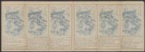
Virginiae Item et Floridae Americae Provinciarum, nova Descriptio. [Karte], in: Gerardi Mercatoris Atlas, sive, Cosmographicae meditationes de fabrica mundi et fabricati figura, S. 553.
1 Karte aus Atlas Mercator, Gerhard Montanus, Petrus
Vereinigte Staaten Von Nord-Amerika In 6 Blattern, Bl. 6.
1 : 3700000 Petermann, A.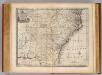
N. & S. Carolina, Georgia &c.
1 : 2900000 Bowen, Emanuel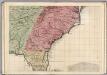
A Map of the British Empire in America. (Sheet 10).
1 : 2000000 Popple, Henry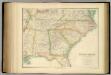
United States ... South Eastern States.
1 : 2851200 Fullarton, A. & Co.
N. & S. Carolina.
1 : 6300000 Grigg, John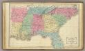
Southern U.S.
1 : 3500000 Cornell, S. S. (Sarah S.)
The Field of Battle.
The Field of Battle and Prominent US Generals. The Field of Battle and Prominent Union Generals is one of the most picturesque maps in the collection, detailing the main theatres of conflict in the Confederacy, with each state broken up by counties, and surrounded by virtually all of the main Union Army generals that would have been well known to viewers in 1864 when this map was published in New York by Ensign & Bridgman. The generals are mostly all arranged close to the areas where they were conducting operations at the time of the map’s production, for example Generals Grant and Sherman are close to Georgia and South Carolina. Union Navy generals are also pictured, such as General David Farragut who can be seen close to the Georgia coastline. Ensign & Bridgman
Carte des Etats-unis : provinces méridionales.
from Parts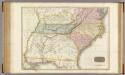
United States of America, southern part.
1 : 2200000 Pinkerton, John, 1758-1826
United States.
1 : 3380000 Sharpe, J.
Southern States.
1 : 3700000 Mitchell, Samuel Augustus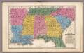
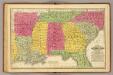
Map of the Southern States.
1 : 3700000 Mitchell, Samuel Augustus
County map of North Carolina, Map of South Carolina, County map of Florida ; Map of Charleston Harbor [inset].
from New general atlas.
Carte general de la Caroline: dresse sur les memoires le plus nouveaux
1 : 1300000 Published in N. Sanson's "Atlas Nouveau Contenant Toutes Les Parties du Monde", Paris, 1696, based on the 1685 Thornton-Morden-Lea map. Relief shown pictorially. Depths shown by soundings. Prime meridian: [Cadiz]. Includes inset [scale ca. 1:203,000] of the Ashley and Cooper Rivers, including Charles Town. Sanson, Nicolas, 1600-1667.;Mortier, Pierre. chez Pierre Mortier
203-204. United States of America, South East. The World Atlas.
1 : 2500000 USSR (Union of Soviet Socialist Republics).
North Carolina, South Carolina, Georgia and Eastern Tennessee

VIRGINIÆ | partis australis, | et FLORIDÆ partis | orientalis, interjacentiumque regionum | NOVA DESCRIPTIO.
[Amsterdam : Joan Blaeu]
Virginiae partis australis, et Floridae partis orientalis, interjacentiumq[ue] regionum, nova descriptio.
from John H. Levine Collection Meurs, Jacob van; Montanus, Arnoldus,
Virginiae partis australis, et Floridae partis orientalis, interjacentiumq[ue] regionum nova descriptio.
from Parts J. and C. Blaeu: [Amsterdam]; Blaeu, Joan; Blaeu, Willem Janszoon,
Virginiae partis australis et Floridae partis orientalis interjacentimq[ue] regionum, nova descriptio.
from Charts and maps Ioannem Ianssonium?: [Amstelodami?]; Jansson, Jan,
Virginiae partis australis, et Floridae partis orientalis, interjacentiumq[ue] regionum nova descriptio.
from Parts J. and C. Blaeu: [Amsterdam]; Blaeu, Joan; Blaeu, Willem Janszoon,
Virginiae partis australis, et Floridae partis orientalis, interjacentiumq[ue] regionum nova descriptio.
from John H. Levine Collection J. and C. Blaeu: [Amsterdam]; Blaeu, Joan; Blaeu, Willem Janszoon,
Virginiae partis australis, et Floridae partis orientalis, interjacentiumq[ue] regionum nova descriptio.
from Charts and maps J. and C. Blaeu: [Amsterdam]; Blaeu, Joan; Blaeu, Willem Janszoon,