Maps of Middletown Township
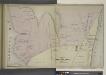
Portion of Long Branch [Village]
from Atlas of Monmouth co., New Jersey. From recent and actual surveys and records, under the superintendence of F.W. Beers.
Seabright & Monmouth Beach Property [Villages]
from Atlas of Monmouth co., New Jersey. From recent and actual surveys and records, under the superintendence of F.W. Beers.
Long Branch, N.J.
1 : 19200 Beers, F. W. (Frederick W.)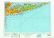
New York
1 : 250000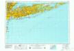
New York
1 : 250000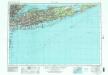
New York
1 : 250000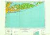
New York
1 : 250000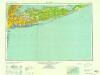
New York
1 : 250000
New York
1 : 250000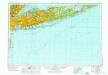
New York
1 : 250000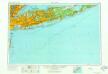
New York
1 : 250000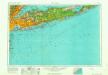
New York
1 : 250000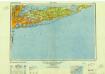
New York
1 : 250000
Long Branch
1 : 100000
Map of New-York Bay and Harbor and the environs / founded upon a trigonometrical survey under the direction of F. R. Hassler, superintendent of the Survey of the Coast of the United States; triangulation by James Ferguson and Edmund Blunt, assistants; the hydrography under the direction of Thomas R. Gedney, lieutenant U.S. Navy; the topography by C. Renard and T.A. Jenkins assists.
from New York harbor Ferdinand R. Hassler; James Ferguson; Thomas R. Gedney; C. Renard; T.A. Jenkins,
Map of New-York Bay and Harbor and the environs / founded upon a trigonometrical survey under the direction of F.R. Hassler, superintendent of the Survey of the Coast of the United States; triangulation by James Ferguson and Edmund Blunt assistants; the hydrography under the direction of Thomas R. Gedney, lieutenant U.S. Navy; the topography by C. Renard and T.A. Jenkins assists.; verified by C.M. Eakin, assistant.
from New York harbor Ferdinand R. Hassler; James Ferguson; Thomas R. Gedney; C. Renard; T.A. Jenkins; C.M. Eakin,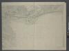
Map of Long Island with the environs of New-York and the southern part of Connecticut / compiled from various surveys & documents by J. Calvin Smith ; engraved & printed by S. Stiles & Co., N. York.
From Long Island
Map of the progress of His Majesty's armies in New York during the late campaign : illustrating the accounts publish'd in the London Gazette.
from Revolutionary War
A chart of New York Harbour: with the banks, soundings and sailing marks from the most accurate surveys & observations.
from Charts and maps Printed for Mount and Page?: [London]; Jno. Mount and Tho. Page,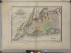
Map of the counties of New York, Queens, Kings, and Richmond.
from An atlas of the state of New York, designed for the use of engineers, containing a map of the state and of the several counties. / Projected and drawn ... under the superintendence and direction of Simeon de Witt.
Map of the counties of New York, Queens, Kings, and Richmond.
from An atlas of the state of New York : containing a map of the state and of the several counties / by David H. Burr.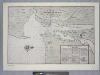
Vingboons map of Manhattan, 1639 : a facsimile from the Library of Congress.
from Whole
A draught of New York and Perthamboy Harbour.
from Charts and maps
Map of New-York Bay and Harbor and the environs / founded upon a trigonometrical survey under the direction of F.R. Hassler, superintendent of the Survey of the Coast of the United States ; triangulation by James Ferguson and Edmund Blunt, assistants ; t
from New York harbor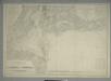
![Portion of Long Branch [Village]](https://images-2.georeferencer.com/images/iiif/411342756547/full/,300/0/native.jpg)

