Cataloged map
Burnt Hills [Village]; Burnt Hills Business Directory. ; Stillwater [Village]; Stillwater Business Directory. ; Jessups Landing Business Directory. ; Middletown Business Directory. ; Jessups Landing [Village]; Middletown [Village]


Full title:Burnt Hills [Village]; Burnt Hills Business Directory. ; Stillwater [Village]; Stillwater Business Directory. ; Jessups Landing Business Directory. ; Middletown Business Directory. ; Jessups Landing [Village]; Middletown [Village]
Depicted:1866
Physical Size:20 x 30 cm
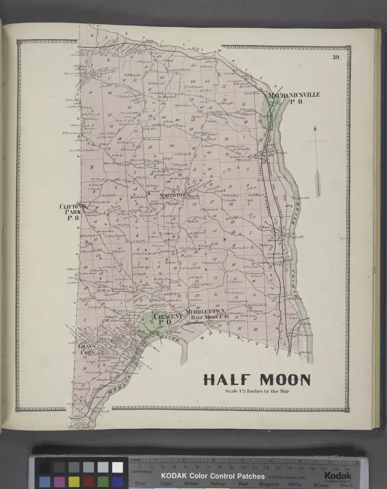
Half Moon [Township]
1866
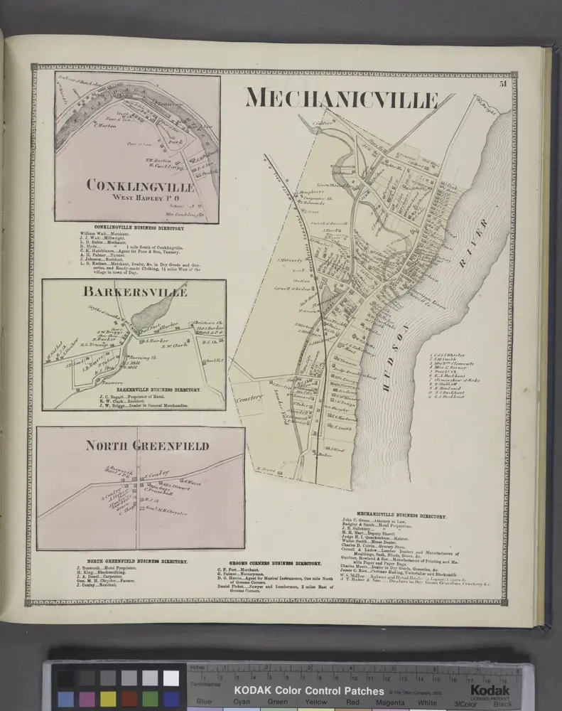
Conklingville [Village]; Conklingville Business Directory. ; Barkersville [Village] Barkersville Business Directory. ; North Greenfield [Village]; North Greenfield Business Directory. ; Mechanicville [Village]; Grooms Corners Business Directory. ; Mechan
1866
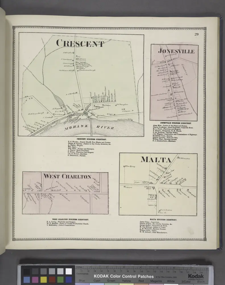
Crescent [Village]; Crescent Business Directory. ; West Charlton [Village]; West Charlton Business Directory. ; Jonesville [Village]; Jonesville Business Directory. ; Malta [Village]; Malta Business Directory.
1866
Troy North
1978
1:24k
Troy North
1954
1:24k
Troy North
1954
1:24k
Troy North
1954
1:24k
Troy North
1954
1:24k
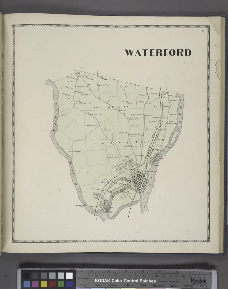
Waterford [Township]
1866
Cohoes
1949
1:63k
Cohoes
1949
1:63k
Cohoes
1947
1:63k
Cohoes
1929
1:63k
Cohoes
1929
1:63k
Cohoes
1929
1:63k
Cohoes
1929
1:63k
Cohoes
1898
1:63k
Cohoes
1898
1:63k
Cohoes
1898
1:63k
Cohoes
1898
1:63k
Cohoes
1898
1:63k
Cohoes
1898
1:63k
Cohoes
1898
1:63k
Cohoes
1898
1:63k
Cohoes
1895
1:63k
Cohoes
1893
1:63k