Mapa catalogado
Schuylerville Business Directory. ; Schuylerville [Village]


Título completo:Schuylerville Business Directory. ; Schuylerville [Village]
Año de ilustración:1866
Tamaño físico:20 x 30 cm
Saratoga Springs
1967
1:24k
Saratoga Springs
1967
1:24k
Saratoga Springs
1934
1:24k
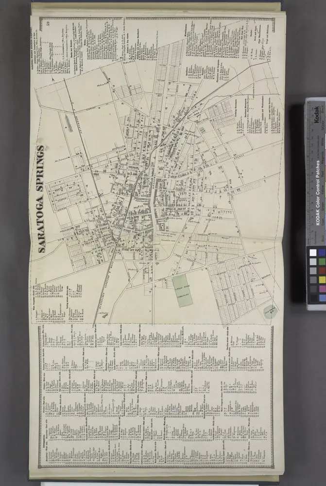
References. ; Saratoga Springs [Village]; Saratoga Springs Business Directory.
1866
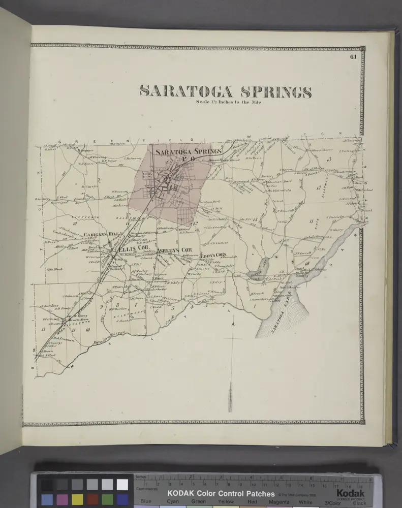
Saratoga Springs [Township]
1866
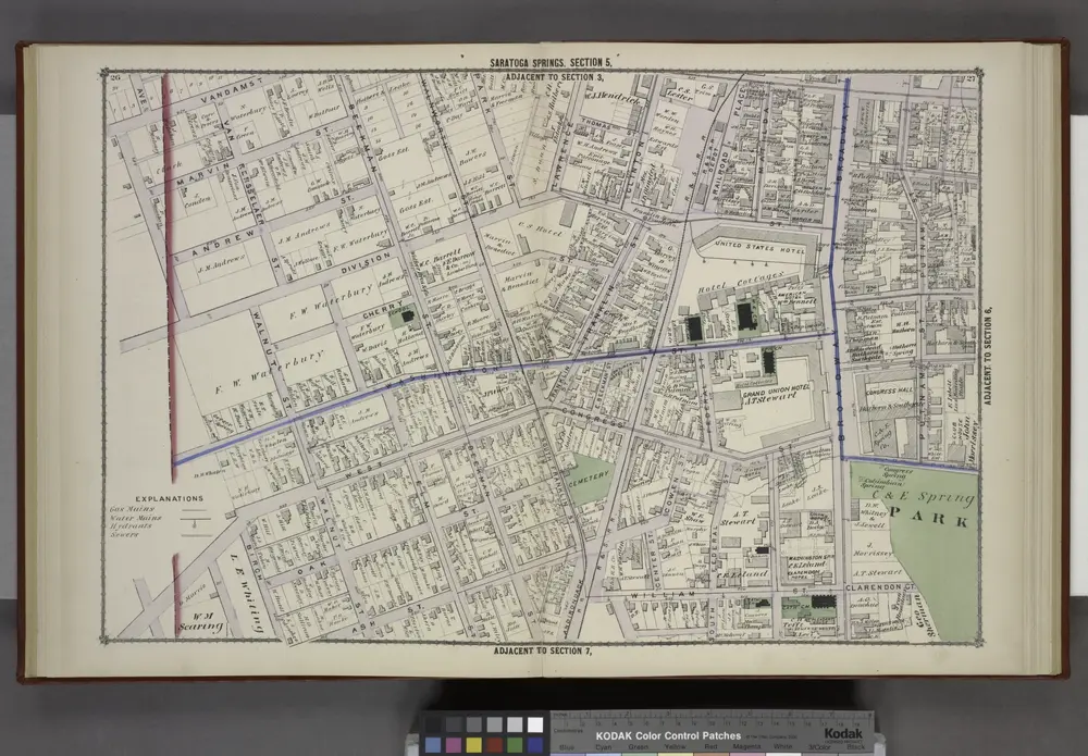
Saratoga Springs [cont.]
1876
Quaker Springs
1967
1:24k
Quaker Springs
1967
1:24k
Quaker Springs
1934
1:24k
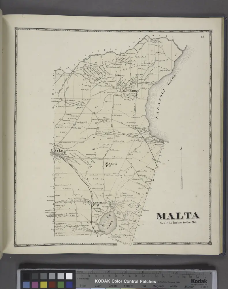
Malta [Township]
1866