Maps of Paterson
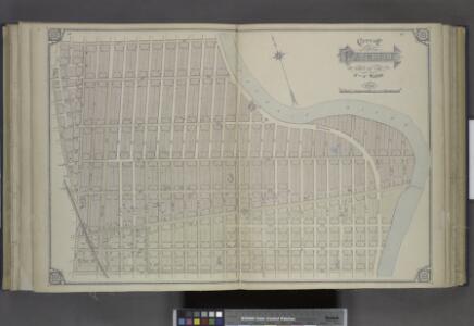
City of Paterson. Part of the 3rd and 4th Wards
from Atlas of Passaic County, New-Jersey : topographical, geological, historical, illustrated ; from actual surveys of each township and village / under the supervision of the publishers, assisted by the able engineers of Paterson.
City of Paterson. Part of the 4th, 5th and 8th Wards
from Atlas of Passaic County, New-Jersey : topographical, geological, historical, illustrated ; from actual surveys of each township and village / under the supervision of the publishers, assisted by the able engineers of Paterson.
City of Paterson. Part of the 3rd Ward
from Atlas of Passaic County, New-Jersey : topographical, geological, historical, illustrated ; from actual surveys of each township and village / under the supervision of the publishers, assisted by the able engineers of Paterson.
City of Paterson. Part of the 4th and 5th Wards
from Atlas of Passaic County, New-Jersey : topographical, geological, historical, illustrated ; from actual surveys of each township and village / under the supervision of the publishers, assisted by the able engineers of Paterson.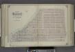
City of Paterson. Part of the 3rd and 6th Wards
from Atlas of Passaic County, New-Jersey : topographical, geological, historical, illustrated ; from actual surveys of each township and village / under the supervision of the publishers, assisted by the able engineers of Paterson.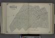
City of Paterson. Part of the 5th and 8th Wards
from Atlas of Passaic County, New-Jersey : topographical, geological, historical, illustrated ; from actual surveys of each township and village / under the supervision of the publishers, assisted by the able engineers of Paterson.
City of Paterson. Part of the 1st and 2nd Wards
from Atlas of Passaic County, New-Jersey : topographical, geological, historical, illustrated ; from actual surveys of each township and village / under the supervision of the publishers, assisted by the able engineers of Paterson.
City of Paterson. Part of the Wards
from Atlas of Passaic County, New-Jersey : topographical, geological, historical, illustrated ; from actual surveys of each township and village / under the supervision of the publishers, assisted by the able engineers of Paterson.
Newark-Paterson.
1 : 31680 Vermeule, C. C. (Cornelius Clarkson), 1858-1950
Paterson
1 : 62500
Paterson
1 : 62500
Paterson
1 : 62500
Paterson
1 : 62500
Paterson
1 : 62500
Paterson
1 : 62500
Paterson
1 : 62500
Paterson
1 : 62500
Paterson
1 : 62500
Paterson
1 : 62500
Paterson
1 : 62500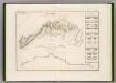
Canal Morris.
1 : 250000 Poussin, Guillaume Tell, 1794-1876
General map of the city of New York, consisting of boroughs of Manhattan, Brooklyn, Bronx, Queens and Richmond : consolidated into one municipality by act of the legislature of the state of New York (Chapter 378 of the laws of 1897) : showing in addition
from Whole
Paterson, N.J. - N.Y., ed. of Feb. 1903, repr. 1924
from New Jersey, 15 minute series (topographic) / mapped, edited, and published by the Geological Survey.
Manhattan public and publicly aided housing
From The Borough
Westchester, Double Page Plate No. 2 [Map of City and County of new York] / prepared under the direction of Joseph R. Bien, from general surveys and official records.
From Atlas of Westchester County, New York
Manhattan land use policy
From The Borough
TheRand McNally map of the Borough of Manhattan, the principal portion of the Boroughs of Bronx, Brooklyn, and Queens and the business district of Jersey City.
From Manhattan
Manhattan Topography
From The Borough
New Guide Map of Manhattan and The Bronx.
From Manhattan