Maps of West Seneca

Eden [Township]
from Atlas of Erie County, New York.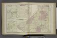
Water Valley [Village]; Griffins Mills [Village]; Abbotts Corners [Village]; Hamburg [Township]
from Atlas of Erie County, New York.
Boston [Township]
from New topographical atlas of Erie Co., New York, from actual surveys especially for this atlas.
Colden [Township]
from Atlas of Erie County, New York.
Eden
1 : 62500
Eden
1 : 62500
Eden
1 : 62500
Eden
1 : 62500
Eden
1 : 62500
Eden
1 : 62500
Springville
1 : 62500
Springville
1 : 62500
Springville
1 : 62500
Hamburg
1 : 24000
Eden
1 : 24000
Hamburg
1 : 24000
Hamburg
1 : 24000
Colden
1 : 24000
Colden
1 : 24000
Colden
1 : 24000
Colden
1 : 24000
Hamburg
1 : 24000
Hamburg
1 : 31680
Orchard Park
1 : 24000
Orchard Park
1 : 24000
Orchard Park
1 : 24000
Orchard Park
1 : 24000
Buffalo SE
1 : 24000
Orchard Park
1 : 24000
![Eden [Township]](https://images-2.georeferencer.com/images/iiif/601826767767/full/,300/0/native.jpg)

