Maps of Franklin County

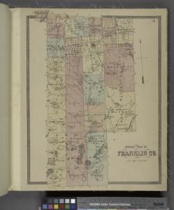
Outline plan of Franklin Co.
from Atlas of Franklin County, New York. : From actual surveys and official records.
Franklin County.
1 : 158400 Bien, Joseph Rudolf
Franklin County.
1 : 151000 Burr, David H., 1803-1875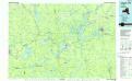
Tupper Lake
1 : 100000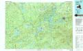
Tupper Lake
1 : 100000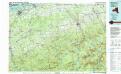
Massena
1 : 100000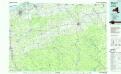
Massena
1 : 100000
Mt. Marcy, ed. of June 1902, repr. Oct. 1912
from New York, 15 minute series (topographic) / mapped, edited, and published by the Geological Survey.
Land classificaton map, Mt. Marcy and vicinity, New York
1 : 62500 Barnard, E.C. U.S. Geological Survey
New York, Mt. Marcy and vicinity : land classification map / Henry Gannett, chief topographer ; H.M. Wilson, geographer in charge ; triangulation by U.S. Coast and Geodetic Survey ; topography by E.C. Barnard ... [et al.]
1 : 62500 Annotatie geografische gegevens: Opname: 1891-1894 Gannett, Henry; Wilson, H. M.; Barnard, E. C.; US Coast and Geodetic Survey [Washington, D.C. : U.S. Geological Survey]
Clinton County.
1 : 158400 Bien, Joseph Rudolf
Clinton County.
1 : 151000 Burr, David H., 1803-1875
Malone [Township]
from Atlas of Franklin County, New York. : From actual surveys and official records.
Long Lake
1 : 62500
Long Lake
1 : 62500
Long Lake
1 : 62500
Long Lake
1 : 62500
Long Lake
1 : 62500
Long Lake
1 : 62500
Tupper Lake
1 : 62500
Tupper Lake
1 : 62500
Tupper Lake
1 : 62500
Santanoni
1 : 62500
Santanoni
1 : 62500
Santanoni
1 : 62500
Santanoni
1 : 62500
Santanoni
1 : 62500
Mount Marcy
1 : 62500
Mount Marcy
1 : 62500
Mount Marcy
1 : 62500
Mount Marcy
1 : 62500
Mount Marcy
1 : 62500
Tupper Lake
1 : 62500
Tupper Lake
1 : 62500
Tupper Lake
1 : 62500
Tupper Lake
1 : 62500
Tupper Lake
1 : 62500
Tupper Lake
1 : 62500
Long Lake
1 : 62500
Long Lake
1 : 62500
Long Lake
1 : 62500
Long Lake
1 : 62500
Long Lake
1 : 62500
Long Lake
1 : 62500
Long Lake
1 : 62500
Long Lake
1 : 62500
Long Lake
1 : 62500
Long Lake
1 : 62500
Santanoni
1 : 62500
Santanoni
1 : 62500
Santanoni
1 : 62500
Santanoni
1 : 62500
Santanoni
1 : 62500
Santanoni
1 : 62500
Santanoni
1 : 62500
Santanoni
1 : 62500