Maps of Tonawanda

Maps of Tonawanda

$title$

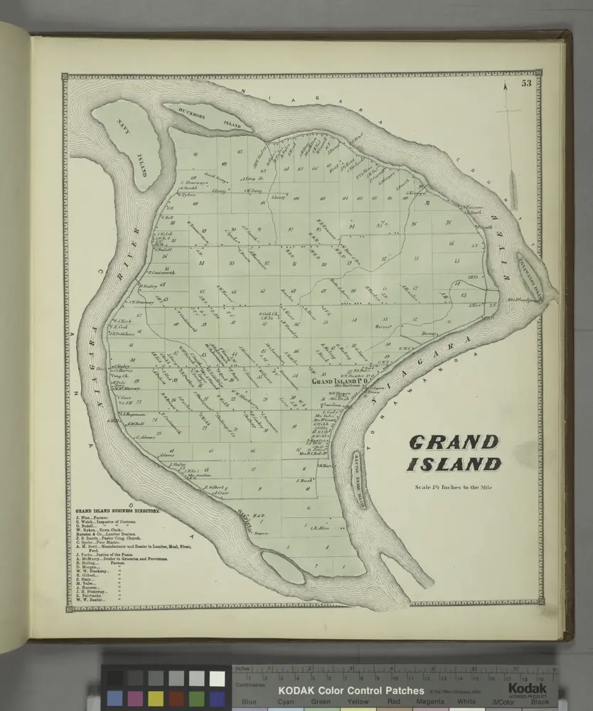
Grand Island [Township]; Grand Island Business Directory.

from New topographical atlas of Erie Co., New York, from actual surveys especially for this atlas.
$title$

Tonawanda West

1 : 25000
$title$

Tonawanda West

1 : 24000
$title$

Tonawanda West

1 : 25000
$title$

Tonawanda West

1 : 24000
$title$

Tonawanda West

1 : 24000
$title$

Tonawanda West

1 : 24000
$title$

Buffalo NW

1 : 24000
$title$

Buffalo NW

1 : 24000
$title$

Buffalo NW

1 : 24000
$title$

Buffalo NW

1 : 24000
$title$

Lower Blackrock being a Part of Twelfth Ward.

from Atlas of the City of Buffalo, Erie Co., New York : from actual surveys & official records.
$title$

Buffalo, V. 3, Double Page Plate No. 10 [Map bounded by Prospect Ave., Miller Blvd., Belmont St., Hiler Ave., Kenmore Ave., Military Rd.] / engraved by Albert Volk.

From v. 3
$title$

Buffalo, V. 3, Double Page Plate No. 27 [Map of Town of Grand Island, Part of the town of Amherst] / engraved by Albert Volk.

From v. 3
$title$

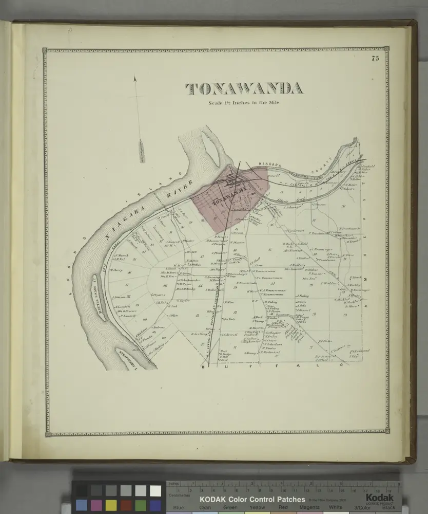
Tonawanda [Township]

from New topographical atlas of Erie Co., New York, from actual surveys especially for this atlas.
$title$

Niagara Falls

1 : 25000
$title$

Niagara Falls

1 : 25000
$title$

Niagara Falls

1 : 25000
$title$

Niagara Falls

1 : 24000
$title$

Niagara Falls

1 : 24000
$title$

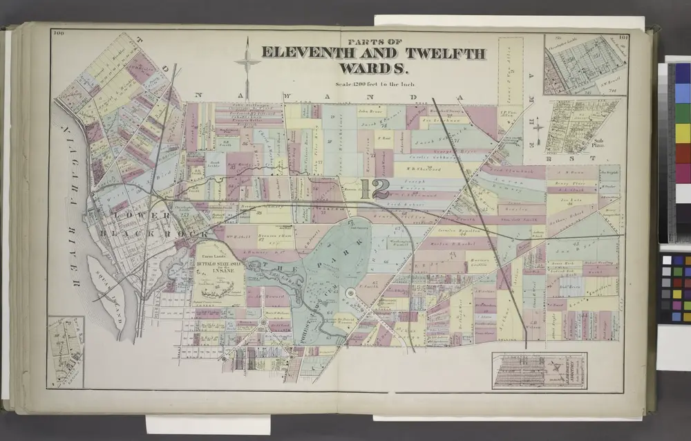
Parts of Eleventh and Twelfth Wards.

from Atlas of the City of Buffalo, Erie Co., New York : from actual surveys & official records.
$title$

Part of Eleventh Ward.

from Atlas of the City of Buffalo, Erie Co., New York : from actual surveys & official records.
$title$

Niagara Falls [Village]

from Atlas of Niagara and Orleans counties, New York. From actual surveys and official records. Compiled & published by Beers, Upton & Co.
$title$

Buffalo, V. 1, Double Page Plate No.17 [Map bounded by Grant St., Forest Ave., Elmwood Ave., Lexington Ave., Massachusetts St., Lawrence Pl.] / engraved by Albert Volk.

From v. 1
$title$

View of the Country round the Falls of Niagara.

1 : 348480 Melish, John
$title$

View of the Country round the Falls of Niagara.

1 : 348480 Melish, John
$title$

View of the Country round the Falls of Niagara.

1 : 253440 Melish, John
$title$

Erie County.

1 : 151000 Burr, David H., 1803-1875
$title$

Sketch of the Niagara River.

from Niagara River
$title$

[Recto], uit: New York, Niagara Falls and vicinity / Henry Gannett, chief topographer ; H.M. Wilson, geographer in charge

1 : 62500 Annotatie geografische gegevens: Opname: 1893 en 1900 Gannett, Henry; Wilson, H. M. [Washington, D.C. : U.S. Geological Survey]
© MapTiler © OpenStreetMap contributors
How does it work?
These instructions will show you how to find historical maps online.
Getting started
Type the place name in the search box to find the exact location. You can further adjust the search by zooming in and out.
Zoom
Zoom in and out with the buttons or use your mouse or touchpad natively.
Exact Area tool
Click here and draw a rectangle over the map to precisely define the search area.
Set filters
Narrow your search with advanced settings, such as Years (from/to), Fulltext, Publisher, etc.
Results
See the results of your search on the right side. You can scroll down to find more maps of this location.
?

Download OldMapsOnline Mobile