Mappa catalogata
"Oneida, Madison, Otsego, Fulton, Montgomery, Schenectady, Albany, Schoharie, Warren, Saratoga, Washington, and Rensselaer Counties"
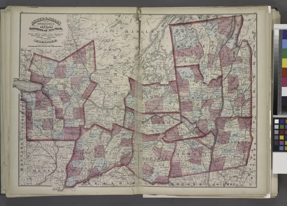

Titolo completo:"Oneida, Madison, Otsego, Fulton, Montgomery, Schenectady, Albany, Schoharie, Warren, Saratoga, Washington, and Rensselaer Counties"
Anno di illustrazione:1871
Dimensione fisica:20 x 30 cm
Map of the New York wilderness : to accompany Wallace's Descriptive guide to the Adirondacks
1876
Ely, William Watson
1:253k
Map of the Adirondack wilderness
1883
Stoddard, Seneca Ray, 1844-1917
1:255k
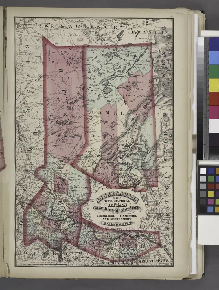
"Herkimer, Hamilton, and Montgomery"
1871
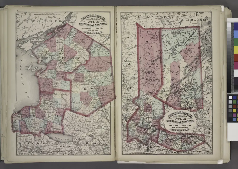
"Jefferson, Oswego, and Lewis Counties"
1871
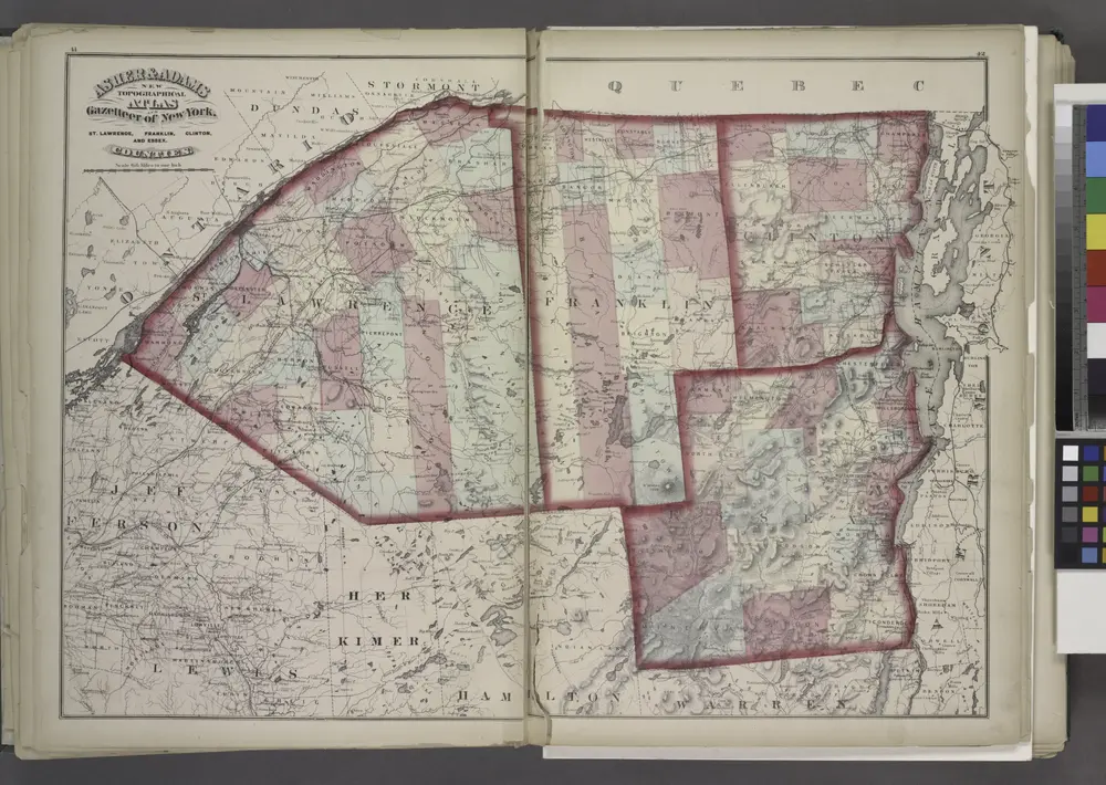
"St. Lawrence, Franklin, Clinton, and Essex"
1871
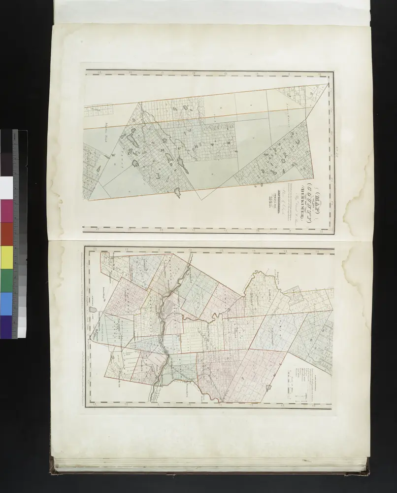
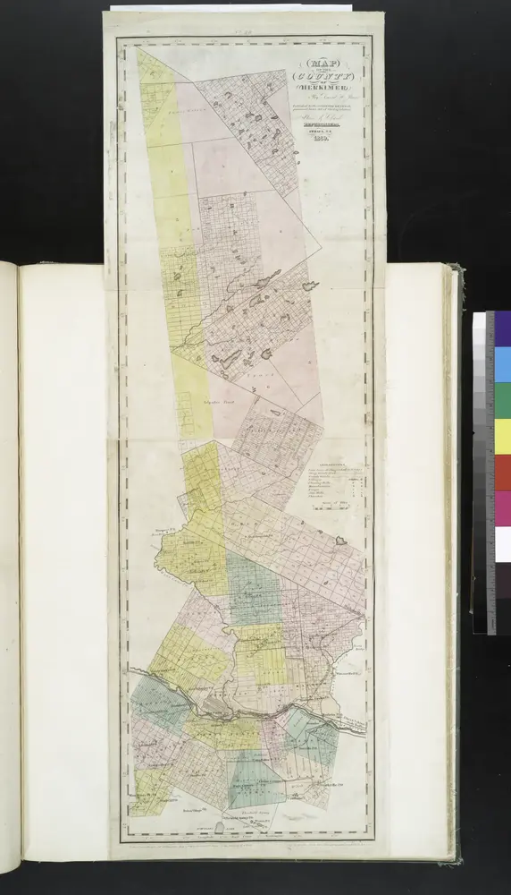
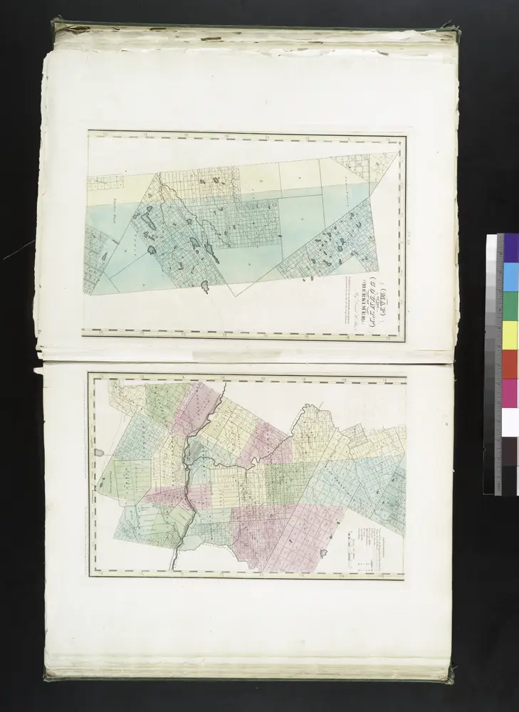
Map of the county of Herkimer / by David H. Burr; engd. by Rawdon, Clark & Co., Albany, & Rawdon, Wright & Co., New York.; An atlas of the state of New York: containing a map of the state and of the several counties / by David H. Burr.
1841
Map of the county of Herkimer / by David H. Burr; engd. by Rawdon, Clark & Co., Albany, & Rawdon, Wright & Co., New York.; An atlas of the state of New York, designed for the use of engineers, containing a map of the state and of the several counties. / Projected and drawn ... under the superintendence and direction of Simeon de Witt.
1839
Map of the county of Herkimer / by David H. Burr; engd. by Rawdon, Clark & Co., Albany, & Rawdon, Wright & Co., New York.; An atlas of the state of New York: containing a map of the state and of the several counties. / Projected and drawn under the superintendence and direction of Simeon de Witt ... And also the physical geography of the State ...
1829
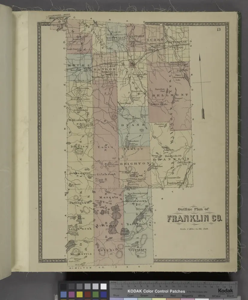
Outline plan of Franklin Co.
1876
Utica
1967
1:250k
Utica
1964
1:250k
Utica
1962
1:250k
Utica
1962
1:250k
Utica
1962
1:250k
Utica
1957
1:250k
Utica
1950
1:250k