Maps of Kings County
28A - N.Y. City (Aerial Set).
from Sectional aerial maps of the City of New York / [photographed and assembled under the direction of the chief engineer, July 1st, 1924].
Brooklyn, Vol. 6, Double Page Plate No. 34; Part of Ward 30, Section 19; [Map bounded by 20th Ave., Warehouse Ave., 17th Ave., Rutherford Pl., Benson Ave.]
from Ward 30.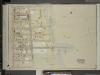
Brooklyn, Vol. 6, Double Page Plate No. 33; Part of Ward 30, Section 19; [Map bounded by 17th Ave., Warehouse Ave., Sharp Ave.; Including Bay Eighth St., Cropsey Ave., 14th Ave., Bath Ave.]
from Ward 30.
Part of the Town of New Utrecht, Kings Co., N.Y.
from Robinson's atlas of Kings County, New York : compiled from official records ... / under the direction of E. Robinson.
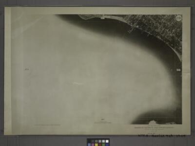
Sheet No. 50. [Includes South Beach and Lower New York Bay.].; Borough of Richmond, Topographical Survey.
from Borough of Richmond, Topographical Survey. Staten Island. Topographical Bureau.,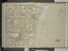
Brooklyn, Vol. 6, Double Page Plate No. 35; Part of Ward 30, Section 19; [Map bounded by 23rd Ave., Warehouse Ave., 20th Ave., Benson Ave.]
from Ward 30.
Double Page Plate No. 25: [Bounded by 81st Street, Eighteenth Avenue, 86th Street, Twenty-Third Avenue, Warehouse Avenue, Seventeenth Avenue, Cropsey Avenue, Bay-Fourteenth Street, 86th Street and Seventeenth Avenue.]
from Atlas of the Brooklyn borough of the City of New York : originally Kings Co.; complete in three volumes ... based upon official maps and plans ... / by and under the supervision of Hugo Ullitz, C.E.
Brooklyn V. 12, Plate No. 1 [Map bounded by Bay 8th St., Warehouse Ave., 16th Ave.]
From Atlas 97. Vol. 12, 1906.
Area District Map Section No. 28
from Area district map / City of New York, Board of Estimate and Apportionment.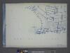
Use District Map Section No. 28; Use district map / City of New York, Board of Estimate and Apportionment.
from Use district map / City of New York, Board of Estimate and Apportionment. New York (N.Y.). Board of Estimate and Apportionment,
Height District Map Section No. 28; Height district map / City of New York, Board of Estimate and Apportionment.
from Height district map / City of New York, Board of Estimate and Apportionment. New York (N.Y.). Board of Estimate and Apportionment,
Map of sewer district of Bath Beach and Bensonhurst-by-the-sea.
From Brooklyn
28C - N.Y. City (Aerial Set).
from Sectional aerial maps of the City of New York / [photographed and assembled under the direction of the chief engineer, July 1st, 1924].
22C - N.Y. City (Aerial Set).
from Sectional aerial maps of the City of New York / [photographed and assembled under the direction of the chief engineer, July 1st, 1924].
Part of the Town of New Utrecht, Kings Co., N.Y.
from Robinson's atlas of Kings County, New York : compiled from official records ... / under the direction of E. Robinson.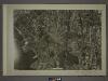
28B - N.Y. City (Aerial Set).
from Sectional aerial maps of the City of New York / [photographed and assembled under the direction of the chief engineer, July 1st, 1924].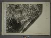
27B - N.Y. City (Aerial Set).
from Sectional aerial maps of the City of New York / [photographed and assembled under the direction of the chief engineer, July 1st, 1924].
Double Page Plate No. 24: [Bounded by (Dyker Beach Park) Bay 8th Street, Fourteenth Avenue, 86th Street, Twelfth Avenue, 81st Street, Seventeenth Avenue, 86th Street, Bay 14th Street, Cropsey Avenue, Seventeenth Avenue and Warehouse Avenue.]
from Atlas of the Brooklyn borough of the City of New York : originally Kings Co.; complete in three volumes ... based upon official maps and plans ... / by and under the supervision of Hugo Ullitz, C.E.
Plate 18:[Bounded by 86th Street, W. 12th Street, Avenue V, Stillwell Avenue, Bay 46th Street, Warehouse Avenue, 20th Street, Cropsey Avenue and De Bruyen's Lane.]
from Robinson's atlas of Kings County, New York : compiled from official records ... / under the direction of E. Robinson.
Double Page Plate No. 23: [Bounded by (U.S. Government Reservation) Fort Hamilton Avenue, 86th Street, Bay 2nd Street, Benson Avenue, Delaplaine Street, Atlantic Avenue, (Dyker Beach Park) Seventh Avenue, 170th Street, Battery Avenue, Cropsey Avenue, Dah
from Atlas of the Brooklyn borough of the City of New York : originally Kings Co.; complete in three volumes ... based upon official maps and plans ... / by and under the supervision of Hugo Ullitz, C.E.
Fort Hamilton. Town of New Utrecht, Kings Co. L.I.
from Atlas of Long Island, New York. From recent and actual surveys and records.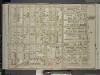
Brooklyn, Vol. 6, Double Page Plate No. 22; Part of Ward 30, Section 19; [Map bounded by 20th Ave., Benson Ave., Ruthrford Pl.; Including 17th Ave., New Utrech Ave., 78th St.]
from Ward 30.
Plate 20: [Bounded by Bay 46th Street, Harway Avenue, Avenue Z, Stillwell Avenue and (Atlantic Ocean) Surf Avenue.]
from Robinson's atlas of Kings County, New York : compiled from official records ... / under the direction of E. Robinson.
Part of the Town of New Utrecht, Kings Co., N.Y.
from Robinson's atlas of Kings County, New York : compiled from official records ... / under the direction of E. Robinson.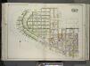
Brooklyn, Vol. 3, Double Page Plate No. 14; Part of Ward 31, Section 21; [Map bounded by Gravesend Bay, W. 35th St., Canal Ave.; Including W. 29th St., Atlantic Ocean] / by and under the direction of Hugo Ullitz.
From Volume 3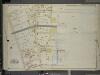
Brooklyn, Vol. 7, Double Page Plate No. 23; Part of Ward 31, Sections 19 & 21; [Map bounded by 26th Ave., Warehouse Ave.; Including 23rd Ave., Bath Ave.]
from Ward 31.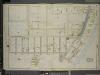
Brooklyn, Vol. 7, Double Page Plate No. 27; Part of Ward 31, Section 21; [Map bounded by W. 32nd St., Atlantic Ocean, Beach 40th St.; Including Surf Ave., Seagate Ave., Bay View Ave., Gravesend Bay, Canal Ave.]; Sub Plan; [Map bounded by Se
from Ward 31.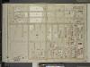
Brooklyn, Vol. 6, Double Page Plate No. 32; Part of Ward 30, Section 19; [Map bounded by 83rd St., 17th Ave., Bath Ave., 14th Ave.; Including Bayfifth St., 86th St., 13th Ave.]
from Ward 30.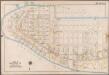
Plate 28: [Bounded by Bay View Avenue, W. 37th Street, (Gravesend Bay) Canal Avenue, W. 23rd Street, Surf Avenue, (Atlantic Ocean) Atlantic Avenue, Surf Avenue, Poplar Avenue and Seagate Avenue.]; Atlas of the borough of Brooklyn, city of New York: from actual surveys and official plans by George W. and Walter S. Bromley.
from Atlas of the borough of Brooklyn, city of New York : from actual surveys and official plans by George W. and Walter S. Bromley. G.W. Bromley & Co.,