Maps of Queens County
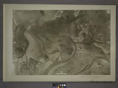
24B - N.Y. City (Aerial Set).
from Sectional aerial maps of the City of New York / [photographed and assembled under the direction of the chief engineer, July 1st, 1924].
Area District Map Section No. 24; Area district map / City of New York, Board of Estimate and Apportionment.
from Area district map / City of New York, Board of Estimate and Apportionment. New York (N.Y.). Board of Estimate and Apportionment,
Use District Map Section No. 24; Use district map / City of New York, Board of Estimate and Apportionment.
from Use district map / City of New York, Board of Estimate and Apportionment. New York (N.Y.). Board of Estimate and Apportionment,
Height District Map Section No. 24; Height district map / City of New York, Board of Estimate and Apportionment.
from Height district map / City of New York, Board of Estimate and Apportionment. New York (N.Y.). Board of Estimate and Apportionment,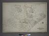
Part of the Borough of Queens, Jamaica, Ward 4.
from Atlas of the city of New York, borough of Queens, Long Island City, Newtown, Flushing, Jamaica, Far Rockaway, from actual surveys and official plans / by George W. and Walter S. Bromley.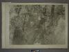
18D - N.Y. City (Aerial Set).
from Sectional aerial maps of the City of New York / [photographed and assembled under the direction of the chief engineer, July 1st, 1924].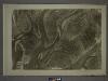
24D - N.Y. City (Aerial Set).
from Sectional aerial maps of the City of New York / [photographed and assembled under the direction of the chief engineer, July 1st, 1924].
Jamaica
1 : 24000
Jamaica
1 : 24000
Jamaica
1 : 24000
Jamaica
1 : 24000
Jamaica
1 : 24000
Jamaica
1 : 24000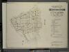
Index to Volume Four. Atlas of the Borough of Brooklyn. Sections 12, 13 & 14. Wards 26 and part of 29 & 32. City of New York. E. Belcher Hyde, 97 Liberty St., Brooklyn Borough. 1904.
from Wards 26 and part of 29 & 32.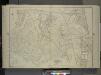
Queens, Vol. 1, Double Page Plate No. 19; Part Of Ward 4; Jamaica; [Map bounded by Conduit Long Island R.R., Boundary Line Of The City of New York; Including Hook Canal Creek, Jamaica Bay, Dead or Salt Creek.]; Sub Plan From Plate No. 17 [Map bou
from Fourth and fifth wards: Jamaica and Rockaway.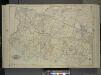
Queens, Vol. 1, Double Page Plate No. 17; Part of Ward 4; Jamaica; [Map bounded by Liberty Ave., Rockaway Turnpike, Mile Hill Road; Including Corn Fill Creek, Spring Creek]
from Fourth and fifth wards: Jamaica and Rockaway.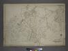
Part of the Borough of Queens, Jamaica, Ward 4.
from Atlas of the city of New York, borough of Queens, Long Island City, Newtown, Flushing, Jamaica, Far Rockaway, from actual surveys and official plans / by George W. and Walter S. Bromley.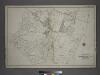
[Plate 40: Bounded by Old South Road, Centerville Avenue, Rockway Plank Road, Road to Bergens Landing, Old South Road, (Jamaica Bay, Vanderveers Island, Hortsmans Island &c.) Conduit Road and Cedar Lane.]
from Atlas of the city of New York, borough of Queens, Long Island City, Newtown, Flushing, Jamaica, Far Rockaway, from actual surveys and official plans / by George W. and Walter S. Bromley.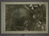
24A - N.Y. City (Aerial Set).
from Sectional aerial maps of the City of New York / [photographed and assembled under the direction of the chief engineer, July 1st, 1924].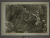
25A - N.Y. City (Aerial Set).
from Sectional aerial maps of the City of New York / [photographed and assembled under the direction of the chief engineer, July 1st, 1924].
Key
From Atlas 145a. Vol. 8, 1912.
Height District Map Section No. 18; Height district map / City of New York, Board of Estimate and Apportionment.
from Height district map / City of New York, Board of Estimate and Apportionment. New York (N.Y.). Board of Estimate and Apportionment,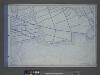
Use District Map Section No. 18; Use district map / City of New York, Board of Estimate and Apportionment.
from Use district map / City of New York, Board of Estimate and Apportionment. New York (N.Y.). Board of Estimate and Apportionment,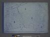
Area District Map Section No. 18; Area district map / City of New York, Board of Estimate and Apportionment.
from Area district map / City of New York, Board of Estimate and Apportionment. New York (N.Y.). Board of Estimate and Apportionment,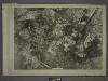
19C - N.Y. City (Aerial Set).
from Sectional aerial maps of the City of New York / [photographed and assembled under the direction of the chief engineer, July 1st, 1924].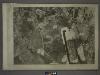
18C - N.Y. City (Aerial Set).
from Sectional aerial maps of the City of New York / [photographed and assembled under the direction of the chief engineer, July 1st, 1924].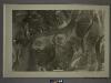
24C - N.Y. City (Aerial Set).
from Sectional aerial maps of the City of New York / [photographed and assembled under the direction of the chief engineer, July 1st, 1924].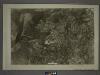
25C - N.Y. City (Aerial Set).
from Sectional aerial maps of the City of New York / [photographed and assembled under the direction of the chief engineer, July 1st, 1924].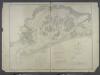
Jamaica Bay and Rockaway Inlet, Long Island, New York.
from U.S. Coast and Geodetic Survey. Nautical chart ; no. 542.