Maps of Queens County

Maps of Queens County

$title$

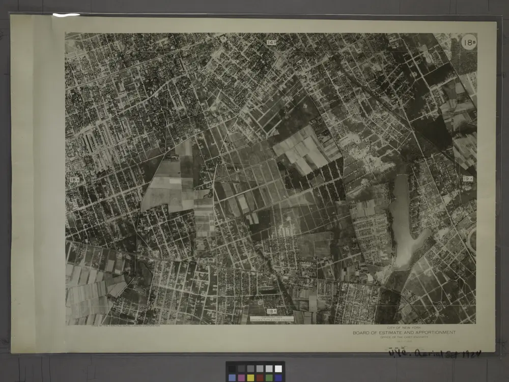
18B - N.Y. City (Aerial Set).

from Sectional aerial maps of the City of New York / [photographed and assembled under the direction of the chief engineer, July 1st, 1924].
$title$

Queens V. 6, Plate No. 104 [Map bounded by 155th St., 159th St., Conduit]

From Atlas 142a, Vol. 6, 1911.
$title$

Queens, Vol. 1, Double Page Plate No. 21; Part of Ward 4; [Map bounded by Metropolis Ave., Mill St., Vansicklen Ave., Sutter Ave., Chestnut St.; Including Metropolis Ave., Grant Ave., Rockaway Plank Road, Clinton Ave.]; Sub Plan From Plate

from Fourth and fifth wards: Jamaica and Rockaway.
$title$

Queens, Vol. 1, Double Page Plate No. 26; Part of Ward 4; [Map bounded by Woodlawn Ave., Remsen St., New York Ave., Claude PL., Mathias St., James St., Oak St., Platt St.; Including Woodland Ave., Boyland Ave., Evergreen Ave., Fisher Ave.,

from Fourth and fifth wards: Jamaica and Rockaway.
$title$

Part of the Borough of Queens, Jamaica, Ward 4.

from Atlas of the city of New York, borough of Queens, Long Island City, Newtown, Flushing, Jamaica, Far Rockaway, from actual surveys and official plans / by George W. and Walter S. Bromley.
$title$

Part of the Borough of Queens, Jamaica, Ward 4.

from Atlas of the city of New York, borough of Queens, Long Island City, Newtown, Flushing, Jamaica, Far Rockaway, from actual surveys and official plans / by George W. and Walter S. Bromley.
$title$

Queens, Vol. 1, Double Page Plate No. 6; Part of Ward 4, Jamaica; [Map bounded by Atlantic Ave., Jefferson Ave., Briggs Ave., Johnson Ave., Lefferts Ave., Chichester Ave., Broadway, Belmont Ave., Liberty Ave., Morris Ave., Maure Ave., Frost Ave.

from Fourth and fifth wards: Jamaica and Rockaway.
$title$

Queens, Vol. 1, Double Page Plate No. 25; Part of Ward 4; Jamaica; [Map bounded by Liberty Ave., Road to Landing, Whitelaw Ave., Arion St., Albert St., Spritz St., Old South Road, Sutter Ave., Vajen PL., Egbert PL., Dalrymple Ave., Glenmor

from Fourth and fifth wards: Jamaica and Rockaway.
$title$

Queens, Vol. 1, Double Page Plate No. 23; Part of Ward 4; Jamaica; [Map bounded by Rockaway Plank road, Three Mile Mill Road, Old South Road; Including Smith St., Sidney St., Lewis St., Bank St., Bedford St.]; Sub Plan From Plate 17, Book 6, Pla

from Fourth and fifth wards: Jamaica and Rockaway.
$title$

Queens, Vol. 1, Double Page Plate No. 30; Part of Ward 4; Sub Plan From Plate Nos. 18 and 19; [ Map bounded by Farmers Ave., Emerson St., Hawthorn St., 1st St., 2nd St., 3rd St., 4th St., 5th St., 6th St., 7th St.; Including New York Ave., N

from Fourth and fifth wards: Jamaica and Rockaway.
$title$

Queens, Vol. 1, Double Page Plate No. 7; Part of Ward 4, Jamaica; [Map bounded by Rockaway Turnpike, Vanderbilt Ave., Foley Ave., Campion Ave., Rose Ave., Mc.Auley Ave., Van Wyck Ave., Lester Ave., Agnolia Ave., Johnson Ave., Chichester Ave.

from Fourth and fifth wards: Jamaica and Rockaway.
$title$

Queens, Vol. 1, Double Page Plate No. 10; Part of Ward 4, Jamaica; [Map bounded by New York Ave., Brooklyn Ave., Globe Ave., Rail Road Ave., Norris Ave., Brown Ave., Phraner Ave., Dubroff Ave., O' Donnell Ave., Russell Ave., Woodlawn Ave.; Includ

from Fourth and fifth wards: Jamaica and Rockaway.
$title$

Queens V. 4, Plate No. 43 [Map bounded by Atlantic Ave., Curtis Ave., Broadway, Beech]

From Atlas 139. Vol. 4, 1901.
$title$

Queens V. 6, Plate No. 89 [Map bounded by 142nd St., Rockaway Blvd., Van Wyck Ave.]

From Atlas 142a, Vol. 6, 1911.
$title$

Queens V. 4, Plate No. 42 [Map bounded by Maure Ave., Garden, Curtis Ave., Fulton Ave.]

From Atlas 139. Vol. 4, 1901.
$title$

Queens V. 4, Plate No. 41 [Map bounded by Stewart Ave., Long Island R.R. repair shops, Atlantic Ave., Beech]

From Atlas 139. Vol. 4, 1901.
$title$

Queens, Vol. 1, Double Page Plate No. 17; Part of Ward 4; Jamaica; [Map bounded by Liberty Ave., Rockaway Turnpike, Mile Hill Road; Including Corn Fill Creek, Spring Creek]

from Fourth and fifth wards: Jamaica and Rockaway.
$title$

Height District Map Section No. 18; Height district map / City of New York, Board of Estimate and Apportionment.

from Height district map / City of New York, Board of Estimate and Apportionment. New York (N.Y.). Board of Estimate and Apportionment,
$title$

Use District Map Section No. 18; Use district map / City of New York, Board of Estimate and Apportionment.

from Use district map / City of New York, Board of Estimate and Apportionment. New York (N.Y.). Board of Estimate and Apportionment,
$title$

Area District Map Section No. 18; Area district map / City of New York, Board of Estimate and Apportionment.

from Area district map / City of New York, Board of Estimate and Apportionment. New York (N.Y.). Board of Estimate and Apportionment,
$title$

Part of the Borough of Queens, Jamaica, Ward 4.

from Atlas of the city of New York, borough of Queens, Long Island City, Newtown, Flushing, Jamaica, Far Rockaway, from actual surveys and official plans / by George W. and Walter S. Bromley.
$title$

Plate 18: [Bounded by Brooklyn Jamaica Plank Road, Van Wyck Avenue, Liberty Avenue and Wyckoff Avenue.]

from Atlas of Queens Co., Long Island, New York / compiled from official records, private plans & actual surveys by and under the direction of Chester Wolverton.
$title$

18D - N.Y. City (Aerial Set).

from Sectional aerial maps of the City of New York / [photographed and assembled under the direction of the chief engineer, July 1st, 1924].
$title$

14D - N.Y. City (Aerial Set).

from Sectional aerial maps of the City of New York / [photographed and assembled under the direction of the chief engineer, July 1st, 1924].
$title$

18A - N.Y. City (Aerial Set).

from Sectional aerial maps of the City of New York / [photographed and assembled under the direction of the chief engineer, July 1st, 1924].
$title$

19A - N.Y. City (Aerial Set).

from Sectional aerial maps of the City of New York / [photographed and assembled under the direction of the chief engineer, July 1st, 1924].
$title$

Queens, Vol. 1, Double Page Plate No. 29; Part of Ward 4; Jamaica; Sub Plan; [Map bounded by Merrick Road, Cumberland St., Carmen PL., Highview PL., Highview Ave., South St.; Including Merrick Plank Road, Hobson St., Dewey Ave., Samuel St.,

from Fourth and fifth wards: Jamaica and Rockaway.
$title$

Queens, Vol. 1, Double Page Plate No. 3; Part of Ward Four, Jamaica; [Map bounded by Atlantic Ave., Napier Ave., Ocean Ave., Hopkinton Ave., Woodhaven Ave., Flushing Ave., Grafton Ave., Hatch Ave., Shattuck Ave., Oakley Ave., Lawn Ave., Union Ave.,

from Fourth and fifth wards: Jamaica and Rockaway.
$title$

Queens, Vol. 1, Double Page Plate No. 28; Part of Ward 4; Jamaica; [Map bounded by Broadway Turnpike, Vermont Way, tennessee Way, Dakota Way, Oregon Way, Idaho Ave., Wyoming Ave., Virginia Way, Alabama Way, Nebraska Way, Florida Way; Includin

from Fourth and fifth wards: Jamaica and Rockaway.
$title$

Jamaica Village. Queens Co. L.I. [From Highland Avenue to Atlantic Avenue, and from Myrtle Avenue to Franklin Avenue.]

from Atlas of Long Island, New York. From recent and actual surveys and records.
© MapTiler © OpenStreetMap contributors
How does it work?
These instructions will show you how to find historical maps online.
Getting started
Type the place name in the search box to find the exact location. You can further adjust the search by zooming in and out.
Zoom
Zoom in and out with the buttons or use your mouse or touchpad natively.
Exact Area tool
Click here and draw a rectangle over the map to precisely define the search area.
Set filters
Narrow your search with advanced settings, such as Years (from/to), Fulltext, Publisher, etc.
Results
See the results of your search on the right side. You can scroll down to find more maps of this location.
?

Download OldMapsOnline Mobile