Maps of Bronx County
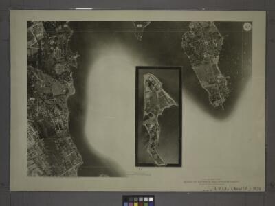
4D - N.Y. City (Aerial Set).
from Sectional aerial maps of the City of New York / [photographed and assembled under the direction of the chief engineer, July 1st, 1924].
Small folder - S1
from Atlas of New York and vicinity : from actual surveys / by and under the direction of F. W. Beers, assisted by A. B. Prindle & others
Town of Pelham, Westchester Co. N.Y. - City Island, Pelham Township, Westchester Co. N.Y.
from County atlas of Westchester, New York. Published by J.B. Beers & Co., assisted by S.W. Wilson and others.
Sheet 38: Grid #26000E - 30000E, #3000N - 7000N. [Includes Eastchester Bay, Pelham Bay Park [Country Club], Town Dock Road, East Road, South Road and North Road.]
from Topographical survey sheets of the borough of the Bronx easterly of the Bronx River.
Sheet 42: Grid #34000E - 35000E, #6000N - 9000N. [Includes City Island between Schofield Avenue and Ditmars Street.]
from Topographical survey and new street system of the borough of the Bronx, easterly of the Bronx River
Sheet 37: Grid #28000E - 32000E, #1000S - 5000S. [Includes Taber Avenue, Fort Schuyler Road, Town Dock Road and Eastchester Bay.]
from Topographical survey sheets of the borough of the Bronx easterly of the Bronx River.
Sheet 43: Grid #32000E - 39000E, #4000N - 11000N. [Includes City Island, South of Ditmars Street to the South of Schofield Avenue.]
from Topographical survey sheets of the borough of the Bronx easterly of the Bronx River.
Bronx, V. B, Plate Letter. D [Map bounded by Duryea Pl., Long Island Sound, Eastchester Bay]
From Atlas 44. Vol. B, 1897.
Planning Grid of the Office of the Topographical Bureau of Bronx.
from Topographical survey sheets of the borough of the Bronx easterly of the Bronx River.
Sheet 39: Grid #32000E - 36000E, #3000S - 5000S. [Includes East Chester, Weir Creek, New Pennyfield Road, Greene Avenue, Morgan Avenue, Pennyfield Road, Chester Bay [Edgewater Park], Washington Place and Stevens Place.]
from Topographical survey sheets of the borough of the Bronx easterly of the Bronx River.
Area District Map Section No. 4
from Area district map / City of New York, Board of Estimate and Apportionment.
Height District Map Section No. 4; Height district map / City of New York, Board of Estimate and Apportionment.
from Height district map / City of New York, Board of Estimate and Apportionment. New York (N.Y.). Board of Estimate and Apportionment,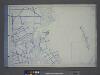
Use District Map Section No. 4; Use district map / City of New York, Board of Estimate and Apportionment.
from Use district map / City of New York, Board of Estimate and Apportionment. New York (N.Y.). Board of Estimate and Apportionment,
Unionport, Schuylerville.
from County atlas of Westchester, New York. Published by J.B. Beers & Co., assisted by S.W. Wilson and others.
Plate 16: Unionport - Westchester - Schuyerville :Town & County of Westchester, N.Y.
from Atlas of New York and vicinity : from actual surveys / by and under the direction of F. W. Beers, assisted by A. B. Prindle & others
Hart & City Island, Sachem's Head Harbor.
1 : 20000 Hassler, F. R.
4B - N.Y. City (Aerial Set).
from Sectional aerial maps of the City of New York / [photographed and assembled under the direction of the chief engineer, July 1st, 1924].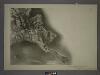
7B - N.Y. City (Aerial Set).
from Sectional aerial maps of the City of New York / [photographed and assembled under the direction of the chief engineer, July 1st, 1924].
Unionport, Westchester and Schuylerville, New York.
1 : 8910 Beers, J.B.
Planning Grid of the Office of the Topographical Bureau of Bronx.
from Topographical survey and new street system of the borough of the Bronx, easterly of the Bronx River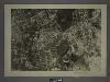
4C - N.Y. City (Aerial Set).
from Sectional aerial maps of the City of New York / [photographed and assembled under the direction of the chief engineer, July 1st, 1924].
Sheet 31: Grid #24000E - 28000E, #1000S - 5000S. [Includes Union Port, Bowne Estate, Westchester Terrace, St. Raymond's Cemetery and Schuylerville.]
from Topographical survey sheets of the borough of the Bronx easterly of the Bronx River.
Sheet 36: Grid #28000E - 32000E, #5000S - 9000S. [Includes Baxter Creek Estuary, [Ferry Point Park].]
from Topographical survey sheets of the borough of the Bronx easterly of the Bronx River.
Hammods Atlas of New York City and the metropolitan district

Flushing
1 : 24000
Flushing
1 : 24000
Flushing
1 : 24000
Flushing
1 : 24000
Flushing
1 : 24000
Flushing
1 : 24000
Flushing
1 : 24000
Flushing
1 : 24000