Maps of Kings County

Maps of Kings County

$title$

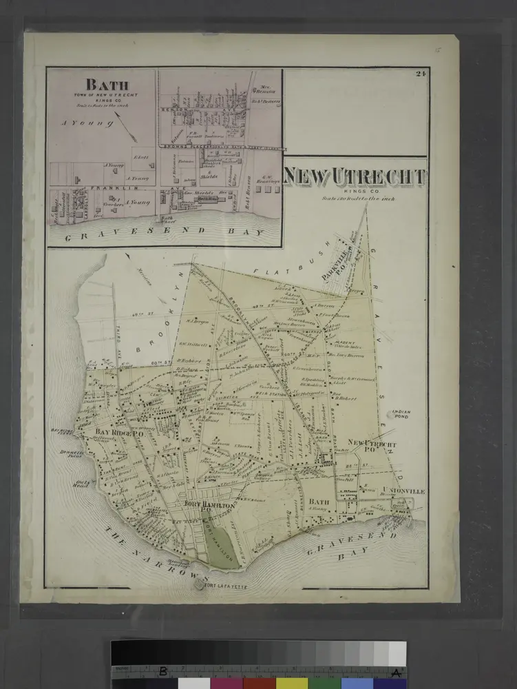
New Lots. Kings Co. L.I.

from Atlas of Long Island, New York. From recent and actual surveys and records.
$title$

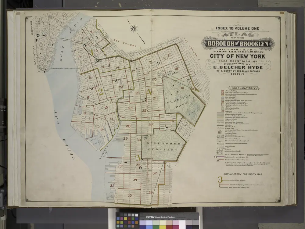
Index to Volume Four. Atlas of the Borough of Brooklyn. Sections 12, 13 & 14. Wards 26 and part of 29 & 32. City of New York. E. Belcher Hyde, 97 Liberty St., Brooklyn Borough. 1904.

from Wards 26 and part of 29 & 32.
$title$

Spring Creek -- Linear City. (cont.)

From Spring Creek -- Linear City
$title$

Community resources

From District 5
$title$

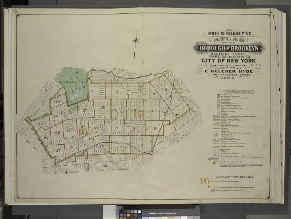
Index to Volume Five. Atlas of the Borough of Brooklyn. Sections 15 & 16. Ward 29 and part of 32. City of New York. E. Belcher Hyde, 97 Liberty St., Brooklyn Borough. 1906.

from Ward 29 and part of 32.
$title$

Key

From Atlas 137. Vol. 3, 1902.
$title$

Area Zoning Map Section No. 17

From Area zoning map of the city of New York, compiled in the Dept. of City Planning, Division of Mapping and Zoning, May 27, 1953. Irving F. Ashworth, senior civil engineer.
$title$

Brooklyn

1 : 24000
$title$

Brooklyn

1 : 24000
$title$

Brooklyn

1 : 24000
$title$

Brooklyn

1 : 24000
$title$

Brooklyn

1 : 24000
$title$

Brooklyn

1 : 24000
$title$

Brooklyn

1 : 24000
$title$

Brooklyn

1 : 24000
$title$

Insurance Maps of the Brooklyn city of New York Volume Eight. Published by the Sanborn map co. 117, Broadway, New York. 1887.

From Atlas 86. Vol. 8, 1887.
$title$

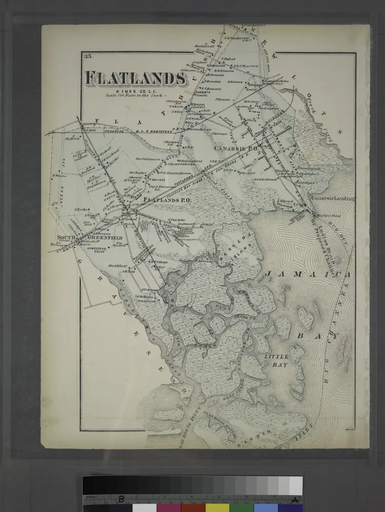
Flatlands. Kings Co. L.I.

From Atlas of Long Island, New York. From recent and actual surveys and records.
$title$

Flatlands. Kings Co. L.I.

from Atlas of Long Island, New York. From recent and actual surveys and records.
$title$

Bushwick, Ridgewood. (cont.)

From District 4
$title$

Insurance Maps of the Brooklyn city of New York Volume Seven. Published by the Sanborn map co. 117, Broadway, New York. 1888.

From Atlas 83. Vol. 7, 1888.
$title$

Area District Map Section No. 13

from Area district map / City of New York, Board of Estimate and Apportionment.
$title$

Area Zoning Map Section No. 13

From Area zoning map of the city of New York, compiled in the Dept. of City Planning, Division of Mapping and Zoning, May 27, 1953. Irving F. Ashworth, senior civil engineer.
$title$

Use District Map Section No. 13

from Use district map / City of New York, Board of Estimate and Apportionment.
$title$

Queens, Vol.2, Double Page Plate No. 29; Part of Ward Two Newtown (East Williamsburgh, Melina and Nassau Heights); [Map bounded by Rotting Course Lane, Dry Harbor Road, Boundary between the Boroughs of Queens and Brooklyn, Newtown Creek, Bradle

from First and second wards: Long Island City and Newtown.
$title$

Plan of the city of Brooklyn, L.I. / by William Perris.

from Brooklyn
$title$

Brooklyn, Double Page Section 7; [Including Wards 18, 24, 25]

from Farm line map of the city of Brooklyn, from official records and surveys; comp. and drawn by Henry Fulton.
$title$

Area District Map Section No. 23; Area district map / City of New York, Board of Estimate and Apportionment.

from Area district map / City of New York, Board of Estimate and Apportionment. New York (N.Y.). Board of Estimate and Apportionment,
$title$

Use District Map Section No. 23; Use district map / City of New York, Board of Estimate and Apportionment.

from Use district map / City of New York, Board of Estimate and Apportionment. New York (N.Y.). Board of Estimate and Apportionment,
$title$

Height District Map Section No. 23; Height district map / City of New York, Board of Estimate and Apportionment.

from Height district map / City of New York, Board of Estimate and Apportionment. New York (N.Y.). Board of Estimate and Apportionment,
$title$

Area District Map Section No. 17; Area district map / City of New York, Board of Estimate and Apportionment.

from Area district map / City of New York, Board of Estimate and Apportionment. New York (N.Y.). Board of Estimate and Apportionment,
$title$

Use District Map Section No. 17; Use district map / City of New York, Board of Estimate and Apportionment.

from Use district map / City of New York, Board of Estimate and Apportionment. New York (N.Y.). Board of Estimate and Apportionment,
$title$

Height District Map Section No. 17; Height district map / City of New York, Board of Estimate and Apportionment.

from Height district map / City of New York, Board of Estimate and Apportionment. New York (N.Y.). Board of Estimate and Apportionment,
© MapTiler © OpenStreetMap contributors
How does it work?
These instructions will show you how to find historical maps online.
Getting started
Type the place name in the search box to find the exact location. You can further adjust the search by zooming in and out.
Zoom
Zoom in and out with the buttons or use your mouse or touchpad natively.
Exact Area tool
Click here and draw a rectangle over the map to precisely define the search area.
Set filters
Narrow your search with advanced settings, such as Years (from/to), Fulltext, Publisher, etc.
Results
See the results of your search on the right side. You can scroll down to find more maps of this location.
?

Download OldMapsOnline Mobile