Cataloged map
Map or Plan of Section 13. [Bounded by E. 179th Street, Lafantaine Avenue, E. 178th Street, Third Avenue, E. 179th Street, Webster Avenue, Southern Boulevard and Crotona Avenue.]; Maps or plans and profiles, with field notes and explanatory remarks, showing the location, width, grades, and class of streets, roads, avenues, public squares and places, located and laid out by the Commissioner of Street Improvements of the 23rd and 24th wards of the city of New York: under authority of Chapter 545 of the laws of 1890.


Full title:Map or Plan of Section 13. [Bounded by E. 179th Street, Lafantaine Avenue, E. 178th Street, Third Avenue, E. 179th Street, Webster Avenue, Southern Boulevard and Crotona Avenue.]; Maps or plans and profiles, with field notes and explanatory remarks, showing the location, width, grades, and class of streets, roads, avenues, public squares and places, located and laid out by the Commissioner of Street Improvements of the 23rd and 24th wards of the city of New York: under authority of Chapter 545 of the laws of 1890.
Depicted:1890
Physical Size:20 x 30 cm
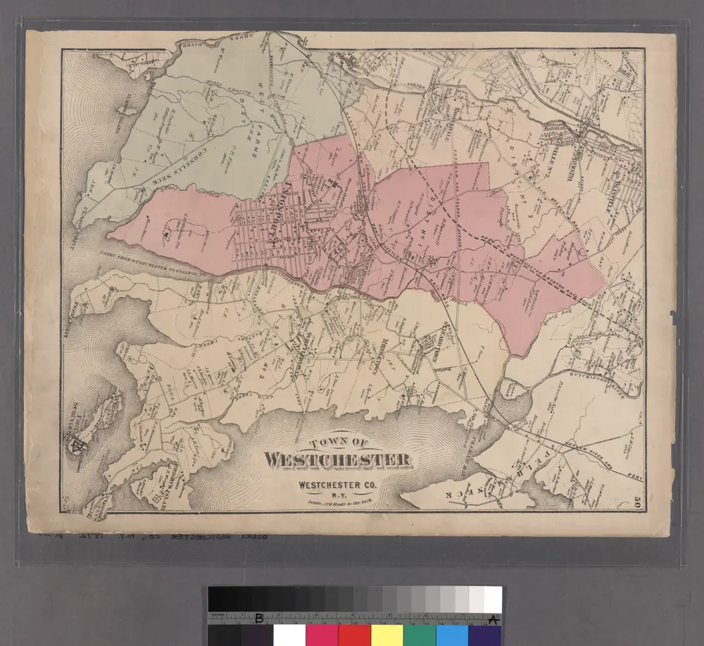
Plate 50: Town of Westchester, Westchester Co. N.Y.
1872
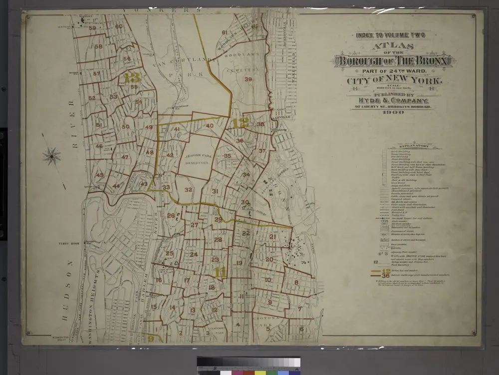
Index to Volume Two: Atlas of the Borough of the Bronx, City of New York. Part of 24th Ward.
1901
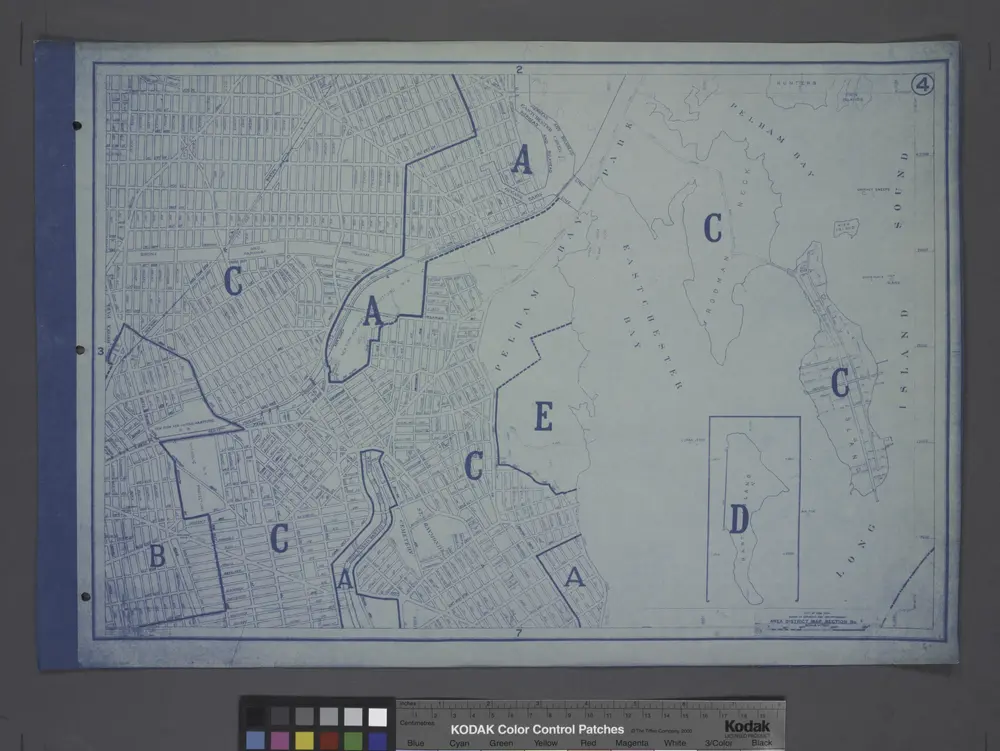
Area District Map Section No. 4
1916
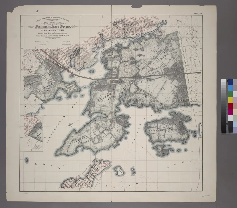
Sheet 29: Map of Pelham Bay Park, City of New York, forming sheet 29 of the Topographical Atlas of the Territory East of the Bronx River.
1905
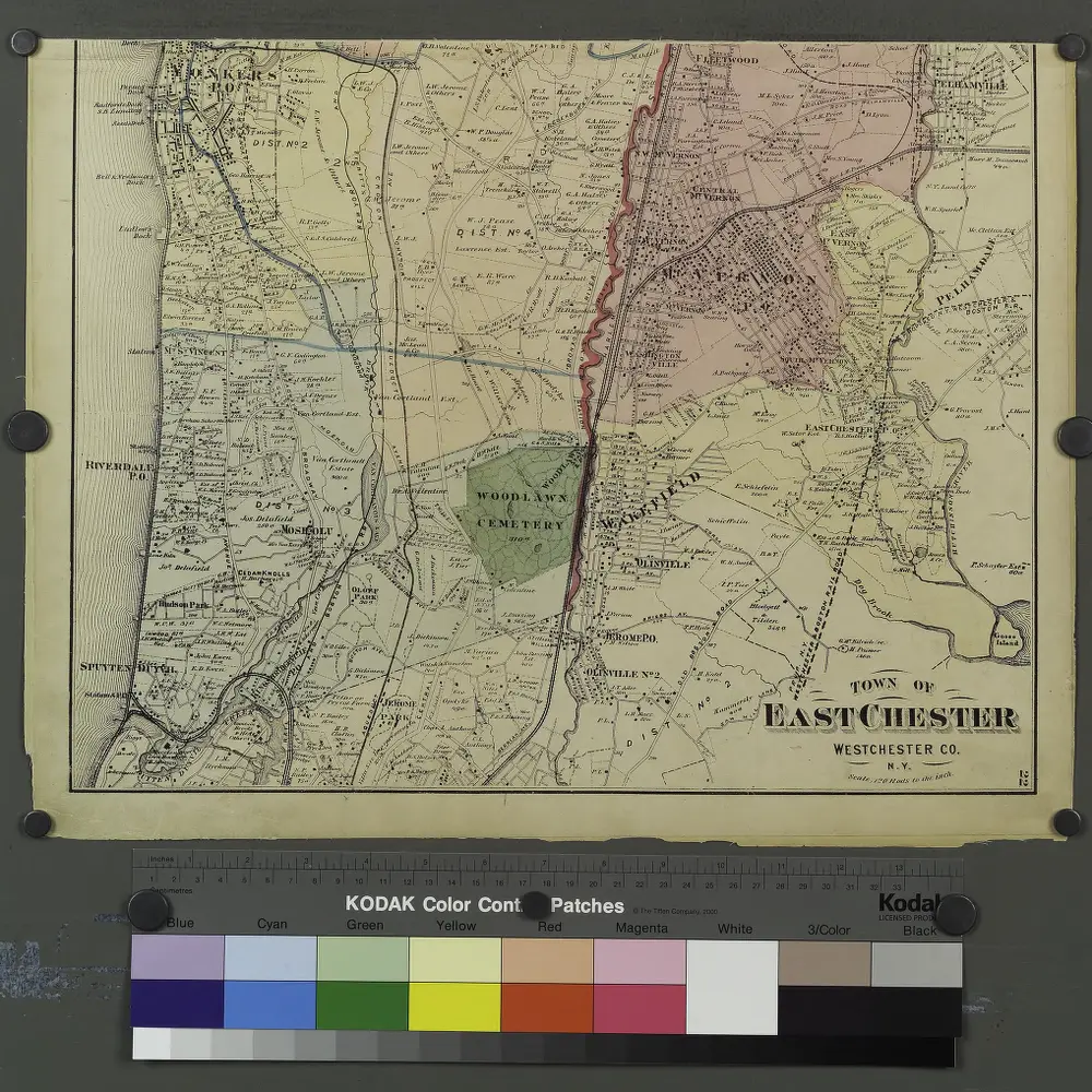
Plates 21 & 22: Town and City of Yonkers, Westchester Co. N.Y. - Town of East Chester, Westchester Co. N.Y.
1872
Flushing
1995
1:24k
Flushing
1966
1:24k
Flushing
1966
1:24k
Flushing
1966
1:24k
Flushing
1966
1:24k
Flushing
1955
1:24k
Flushing
1955
1:24k
Flushing
1947
1:24k
Flushing
1947
1:24k