Cataloged map
Sheet 38: Grid #26000E - 30000E, #3000N - 7000N. [Includes Eastchester Bay, Pelham Bay Park [Country Club], Town Dock Road, East Road, South Road and North Road.]
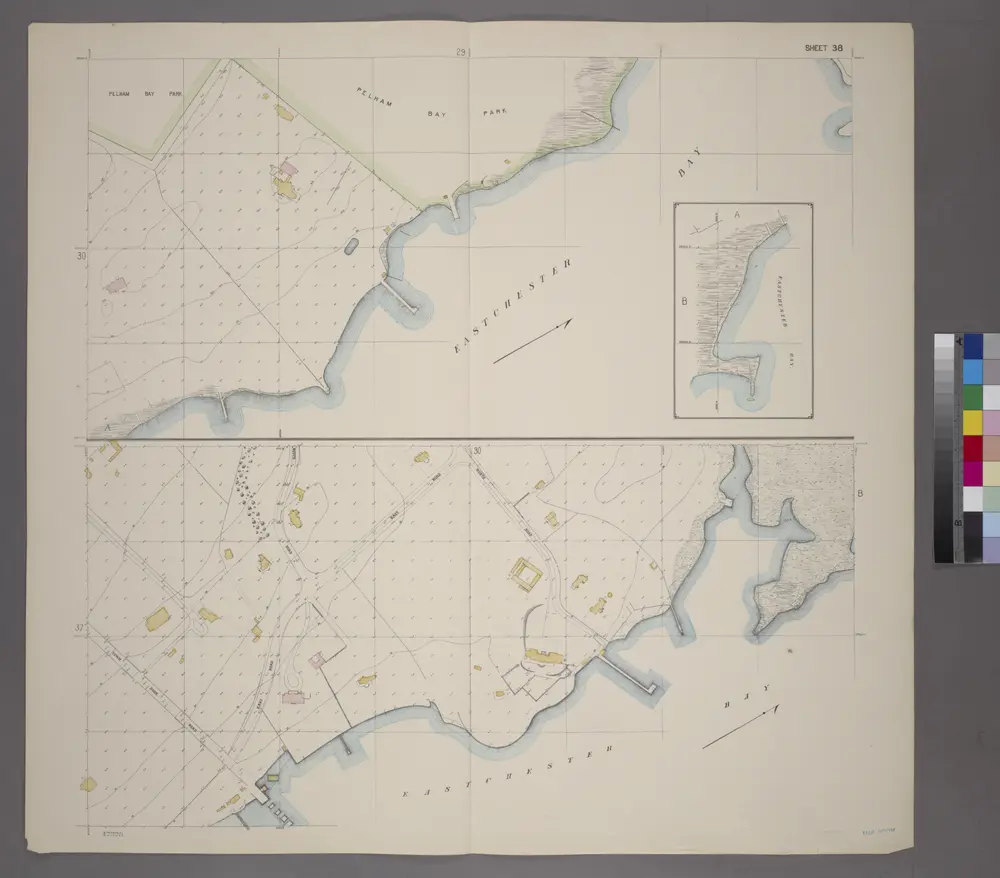

Full title:Sheet 38: Grid #26000E - 30000E, #3000N - 7000N. [Includes Eastchester Bay, Pelham Bay Park [Country Club], Town Dock Road, East Road, South Road and North Road.]
Depicted:1905
Physical Size:20 x 30 cm
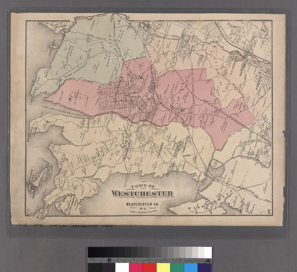
Plate 50: Town of Westchester, Westchester Co. N.Y.
1872
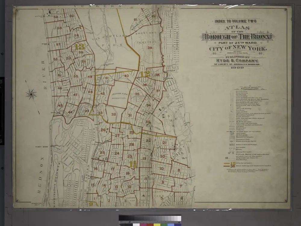
Index to Volume Two: Atlas of the Borough of the Bronx, City of New York. Part of 24th Ward.
1901
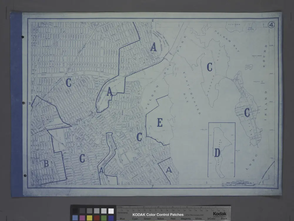
Area District Map Section No. 4
1916
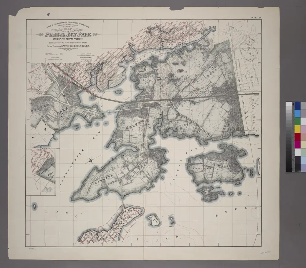
Sheet 29: Map of Pelham Bay Park, City of New York, forming sheet 29 of the Topographical Atlas of the Territory East of the Bronx River.
1905
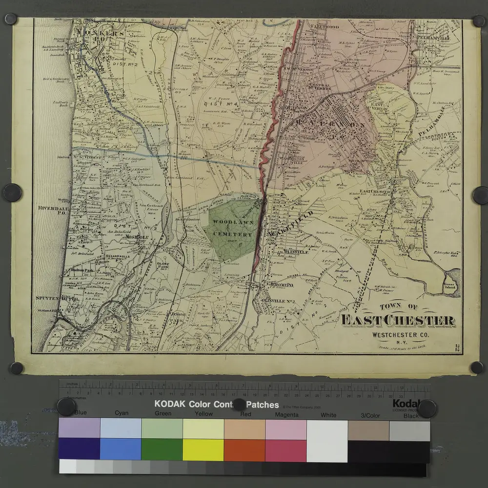
Plates 21 & 22: Town and City of Yonkers, Westchester Co. N.Y. - Town of East Chester, Westchester Co. N.Y.
1872
Flushing
1995
1:24k
Flushing
1966
1:24k
Flushing
1966
1:24k
Flushing
1966
1:24k
Flushing
1966
1:24k
Flushing
1955
1:24k
Flushing
1955
1:24k
Flushing
1947
1:24k
Flushing
1947
1:24k