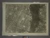
Maps of Weehawken
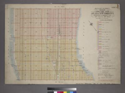
Outline & Index Map of Volume Two, Atlas of New York City, 14th Street to 59th Street.
from Atlas of the city of New York, borough of Manhattan. From actual surveys and official plans / by George W. and Walter S. Bromley.
Outline and Index Map of Atlas of New York City.
from Atlas of the borough of Manhattan, city of New York.
Topographical Atlas Of The City Of New York
1 : 12000 Viele, Egbert L.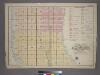
Outline and Index Map of Volume Two, Atlas of New York City, Borough of Manhattan. 14th Street to 59th Street.
from Atlas of the city of New York, borough of Manhattan. From actual surveys and official plans / by George W. and Walter S. Bromley.
[Map of that part of New York City Between 34th St. and 46th St., and the East and Hudson Rivers, showing] encroachment of nuisances upon populous up-town districts.
From Manhattan
Map of the City of New-York with part of Brooklyn and Williamsburgh : population in the year 1850: 450,000 inhabitants.
from Manhattan
City of New York.
1 : 17000 Tanner, Henry S.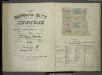
[Volume 6 Index Map.]
from Maps of the city of New York / surveyed under directions of insurance companies of said city.
Map of the city of New-York extending northward to Fiftieth St. / surveyed and drawn by John F. Harrison, C.E.
from Manhattan
Height District Map Section No. 8
from Height district map / City of New York, Board of Estimate and Apportionment.
[Maps of the 14, 15, 16, 17, 20, 21 assembly districts and 23 & 24 Wards of New York City.]
From Manhattan
Use District Map Section No. 8
from Use district map / City of New York, Board of Estimate and Apportionment.
Area District Map Section No. 8
from Area district map / City of New York, Board of Estimate and Apportionment.
A new map of the city of New York : comprising all the late improvements, compiled and corrected from authentic documents, designed to accompany the Description of New York.
from Manhattan
A new map of the city of New York : comprising all the late improvements, compiled and corrected from authentic documents.
from Manhattan
New map of that part of the city of New York south from 20th Street on the Hudson & 35th Street on the East River : showing the position of Greenwich, Washington and West Streets on the Hudson River, and Pearl, Water, Front, Cherry & Tompkins Sts. on the
from Manhattan
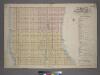
Part of the 23rd Ward, New York City.
from Atlas of the city of New York : from official records, private plans & actual surveys / compiled under the supervision of E. Robinson & R. H. Pidgeon.
A new map of the city of New York : comprising all the late improvements, compiled and corrected from authentic documents.
from Manhattan
Key
From Atlas 42.55. Vol. 5, 1890.
Map of the city of New York, shewing the original high water line and the location of the different farms and estates
Common Council
Plan von New York
1 : 2000 New York (New York) Bibliographisches Institut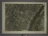
8D - N.Y. City (Aerial Set).
from Sectional aerial maps of the City of New York / [photographed and assembled under the direction of the chief engineer, July 1st, 1924].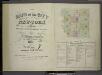
[Volume 7 Index Map.]
from Maps of the city of New York / surveyed under directions of insurance companies of said city.
Block distribution of children of 4 to 18 years of age for Chelsea and Greenwich for 1910.
From Manhattan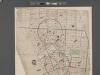
[Map of New York City between Canal and 22nd Sts?? and Broadway and the Hudson River School District No. 9, showing population and school attendance figures.]
From Manhattan
City of New-York
1 : 12500 Burr, David H., 1803-1875 Edward Walker
City of New-York.
1 : 17000 Mitchell, Samuel Augustus
Key
From Atlas 110. Vol. 2, 1903.
"Where all the Village meet to eat" - An accurate and detailed map of Greenwich Village and Environment.
From Manhattan