Carte cataloguée
Plate 4: Map No. 302 [Bounded by Harlem River, [149th Street] and Post Road from New York to Boston.]- Map No. 549 [Bounded by Grove St., Cottage St., Villa Place, Old Boston Road, 130th Street, 4th Avenue, Macomb Avenue and Walton Avenue.]


Titre complet:Plate 4: Map No. 302 [Bounded by Harlem River, [149th Street] and Post Road from New York to Boston.]- Map No. 549 [Bounded by Grove St., Cottage St., Villa Place, Old Boston Road, 130th Street, 4th Avenue, Macomb Avenue and Walton Avenue.]
Année de l'image:1888
Taille physique:20 x 30 cm
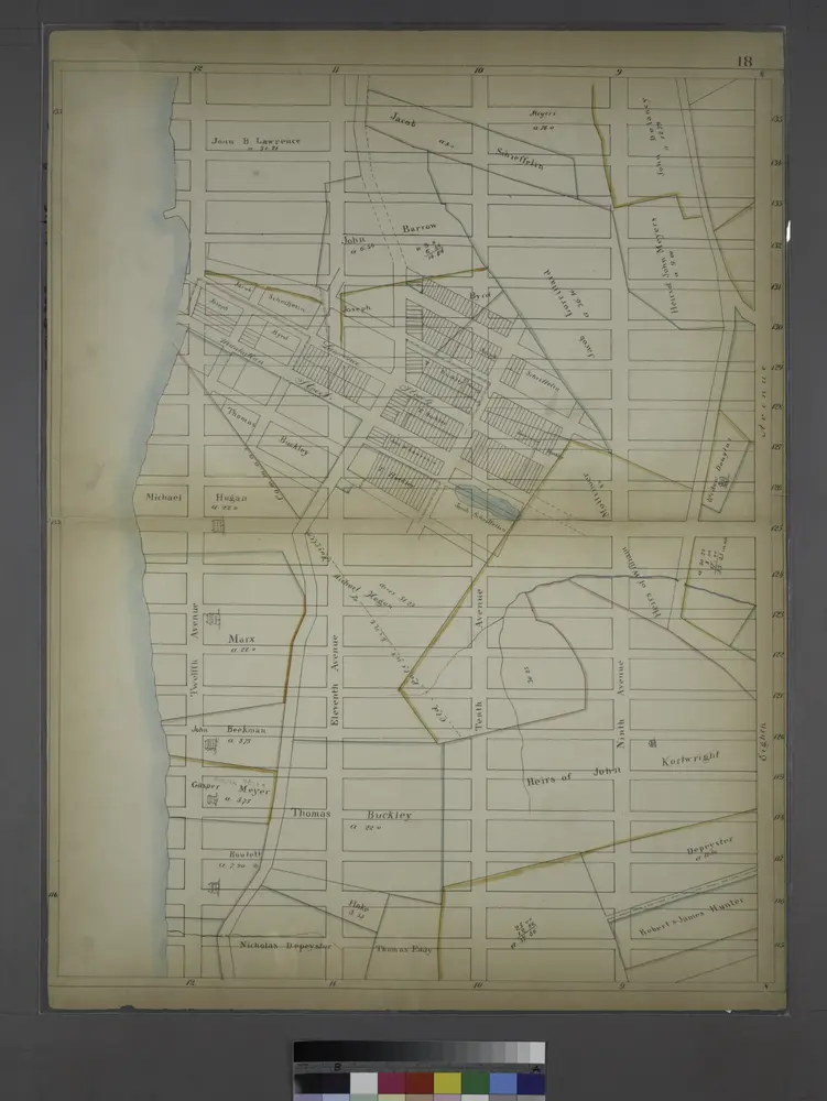
Page 18: [Bounded by W. 135th Street, Eighth Avenue, W. 115th Street and (Morningside Heights) Hudson River.]
1819
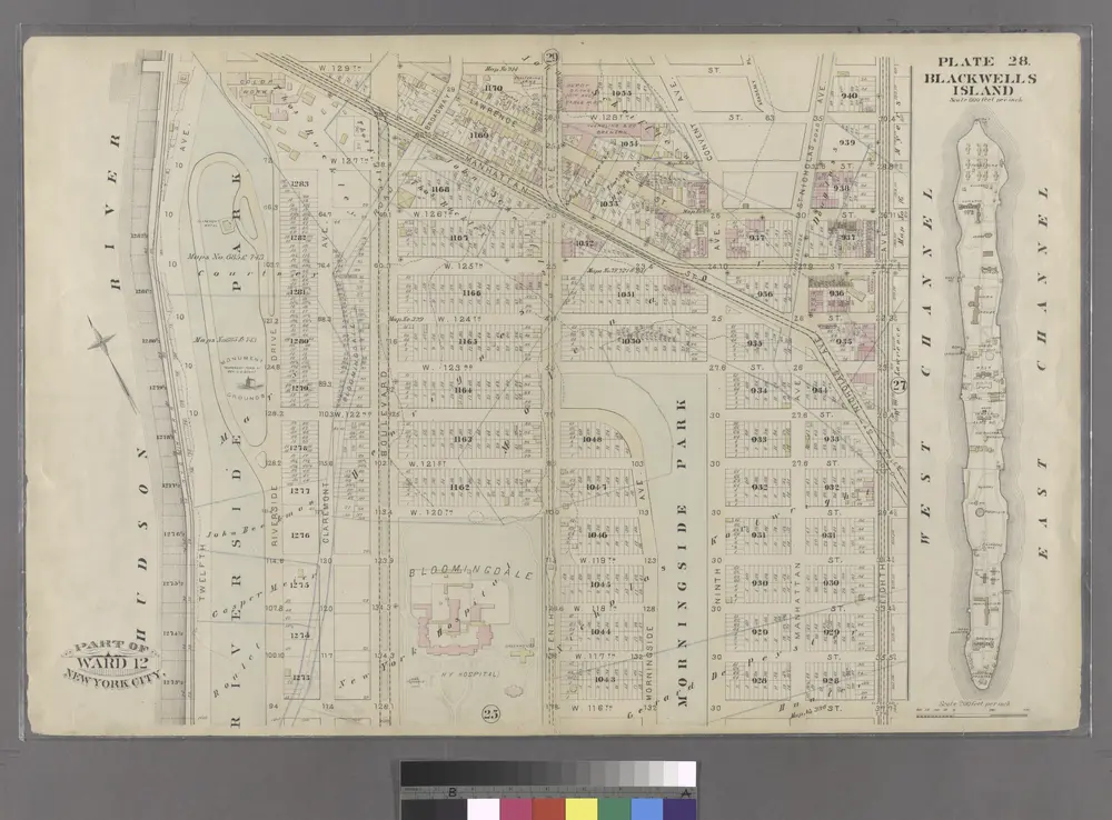
Blackwell's Island.
1885
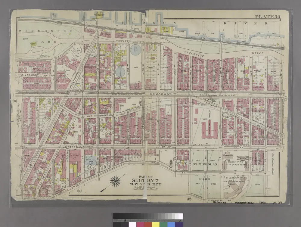
[Plate 39: Bounded by Twelfth Avenue (Hudson River), Riverside Drive, W. 142nd Street, 10th Avenue, W. 141st Street, Convent Avenue, and W. 125th Street.]
1911
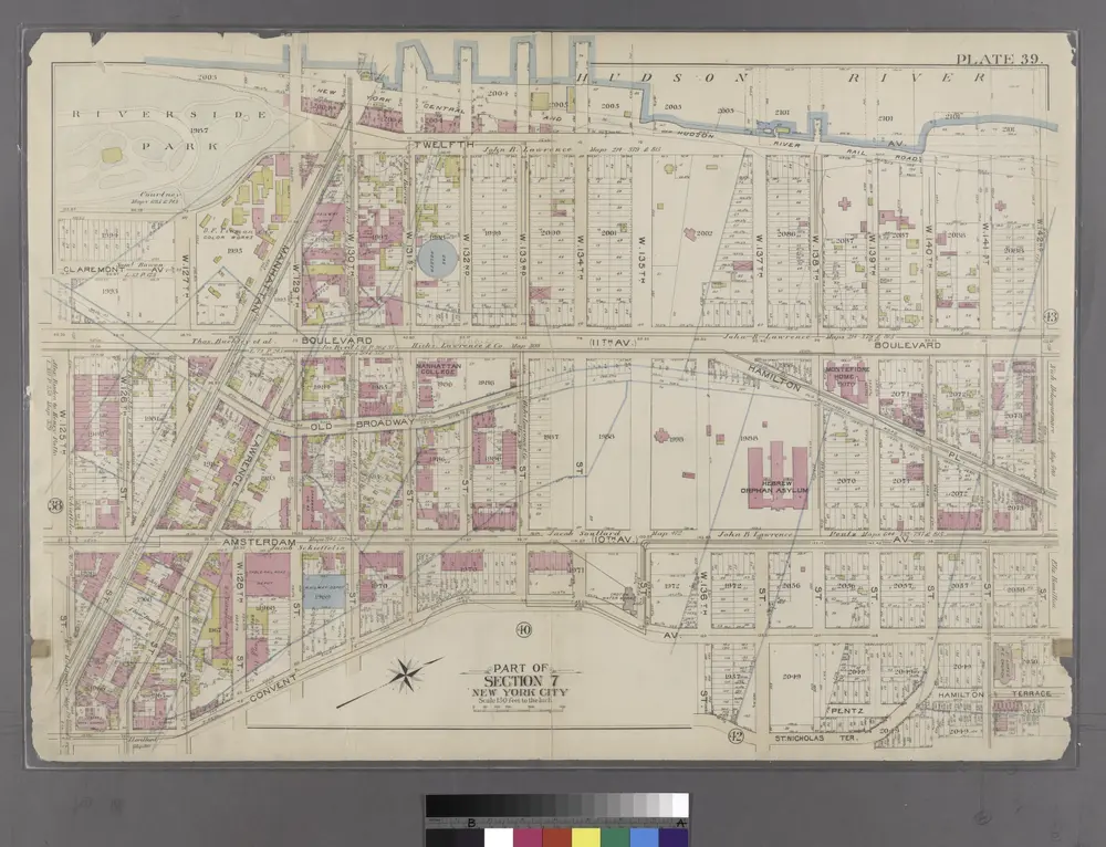
Part of Section 7: New York City.
1897
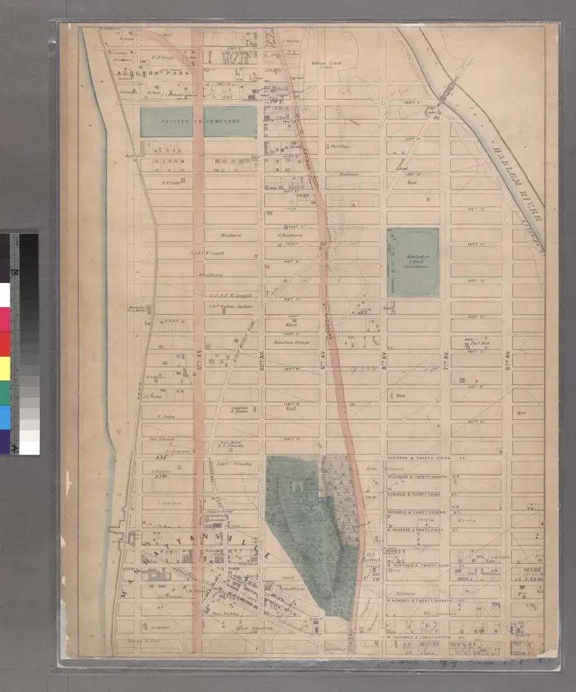
Sheet 17: [Bounded by 158th Street, 10th Avenue, 155th Street, 8th Avenue, 154th Street, 7th Avenue, 149th Street, 6th Avenue, W. Hundred & Twenty Fifth Street, and (Audubon Park) 11th Avenue.]
1867
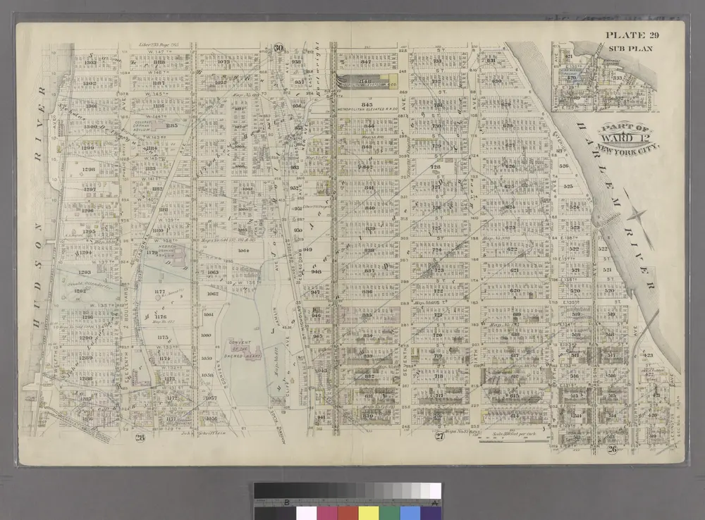
Part of Ward 12, New York City.
1885
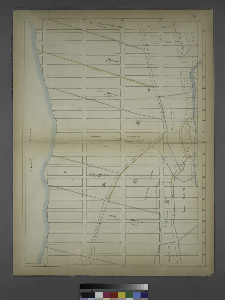
Page 21: [Bounded by W. 156th Street, (Hamilton Heights) Ninth Avenue, W. 136th Street and North River.]
1819
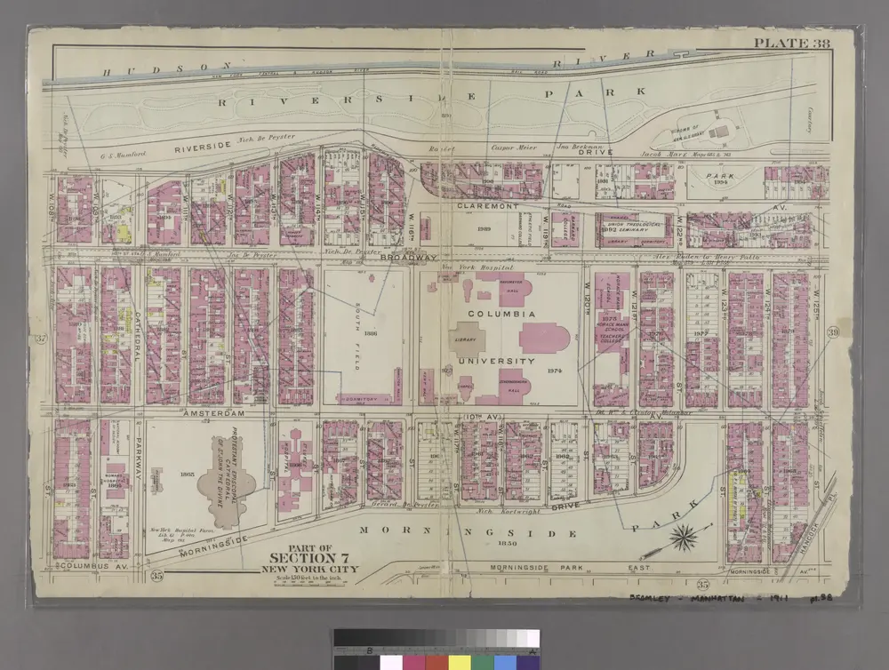
[Plate 38: Bounded by Hudson River (Riverside Park, Riverside Drive), W. 125th Street, Morningside Drive, Columbus Avenue, and W. 108th Street.]
1911
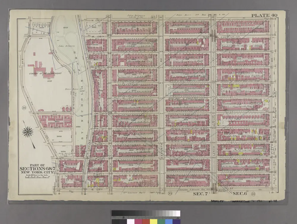
[Plate 40: Bounded by W. 136th Street, Fifth Avenue, W. 125th Street, and Morningside Avenue.]
1911
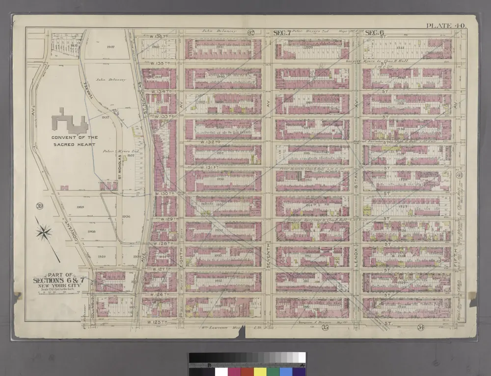
Plate 40: Bounded by W. 136th Street, Fifth Avenue, W. 125th Street, and Convent Avenue.
1897